

Click here for a list of acronyms
| Organization | Year | Title and Description | Preview |
|---|---|---|---|
| WMO, GWP, IDMP, NDMC | 2025 | The Baseline Assessment of Drought Impact Monitoring(WMO-No. 1355) provides a baseline assement on the current status of collecting drought impacts and related monitoring efforts from around the world. It provides a review of the various drought impact collection efforts as well of food, water security and livelihood monitoring systems. There is an overview of data characteristics that are needed for drought impact collection, on how to put drought impact data to use, and recommendations and conclusion. |  |
| FAO, WMO, GWP, IDMP, GWPCEE, GWPSA | 2025 | The report “Mainstreaming gender in national drought plans, national action plans and national policies” highlights critical strategies that can be applied to ensure gender equality and social inclusion to enhance the effectiveness and inclusivity of drought-related interventions. This report is a joint effort of FAO, the Global Water Partnership and its regional offices of Central and Eastern Europe (GWPCEE) and Southern Africa (GWPSA), and the World Meteorological Organization (WMO). |  |
| FAO, WMO, GWP, IDMP | 2024 | Guidelines on institutional coordination for drought management highlights the critical role of institutional coordination and communication in effective drought management, emphasizing collaboration among government agencies, stakeholders, and communities. It provides guidelines for establishing and maintaining institutional frameworks that integrate national drought plans into existing systems. By analyzing pilot cases from the UNCCD’s Drought Initiative, the report defines a minimum set of key institutions required for managing drought while allowing flexibility for country-specific needs. Various coordination models, including cluster, committee, and technical working groups, are presented, alongside strategies for stakeholder engagement, communication, and monitoring. These guidelines aim to enhance countries’ capacities to manage drought proactively and effectively. |  |
| IDMP | 2023 | IDMP Strategy 2023-2025 | |
| WHO | 2023 | Drought and Public Health: A Roadmap for Advancing Engagement and Preparedness | |
| UNCCD | 2022 | The report, an authoritative compendium of drought-related information and data, helps inform negotiations of one of several decisions by UNCCD’s 196 member states, to be issued 20 May at the conclusion of COP15. The report puts numbers to drought events and related impacts on human society and ecosystems. It also sketches future paths to resilience through proactive interventions, business cases, and landscape restoration. |  |
| Ministry of Infrastructure and Water Management of the Netherlands, Deltares and AGWA | 2022 | HELP Guiding Principles for Drought Risk Management under a Changing Climate In recent years, countries around the world have been hit hard by drought events that affect food supplies, agricultural incomes, employment, drinking water supplies, ecosystem health, transportation systems, and energy production. As the risk of drought is increasing due to ongoing climate change the HELP community started the flagship initiative to draft a report as guidance for supporting, defining and refining DRR for drought risk management. In this report proactive approaches, having greater emphasis on building resilience, are advocated. This present ‘Flagship Report on Drought Risk Management under a Changing Climate’ aims at raising awareness and mainstream best practices for climate-resilient integrated drought management worldwide. |  |
| IDMP (WMO, GWP, UNCCD, FAO) | 2022 | Drought and Water Scarcity The terms ‘water scarcity’ and ‘drought’ are often used interchangeably, despite their subtle but important differences with regards to water management. The aim of this publication is to inform stakeholders about the different characteristics of drought and water scarcity and how they can be interdependent (with clear examples of each). This publication also shows that with climate change, increased water use by the various economic sectors, and poor water management, the line between drought and water scarcity can become blurred. |  |
| UNDRR | 2021 | UN GAR Special Report on Drought 2021 The risks that drought poses to communities, ecosystems and economies are much larger and more profound than can be measured. The impacts are borne disproportionately by the most vulnerable people. Drought impacts are extensive across societies – they interconnect across large areas, cascade through socioecological and technical systems at different scales, and linger through time. A lack of awareness of such characteristics, including the consistent underestimation of the cost of drought impacts, can lead to ineffective response and systemic failure. As understanding of the globally networked aspects of drought and other complex risks improves, the changes required to reduce risk and improve the experience of drought become possible. This Global Assessment Report on Disaster Risk Reduction (GAR) Special Report on Drought 2021 aims to take a clear step forward in building that awareness. |  |
| World Bank | 2021 | An EPIC response: Innovative governance for flood and drought risk management Flood and drought disasters impose a huge toll. Over the last two decades, at least 1.65 billion people have been affected by floods and 1.43 billion by droughts. The economic costs have been staggering and the social costs even higher as the poor and marginalized are disproportionately affected. Hydro-climatic disasters can have intergenerational poverty impacts, spur migration and contribute to geopolitical instability. |  |
| UN ESCAP | 2020 | Adaptation and Resilience to Drought: From know how to do how - A guidebook for the practitioners South-East Asia has long experienced severe droughts. The Ready for the Dry Years publication series is part of the effort to mobilize a region-wide action as the drought risk intensifies. This edition expands the geographical coverage of the first edition and combines rainfall data with other socio-economic indicators to reveal the hotspots where the populations are most vulnerable to drought. It takes a holistic approach to understanding drought impacts by adopting a standard definition of drought across the region and by examining the issue from socioeconomic, health, environmental, and humanitarian perspectives. This report aims to provide practical guidance on adaptation and resilience to drought to practitioners. |  |
| UNDP Cap-Net | 2020 | Drought Risk Reduction in Integrated Water Management - Manual Drought risk is a growing threat to many people and economies in both developing and developed countries, although the characteristics may differ considerably across the world. This manual is primarily for learners, trainers and facilitators, practitioners, and water and natural resources managers, and is aimed at strengthening the capacity to anticipate and reduce the impact of drought by enhancing knowledge and skills for drought risk reduction practices as an integral part of the development process at community, national, subregional and regional levels. |  |
| UNDP Cap-Net | 2020 | Réduction des risques de sécheresse dans le cadre de la gestion intégrée des ressources en eau Le risque de sécheresse est une menace croissante pour de nombreuses personnes et économies dans les pays en développement comme dans les pays développés, bien que les caractéristiques puissent différer considérablement à travers le monde. Ce manuel est principalement destiné aux apprenants, formateurs et animateurs, praticiens et gestionnaires de l'eau et des ressources naturelles, et vise à renforcer la capacité d'anticiper et de réduire l'impact de la sécheresse en améliorant les connaissances et les compétences pour les pratiques de réduction des risques de sécheresse en tant que partie intégrante de le processus de développement aux niveaux communautaire, national, sous-régional et régional. |  |
| Slovenian Environmental Agency | 2019 | Better prepared for drought - Danube drought strategy Danube Drought Strategy is a document proposing a new framework for improved drought management in the Danube region. The core part of the Strategy is the Optimal Drought Management Model, a concept for comprehensively tackling drought management issues. It was created within the DriDanube (Drought risk in the Danube Region) project funded by the Danube Transnational Programme. The main aim of the Strategy is to build the capacity of the Danube region to overcome common deficiencies in coping with drought, and thus help switch from a reactive to a proactive drought management approach. This document pursues this aim by identifying the common steps that were used to launch the proactive drought management in the Danube countries. It then gives clear guidance for overcoming the gaps in the drought decision-making processes and for improving drought emergency responses in the countries of the Danube region. |  |
| IDMP CEE | 2019 | How to communicate drought - A guide by the Integrated Drought Management Programme in Central and Eastern Europe What do you think about when you hear the word ‘drought’? For the public it can mean water restrictions at home; for farmers it is loss of crops and income; for industry it is loss of production and jobs; for the environment it means loss of flora and fauna, and amenity like boating and fishing; and for governments droughts can mean lost revenue as economic growth slows. For some people in more extreme climates and social settings, drought can mean famine and death. This guide supports the CEE regional Integrated Drought Management Programme (IDMP) to increase public |  |
| WB, GWP, WMO, IDMP | 2019 | Framework for the Assessment of Benefits of Action/Cost of Inaction (BACI) for Drought This working paper draws from the joint World Bank and World Meteorological Organization / Global Water Partnership Integrated Drought Management Program (IDMP) work stream on benefits of action and costs of inaction (BACI) for drought preparedness and mitigation. It suggests a methodological framework for assessment of BACI as a tool to support a shift in drought policy and programs from crisis management to a risk management approach. The framework should be systematic enough to allow for comparability across countries and contexts, with the option of being tailored to the context in which it is being used. In proposing an initial framework for BACI analysis, the authors use the ten-step methodology for developing drought strategies that was created by Wilhite et al. and subsequently codified by IDMP to help organize the assessment. In this way, the authors embed the BACI assessment in the overall development of a drought risk management strategy. This document is a first approach to guide those responsible for drought management and BACI assessments to ask the right questions at the different stages. Key next steps are to experiment with this draft approach by applying it in multiple contexts to test its usability and to develop more case study examples to showcase how this process can be undertaken and how it can be advantageous to stimulate positive action. |  |
| UNCCD, FAO, GWP, WMO – IDMP | 2019 | Drought Impact and Vulnerability Assessment, A Rapid Review of Practices and Policy Recommendations National policies should take a proactive approach to direct and coordinate drought vulnerability assessments with vulnerable groups. This rapid review explores the application of available approaches and methods for assessing drought impacts and vulnerability. It is based on a series of interviews with expert practitioners from different drought-affected regions of the world. This was complemented by a brief review of the relevant published literature and a summary appraisal of the strengths and weaknesses of the range of assessment approaches available. At the present time, most of the available assessments still fall short in their consideration of the longer-term impacts and vulnerability associated with drought. However, they can be improved by practical application and continuous review including the most vulnerable groups. International action can support national efforts to apply the best available approaches, build capacities and exchange lessons. This is necessary to reduce the wider destabilising effects of un-managed drought risks and persistent vulnerability on the regional and global economies and security. Vulnerability baselines, achievable targets and monitoring systems can facilitate global assessment and reductions in drought risk. |  |
| FAO, UNCCD, WMO, GWP – IDMP | 2019 | Proactive approaches to drought preparedness – Where are we now and where do we go from here? The paper presents current approaches to building proactive policies that support drought-stricken populations and activities, reduce vulnerability, and strengthen resilience to droughts. The paper analyses challenges and options for countries to adopt proactive drought preparedness policies, and addresses opportunities for enhancing the role of international organizations. The first section presents an overview of the regions and countries that are most affected by drought. The following sections present the context for drought, the main approaches to drought management, and the process to build a proactive drought policy that was started by the High-Level Meeting on National Drought Policies, including some country experiences. It also discusses the challenges and opportunities for adopting national drought policies in developing countries and offers some suggestions of support for current and future policies, including the role of international organizations. |  |
| UNICEF, GWP Central America, GOAL | 2019 | Impactos de la sequía en agua, saneamiento e higiene UNICEF, GWP Centroamérica y GOAL, llevaron a cabo un estudio para identificar el efecto de la sequía en los servicios de agua, saneamiento e higiene (ASH) en siete municipios ubicados en el Corredor Seco de Honduras, con énfasis en la niñez. GWP Centroamérica y UNICEF han venido implementando una serie de acciones para entender mejor este fenómeno, y para contribuir a fortalecer las capacidades de la población para hacerle frente y reducir su vulnerabilidad, aunando esfuerzos en la presente iniciativa. |  |
| WB | 2019 | Assessing Drought Hazard and Risk: Principles and Implementation Guide This drought risk guidance gives support at various levels of detail. First, a foundation with key definitions and aspects of drought risk assessments is provided: drought hazard, exposure and vulnerability of sectors susceptible to drought, and drought risk. Next, crucial guiding principles of drought risk assessments that should be taken into account when designing the overall approach of the drought risk assessment are identified and described. For professionals who require practical guidance while assessing droughts, an implementation guide is included. This implementation guide is complemented with drought risk assessment application examples. |  |
| EC-JRC | 2018 | Drought Risk Assessment. A conceptual Framework The causes and characteristics of drought events as well as their link with climate variability and climate change are discussed in chapters 1 and 2. The concept of drought risk is presented, including a first approach to map drought risk at global scale as a function of hazard, exposure and vulnerability (chapter 3). This framework is then linked to expected impacts in different economic sectors and the environment, including the discussion of case studies from Argentina, South Africa, Syria and the United States (chapter 4). Finally, a brief introduction to the key aspects of drought risk management and an outlook on future challenges and opportunities are presented in chapters 5 and 6. |  |
| FAO | 2018 | Drought characteristics and management in North Africa and the Near East The report assesses the occurrence and impacts of Drought, the current policies underlying drought management as well as the mitigation measures and responses adopted in the Near East and North Africa region, with a focus on the Agriculture Sector. It is the third of a series of similar studies carried out in different regions and countries of the world, with the objective of shedding light on drought effects, sensitizing policy-makers for the much needed paradigm shift to pro-active drought management planning and providing guidance for the development of such policies. | |
| UNCCD, FAO, WMO | 2018 | Strategic framework for drought risk management and enhancing resilience in Africa: white paper For generations, Africans have grappled with the far-reaching consequences of drought that has killed millions of people and caused significant social, environmental and economic damage throughout Africa’s history. Leveraging past and present experiences and lessons learned in Africa, in line with the global disaster reduction frameworks such as the Sendai Framework and the High-level Meeting on National Drought Policy (HMNDP), a new strategic framework called “Drought Resilient and Prepared Africa (DRAPA)” is proposed. DRAPA is designed to build an effective drought risk management approach along with enhanced resilience at continental, regional, national or local and community levels. The DRAPA strategic framework will have six main elements that are aligned with the priorities of African regional networks, such as the IGAD drought disaster resilience and sustainability initiative, national action programmes (NAPs), and the global disaster risk reduction frameworks, for example, the Sendai Framework. In colaboration with international institutes and countries around the world, Africa can integrate drought risk management into sustainable development policies and planning. In addition, African countries need to focus on the development of national and regional institutions, cultivate efficient mechanisms for addressing drought and build disaster resilience. |  |
| WMO, GWP | 2017 | Integrated Drought Management Programme (IDMP) Case Study: Benefits of action and costs of inaction in a water reservoir project for agricultural purposes in Azacualpa, Honduras This study analyses the cost of inaction and the benefits of action in Azacualpa, a small village in the outskirts of Tegucigalpa, the capital City of Honduras, where 27 reservoirs were built as a strategy to face drought, which had been affecting up to 70% of horticultural production; by an alliance involving financial, technical and organizational support from the public sector, the international cooperation and the community itself; to support Azacualpa’s small scale horticultural producers. |  |
| WMO, GWP | 2017 | Benefits of action and costs of inaction: Drought mitigation and preparedness – a literature review This review of available literature on the benefits of action and costs of inaction of drought mitigation and preparedness shows that significant progress has been made over the past decade in improving understanding of droughts and their impacts. However, significant gaps in research, policy and practice remain. This paper reviews several methodologies for making economic drought impact assessments and describes the main obstacles and opportunities facing the transition from crisis management to risk management. It identifies drivers of ex ante and ex post action against drought and highlights actions that are associated with co-benefits beyond drought risk management. The findings underline the need for mutually compatible methodologies as a means of comprehensively assessing drought costs and impacts. |  |
| FAO | 2017 | Drought characteristics and management in Central Asia and Turkey This reports reviews drought issues in the region of Central Asia - in the countries of Kazakhstan, Kyrgyzstan, Tajikistan Turkmenistan, Uzbekistan and Turkey - which is prone to drought with varying intensity and frequency. This situation is exacerbated in the region by political instability, conflicts and structural characteristics of the economy, with a high rural poor population depending on agriculture and livestock for income and employment generation and weak institutional and policy frameworks, contributing to higher vulnerability. The report constitutes a basis to rethink policies and reformulate preparedness and response plans that can strengthen resilience to droughts in Central Asia, taking into account the social, economic and environmental contexts specific to each country. |  |
| WMO, GWP | 2017 | Programa de Gestión Integrada de Sequías (IDMP) - El costo de la inacción/beneficios de la acción en un proyecto de reservorios para fines agrícolas en Azacualpa, Honduras Este estudio analiza el costo de la inacción y los beneficios de la acción en Azacualpa, una pequeña aldea en las afueras de Tegucigalpa, la capital de Honduras, donde se construyeron 27 reservorios como estrategia para enfrentar la sequía que llegó a afectar hasta un 70 por ciento de la producción hortícola. Esto se hizo mediante una alianza, que incluyó apoyo financiero, técnico y organizativo de parte del sector público, de la cooperación internacional y de la misma comunidad, para apoyar a los productores hortícolas de pequeña escala en Azacualpa. |  |
| AFD, WB | 2016 | Confronting drought in Africa's drylands : opportunities for enhancing resilience This book focuses on the medium-term prospects (over the next two decades) for increasing the resilience to drought and other shocks of people living in dryland areas of East and West Africa. The questions concerning vulnerability and resilience addressed in this book must be understood against the backdrop of an extremely dynamic environment. Dryland regions of Africa are already undergoing sweeping changes that are affecting the livelihoods of millions of households. Because the ongoing transformation of the drylands is being propelled by demographic drivers that have a great deal of momentum, the key question for policy makers is how best to manage the demographic, social, and economic changes that are coming. |  |
| WMO, GWP | 2016 | Handbook of Drought Indicators and Indices (Russian) This handbook covers some of the most commonly used drought indicators/indices that are being applied across drought-prone regions, with the goal of advancing monitoring, early warning and information delivery systems in support of risk-based drought management policies and preparedness plans |  |
| IDMP HOA | 2016 | Building resilience to drought: Learning from experience in the Horn of Africa This publication was compiled with the aim of sharing lessons learned from innovative drought and water security demonstration projects conducted by communities and partners in Ethiopia, Kenya and Uganda. In preparing this document, country facilitators reviewed 10 documented case studies of interventions in drought and water security with a view to consolidating general lessons and examples of good practice that could be replicated elsewhere in the region. It is hoped that these lessons will help stakeholders to deal with water scarcity in their own situations throughout the Horn of Africa. |  |
| WMO, GWP | 2016 | Handbook of Drought Indicators and Indices This handbook covers some of the most commonly used drought indicators/indices that are being applied across drought-prone regions, with the goal of advancing monitoring, early warning and information delivery systems in support of risk-based drought management policies and preparedness plans |  |
| CR | 2016 | Drought in Central Europe—from drought response to preparedness This publication highlights some of the main findings from the interdisciplinary drought research (InterSucho) project, which aimed at understanding droughts as multifaceted extreme events at a regional scale with a focus on the Czech Republic and Central Europe, and across various time scales. Contributions to this CR SPECIAL provide—for the first time—a comprehensive overview of drought and its impacts, as well as possible measures to increase resilience in the region, which is considered to be one of Europe’s climate change hot spots. | 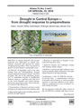 |
| WMO, GWP | 2016 | Handbook of Drought Indicators and Indices (Arabic) This handbook covers some of the most commonly used drought indicators/indices that are being applied across drought-prone regions, with the goal of advancing monitoring, early warning and information delivery systems in support of risk-based drought management policies and preparedness plans |  |
| GWP CA | 2016 | Socio-economic Analysis of the Sectoral Impacts of the 2014 Drought in Central America This document provides an estimate of the cost of the 2014 drought to economic sectors of considerable importance in the region, which are significantly affected by decreased precipitation. These include the agricultural sector, which generates a significant portion of production in rural areas, and in particular provides employment to the most economically vulnerable population; the hydroelectric sector, which generates a substantial portion of power in the region; and the WASH sector, which is undoubtedly a necessary condition for human development. The study concludes that losses in all three sectors are substantial, exceeding US$ 650 million; therefore, investments aimed at reducing vulnerability to climate change can be very profitable for countries from a socio-economic development point of view. | 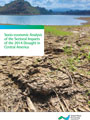 |
| GWP CA | 2016 | Análisis socioeconómico del impacto sectorial de la sequía de 2014 en Centroamérica En este documento se hace una estimación del costo que tuvo la sequía del 2014 en sectores económicos de gran importancia para la región y que se ven afectados de forma importante con la disminución de la precipitación. Estos son: el sector agrícola, que genera una parte muy importante de la producción de las zonas rurales, y en especial brinda empleo a la población más vulnerable desde el punto de vista económico; el sector hidroeléctrico, que genera una gran parte de la energía eléctrica de la región; y el sector de agua potable, que es indiscutiblemente una condición necesaria para el desarrollo humano. El estudio concluye que las pérdidas son cuantiosas en los tres sectores y sobrepasan los US$650 millones. Por esta razón, inversiones dirigidas a reducir la vulnerabilidad ante el cambio climático pueden llegar a ser muy rentables desde el punto de vista social y de desarrollo económico de los países. | 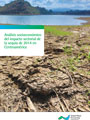 |
| FAO, WFI, NDMC, CIMH | 2016 | Drought characteristics and management in the Caribbean The report reviews information on drought characteristics and management in the Caribbean region, identifies the relevant actors involved in drought management and brings together information on their work at national and regional levels. It is based on three approaches: a review of drought literature, specifically its impact on agriculture; a review of the steps being taken mainly by government agencies to plan for and manage drought; and a questionnaire on drought sent to farmers and those who provide water services to assess their views on drought and drought management. | 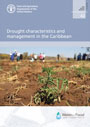 |
| WMO, GWP | 2016 | Manual de indicadores e índices de sequía La finalidad del presente manual es tratar algunos de los indicadores e índices de sequía de uso más habitual en las regiones más propensas a las sequías, con el objeto de impulsar sistemas de vigilancia, de alerta temprana y de suministro de información que respalden los planes de preparación y las políticas de gestión de la sequía basados en riesgos | 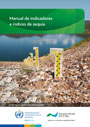 |
| WMO, GWP | 2016 | Drought management policies – from global collaboration to national action The article provides an overview of the development of national drought management policies (NDMP). It explores collaborative efforts that were started at the High-level Meeting on National Drought Policy – whose declaration provides the backdrop to this article – and are implemented through the World Meteorological Organization (WMO)/Global Water Partnership (GWP) Integrated Drought Management Programme (IDMP) and related initiatives. The article emphasizes how information from different sources is used to support countries to shift from only reacting to droughts when they occur to adopt proactive national drought policies that focus on improved collaboration and the mitigation of drought impacts. (Note: Subscription access is required to view the full article) |  |
| WMO, GWP | 2016 | Manuel des indicateurs et indices de sécheresse Le manuel présente les indicateurs et les indices les plus couramment employés dans les régions sujettes à la sécheresse dans le but de faire progresser le suivi, l’alerte précoce et la diffusion de l’information à l’appui des politiques de gestion des situations de sécheresse et des plans de préparation axés sur les risques | 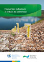 |
| WMO, GWP | 2016 | Handbook of Drought Indicators and Indices (Chinese) This handbook covers some of the most commonly used drought indicators/indices that are being applied across drought-prone regions, with the goal of advancing monitoring, early warning and information delivery systems in support of risk-based drought management policies and preparedness plans |  |
| EC-JRC | 2016 | Meteorological Droughts in Europe: Events and Impacts, Past Trends and Future Projections The findings presented in this report result from the analysis of climatological data and climate projections made as part of the GAP-PESETA project. This project aimed to gain insights into the patterns of climate change impacts in Europe until the end of the 21st century. The report provides a detailed description of the characteristics of drought events (i.e. their frequency, duration, intensity, severity) across Europe, and their evolution over the period 1950 to 2012, as well as projections until the end of the 21st century. |  |
| OECD | 2016 | Mitigating droughts and floods in agriculture: policy lessons and approaches This report proposes a comprehensive analysis of, and a set of key recommendations on policy approaches to the sustainable management of droughts and floods in agriculture. It builds on recent trends, experiences and research from OECD countries in this area, in particular Australia, Canada, France, Spain and the United Kingdom. It also provides a general policy framework that could be useful for countries to analyse their own drought and flood policies, as well as to identify ways forward. |  |
| EC JRC | 2016 | Mapping global patterns of drought risk: An empirical framework based on sub-national estimates of hazard, exposure and vulnerability The motivation for this study is the observation that little research and no concerted efforts have been made at the global level to provide a consistent and equitable drought risk management framework for multiple regions, population groups and economic sectors. Drought risk is assessed for the period 2000–2014 and is based on the product of three independent determinants: hazard, exposure and vulnerability. Findings support the idea that drought risk is driven by an exponential growth of regional exposure, while hazard and vulnerability exhibit a weaker relationship with the geographic distribution of risk values. |  |
| UNESCO | 2016 | Drought risk management: A strategic approach This book seeks to address water resource-related challenges during periods of drought. It outlines a new framework of Strategic Drought Risk Management (SDRM) that builds resilience to drought using a combination of actions to better prepare for, respond to, and recover from a drought in a way that aids the transition towards a drought resilient society. Implicit within this framework is the recognition that to manage water resources in the context of drought requires multiple responses to achieve multiple outcomes. SDRM challenges current practices that focus on meeting an ever-increasing supply requirement through engineered infrastructure such as dams and reservoirs. These practices are ineffective at providing long-term solutions and often have serious impacts on ecosystems. The research underpinning the new approach is based on (i) a review of international best practice from Australia, North Africa, Europe, North America and Latin America; (ii) lessons from historical droughts; (iii) leading academic articles; and (iv) various face-to-face expert working sessions with WWF (UK and China); leading specialists in China from the GIWP; and international experts from Australia, South Africa, US and Europe. |  |
| GWP CEE | 2015 | Natural Water Retention Measures - Guidelines Within the regional activities of the Integrated Drought Management Programme in Central and Eastern Europe (IDMP CEE), a specific project on Natural Small Water Retention Measures (NSWRM) has been implemented by a group of experts from four CEE countries: Poland, Slovakia, Hungary, and Slovenia. The outcome of this project and the lessons learnt from the activities carried out in the period 2013'2015 are summarised and presented in these Guidelines. The NWRM aim to restore the natural water retention capacity of catchments. In the past, NWRM did not includ active human involvement in the maintenance and the exploitation of the existing water systems. However, aligning with the idea of NSWRM, small hydro-technical investments such as small damming reservoirs or damming on watercourses have been advocated for. Additionally, new methods for utilising water systems, including drainage systems in river valleys, and irrigation have been suggested. |  " " |
| JH | 2015 | The drought risk atlas: Enhancing decision support for drought risk management in the United States With drought continuing to be one of the most problematic and costly natural disasters within the United States, and building on the work of the original National Drought Atlas (NDA) (1996), an updated and expanded Drought Risk Atlas (DRA) decision support tool for the United States was developed and is housed at the National Drought Mitigation Center. The DRA provides weekly calculations of multiple indices/indicators, with more than a billion records made freely available, including the SPI, SPEI, PDSI, scPDSI, Deciles and U.S. Drought Monitor. It houses more than 3000 stations with data through 2012, nearly tripling the station count of the original NDA, and utilizes a much longer period of record, nearly double that of the NDA in most cases. |  |
| GWP CEE | 2015 | Agricultural drought monitoring and yield loss prediction method - Briefing Note This report presents the results from the Demonstration Project on "Drought Risk Management Scheme: A Decision Support System", which was part of the wider Integrated Drought Management Programme in Central and East Europe (IDMP CEE). Based on the results of the demonstration project and the expertise of the people involved, recommendations for the development of a decision support system were made. |  |
| GWP CEE | 2015 | Drought Risk Management Scheme - a decision support system - Technical Note This report presents the results from the Demonstration Project on "Drought Risk Management Scheme: A Decision Support System", which was part of the wider Integrated Drought Management Programme in Central and East Europe (IDMP CEE). Based on the results of the demonstration project and the expertise of the people involved, recommendations for the development of a decision support system were made. |  |
| GWP CEE | 2015 | Guidelines for preparation of the Drought Management Plans The recommendations for the development of a drought management system described in these Guidelines provide a set of basic steps that EU and/or accession countries can use to develop national drought policy aimed at risk reduction. The Guidelines are intended for those countries that are trying to move from crisis management to drought risk reduction policy. The step-by-step planning process is based on the National Drought Management Policy Guidelines (WMO, GWP 2014) and was harmonized for EU and/or accession countries in compliance with the key principles of integrated water management and within the context of the Water Framework Directive. |  |
| IDMP HOA | 2015 | Assessment of Drought Resilience Frameworks in the Horn of Africa Global Water Partnership Eastern Africa (GWPEA), through the Integrated Drought Management Programin the Horn of Africa (IDMP HOA), facilitated country drought resilience assessments in the region. Theassessments covered socio-economic, environmental and policy issues; challenges, initiatives and available opportunities to enhance drought resilience. The assessments identified the following opportunities forpromoting drought resilience in the HOA region: 1) Existence of IGAD to establish regional and internationalmechanisms for cooperation to address cross-border drought issues; 2) The IDDRSI framework whichsupports drought resilience and sustainable development with political support and commitment at regionaland national level; 3) Availability of relevant national policies, plans and strategies; 4) Existence of nationalimplementing and coordination structures; 5) Accumulated experiences in implementing related programs,projects and initiatives; and 6) Observed interest of donors to support national and regional initiatives toenhance drought resilience. |  |
| BCMA | 2015 | Soil Water Storage Capacity and Available Soil Moisture Water Conservation Fact Sheet. |  |
| EC-JRC, IES | 2015 | Models of Drought Hazard, Exposure, Vulnerability and Risk for Latin America This Technical Report focuses on the development of models to map the geographic distribution and intensity of drought hazard, exposure, vulnerability and risk for Latin America. |  |
| GWP CEE | 2015 | Natural Water Retention Measures - Case Studies Different projects engaging with the implementation of small water natural retention measures (SWNRM) have been executed in all the countries participating in that publication. Various examples of technical solutions for surface water retention, including retention for flood protection purposes, as well as water retention resulting from beavers' activity have been presented in this manual. The main focus among these case studies is surface water retention, including construction of small water reservoirs. However, one case study focuses on wetlands protection. The aim of this particular project was to limit the negative ecological effects resulting from drainage. This project is an example of combining the problem of rainwater retention, and the protection of wetlands ecosystems. In addition, because many small water retention measures are implemented in forests, one example of a project implemented in such an area is provided. | 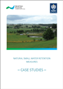 |
| MODSIM | 2015 | Drought Assessment in the Pampanga River Basin, the Philippines. Part 1: A Role of Dam Infrastructure in Historical Droughts Droughts are frequent disasters in the Philippines with the most severe 1998 drought, which caused food shortages nationwide and major losses of rice production in the Pampanga River basin. We conducted drought assessment with standardized indices in the Pampanga River basin by characterizing historical droughts (Part 1), introducing a comparative approach of standardized indices for climate change quantification (Part 2), and evaluating climate change impacts (Part 3). In Part 1, we computed standardized indices with collected field data (i.e., precipitation, reservoir inflows and water volumes, and dam discharges) to identify natural and socio-economic droughts at the Pantabangan and Angat dams. We utilized the standardized precipitation index (SPI) to characterize meteorological droughts and developed a standardized inflow index (SII) from reservoir inflows for hydrological drought assessment. To characterize socioeconomic droughts, we developed a standardized reservoir storage index (SRSI), which was computed with reservoir inflow and water volume data, and compared SRSI values with standardized discharge index (SDI) values, which were estimated from dam discharges that were released to meet irrigation and municipal water demands. From the results of our drought assessment, we identified several meteorological, hydrological and socioeconomic droughts between 1980 and 2012 with standardized indices. The use of several standardized indices allows us to identify the most extreme conditions based on the combined meteorological, hydrological and socio-economic droughts. The newly developed SII and SRSI indices match historical natural and socio-economic droughts in the Pampanga river basin and reflect increased inflows in the Pantabangan dam after the construction of trans-basin tunnel. As a result, the full-set of standardized indices represents the existing dam infrastructure and operation and could also be utilized for drought forecasting in the Pampanga river basin. |  |
| UNW-DPC | 2015 | Proceedings of the Regional Workshop on Capacity Development to Support National Drought Management Policies for Asia-Pacific Countries Launched in March 2013 on the margins of the High-level Meeting on National Drought Policy (HMNDP) in Geneva, Switzerland, the UN-Water initiative on Capacity Development to Support National Drought Management Policies (NDMP) is a collaborative effort to help drought-prone countries formulate and adopt effective, risk-based national drought management policies through the targeted development of capacities among the various stakeholders dealing with drought at all levels. The present proceedings cover the outcomes of the regional workshop for Latin American and the Caribbean Countries, which took place in Fortaleza, Brazil from 4 to 6 December 2013. |  |
| UNW-DPC | 2015 | Proceedings of the Regional Workshop on Capacity Development to Support National Drought Management Policies for Latin America and the Caribbean Countries (Spanish) La iniciativa de ONU-Agua para el desarrollo de capacidades en apoyo de las políticas nacionales de gestión de sequías (NDMP), lanzada el 12 de marzo de 2013 en el marco de la reunión de alto nivel de políticas nacionales sobre la sequía, en Ginebra, es una actividad de colaboración para ayudar a los Estados Miembros propensos a la sequía a formular y aprobar políticas nacionales de gestión de la sequía tras la evaluación de los riesgos mediante el desarrollo de capacidades específicas de diversos interesados que se ocupan de la sequía a diferentes niveles. El tema de la presente acta abarca los resultados del taller regional para los países de América Latina y el Caribe que se celebró en Fortaleza (Brasil), entre el 4 y el 6 de diciembre de 2013. |  |
| UNW-DPC | 2015 | Proceedings of the Regional Workshops on Capacity Development to Support National Drought Management Policies for Eastern and Southern Africa and the Near East and North Africa countries Launched in March 2013 on the margins of the High-level Meeting on National Drought Policy (HMNDP) in Geneva, Switzerland, the UN-Water initiative on Capacity Development to Support National Drought Management Policies (NDMP) is a collaborative effort to help drought-prone countries formulate and adopt effective, risk-based national drought management policies through the targeted development of capacities among the various stakeholders dealing with drought at all levels. The present proceedings cover the outcomes of the regional workshop for Eastern and Southern Africa which took place in Addis Ababa, Ethiopia from 5 to 8 August 2014, and the regional workshop for the Near East and North Africa which took place in Cairo, Egypt from 17 to 20 November 2014. |  |
| UNW-DPC | 2015 | Synthesis: Capacity Development to Support National Drought Management Policies This document is a collaborative output of the partners of the UN-Water Initiative on 'Capacity Development to Support National Drought Management Policy (NDMP)'. It presents the initiative's major objectives, the rationale behind national drought management policies, the key pillars and the 10-step process for developing national drought policies and drought preparedness plans. It also provides the lessons learnt from the series of regional workshops and conveys the challenges and key steps for countries on how to develop and implement national drought policies. The document is directed to government policymakers and to other stakeholders mandated to support them in building drought-resilient communities. |  |
| SD | 2014 | Global integrated drought monitoring and prediction system Drought is by far the most costly natural disaster that can lead to widespread impacts, including water and food crises. Here we present data sets available from the Global Integrated Drought Monitoring and Prediction System (GIDMaPS), which provides drought information based on multiple drought indicators. The system provides meteorological and agricultural drought information based on multiple satellite-, and model-based precipitation and soil moisture data sets. GIDMaPS includes a near real-time monitoring component and a seasonal probabilistic prediction module. The data sets include historical drought severity data from the monitoring component, and probabilistic seasonal forecasts from the prediction module. The probabilistic forecasts provide essential information for early warning, taking preventive measures, and planning mitigation strategies. GIDMaPS data sets are a significant extension to current capabilities and data sets for global drought assessment and early warning. The presented data sets would be instrumental in reducing drought impacts especially in developing countries. Our results indicate that GIDMaPS data sets reliably captured several major droughts from across the globe. |  |
| IFRC | 2014 | Early Warning Early Action: Mechanisms for Rapid Decision Making This report looks at the existing early warning and early actions systems in Kenya, Uganda and Ethiopia, as well as at regional level, and presents a model system. It builds on many ideas and examples that came to light during the research project led by the International Federation of Red Cross and Red Crescent Societies (IFRC), in partnership with Oxfam, Save the Children, FAO and WFP, and combines these into a single model. It considers both the components of the system, and the environment in which it operates. Furthermore, this research seeks to identify the most important areas for further investment to address substantial gaps. Some of these gaps are in 'hardware', but some of them are 'software'. Additional work to increase confidence in the early warning systems and analysis is a critical precursor to be able to address most of the gaps. |  |
| WCE | 2014 | Information systsems in a changing climate: early warnings and drought risk management There are numerous warning systems being implemented at different scales of governance. We draw on the lessons of over 21 drought early warning systems around the world, in both developing and developed countries and at regional, national and community levels. The successes illustrate that effective early warning depends upon a multi-sectoral and interdisciplinary collaboration among all concerned actors at each stage in the warning process from monitoring to response and evaluation. However, the links between the community-based approach and the national and global EWSs are relatively weak. Using the rich experience of information systems across the globe, this paper identifies pathways for knowledge management and action at the relevant scales for decision-making in response to a changing climate. |  |
| WEF | 2014 | Global Risks 2014: Ninth Edition This report highlights how global risks are not only interconnected but also have systemic impacts. It features the failure of climate change mitigation and adaptation, and the greater incidence of extreme weather events (e.g. floods, storms, fires), in 5th and 6th position among the ten global risks of highest concern in 2014. The report argues that, in order to manage global risks effectively and build resilience to their impacts, better efforts are needed to understand, measure and foresee the evolution of interdependencies between risks, supplementing traditional risk-management tools with new concepts designed for uncertain environments. It considers that the world faces risks that can be addressed only by long-term thinking and collaboration among business, governments and civil society. It aims to support this process by: (i) exploring the nature of systemic risks; (ii) mapping 31 global risks according to the level of concern they arouse, their likelihood and potential impact, as well as the strength of the interconnections between them; (iii) looking in-depth at the ways in which three constellations of global risk ' centred on youth, cyberspace and geopolitics ' could interplay and have systemic impact. |  |
| CARE | 2014 | Firm Footing in the Face of Change: Rights and Equity in the Context of Climate Change, Food Insecurity and Human Mobility This policy report presents the results of 'Where the rain falls', a research undertaken across 8 countries by CARE and the United Nations University, which confirms that communities are already grappling with the effects of changing rainfall patterns and need to be supported to make better and more informed choices for successful adaptation. It argues that, if we do not reduce emissions urgently and drastically, if we do not expand livelihoods and risk management options for vulnerable households, they will fall further into poverty with no choice but to migrate. Using case studies, the report highlights evidence for urgent action related to increased climate variability, increased risk, community-based adaptation, food insecurity and gender, among others; and calls on Parties to the UNFCCC to act now to: (i) reduce greenhouse gas emissions; (ii) prioritise and increase new and additional financing for adaptation; (iii) prioritise the most vulnerable populations and integrate gender in efforts to tackle climate change; (iv) give particular attention to the impacts of climate change on food and nutrition security and smallholder agriculture; and (v) ensure linkages with key global policy processes like the post-2015 Development Goals and the Hyogo Framework for Action. |  |
| IDMP | 2014 | National Drought Management Policy Guidelines. A Template for Action (French) The National Drought Management Policy Guidelines provide a template for action that countries can use in the development of a national drought management policy and drought preparedness/mitigation plans. The process is structured in 10 steps that can be adapted by countries to reflect their institutional, infrastructure, legal, socio-economic and environmental context. It includes case studies from Brazil, Mexico, Morocco and the USA and will be continuously updated based on the experiences gained in the guidelines' application. The guidelines respond to a need for action oriented drought policies, which Governments articulated at the High-Level Meeting on National Drought Policies. |  |
| FAO | 2014 | Helping Farmers to Cope with Climate Change This brochure addresses the increasing vulnerability of rural populations of Uganda to the impact of climate change. It presents FAO's work in building the capacity of policy makers and government officials in making national planning and development climate proof, and in contributing to vulnerability assessments and the development of early warning and risk management systems that facilitate adaptation to climate variability and change. |  |
| GWP CA | 2014 | Hoja Informativa - Sequía en Centroamérica Cuando se habla de sequía, se suele pensar en otras partes del mundo. Pero es un tema de gran importancia para Centroamérica, porque aunque es una región reconocida por la abundancia de sus recursos hídricos, los períodos de sequía se manifiestan en picos de desnutrición aguda en la población que ya sufre desnutrición crónica. |  |
| GWP SA | 2014 | Summary Report of the Need Assessment Survey on the Development of South Asian Drought Monitoring System (SA DMS) GWP South Asia with support from the IDMP conducted a Needs and Capacity Assessment Survey for the development of a South Asian Drought Monitoring System (SA DMS) in Afghanistan, Bhutan, Bangladesh, Maldives, Nepal, India, Pakistan and Sri Lanka with the support of GWP's Country Water Partnerships. It revealed that there is no validated system of early warning on drought that could meet the requirement for a high spatial resolution in any of the surveyed countries. Challenges that countries face include lack of hydrological/meteorological measurement stations, missing access to satellite data, insufficient rainfall prediction capability, or shortage of well-trained staff. |  |
| UNCCD | 2014 | Desertification: The Invisible Frontline A new publication by the UNCCD examines desertification as a cause of global conflict and instability and calls for urgent action to support communities in crisis.More than 1.5 billion people in the world depend on degrading land, and 74% of them are poor. As the effects of climate change undermine livelihoods, inter-ethnic clashes are breaking out within and across states and fragile states are turning to militarization to control the situation. The effects of desertification are increasingly felt globally as victims turn into refugees, internally displaced people and forced migrants or they turn to radicalization, extremism or resource-driven wars for survival. If we are to restore peace, security and international stability in a context where changing weather events are threatening the livelihoods of more and more people, survival options are declining and state capacities are overburdened, then more should be done to combat desertification, reverse land degradation and mitigate the effects of drought. Otherwise, many small-scale farmers and poor, land-dependent communities face two choices: fight or flight. |  |
| IDMP | 2014 | IDMP Flyer (Arabic) Integrated Drought Management (IDM) is a critical component of disaster risk reduction programmes, climateadaptation strategies and national water resources policies, bringing together the needs of the different stakeholders affected by droughts. In order to address drought issues more effectively, WMO and GWP have jointly launched the Integrated Drought Management Programme (IDMP). Together with our partners, the IDMP aims to provide preventive and demand-driven support mechanisms for the communities, countries and regions affected by drought. |  |
| IDMP | 2014 | IDMP Flyer (Chinese) Integrated Drought Management (IDM) is a critical component of disaster risk reduction programmes, climateadaptation strategies and national water resources policies, bringing together the needs of the different stakeholders affected by droughts. In order to address drought issues more effectively, WMO and GWP have jointly launched the Integrated Drought Management Programme (IDMP). Together with our partners, the IDMP aims to provide preventive and demand-driven support mechanisms for the communities, countries and regions affected by drought. |  |
| IDMP | 2014 | IDMP Flyer (Spanish) La gestión integrada de sequías es un componente esencial de los programas de reducción de riesgos de desastre, las estrategias de adaptación al clima y las políticas nacionales relativas a recursos hídricos, que agrupan las necesidades de las diferentes partes interesadas afectadas por las sequías. Con el fin de abordar las cuestiones relacionadas con la sequía de forma más eficaz, la OMM y la Asociación Mundial para el Agua pusieron en marcha conjuntamente el Programa de gestión integrada de sequías. Con este último, se pretende proporcionar mecanismos de apoyo preventivos basados en la demanda destinados a las comunidades, los países y las regiones afectados por la sequía y para lo cual se cuenta con la colaboración de nuestros asociados. |  |
| IDMP | 2014 | IDMP Flyer (French) S'attachant à concilier les besoins des différentes parties prenantes, la gestion intégrée des sécheresses est une composante essentielle des programmes de prévention des catastrophes, des stratégies d'adaptation au climat et des politiques nationales de gestion des ressources en eau. Afin de mieux traiter les questions relatives à la sécheresse, l'OMM et le GWP ont lancé le Programme de gestion intégrée des sécheresses (IDMP). En collaboration avec les différents partenaires, l'IDMP vise à établir des mécanismes de soutien préventifs, déterminés par la demande, au bénéfice des populations, des régions et des pays victimes de la sécheresse. |  |
| IDMP | 2014 | IDMP Flyer (Russian) Integrated Drought Management (IDM) is a critical component of disaster risk reduction programmes, climateadaptation strategies and national water resources policies, bringing together the needs of the different stakeholders affected by droughts. In order to address drought issues more effectively, WMO and GWP have jointly launched the Integrated Drought Management Programme (IDMP). Together with our partners, the IDMP aims to provide preventive and demand-driven support mechanisms for the communities, countries and regions affected by drought. |  |
| IDMP | 2014 | National Drought Management Policy Guidelines. A Template for Action (English) The National Drought Management Policy Guidelines provide a template for action that countries can use in the development of a national drought management policy and drought preparedness/mitigation plans. The process is structured in 10 steps that can be adapted by countries to reflect their institutional, infrastructure, legal, socio-economic and environmental context. It includes case studies from Brazil, Mexico, Morocco and the USA and will be continuously updated based on the experiences gained in the guidelines' application. The guidelines respond to a need for action oriented drought policies, which Governments articulated at the High-Level Meeting on National Drought Policies. | 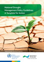 |
| IDMP | 2014 | National Drought Management Policy Guidelines. A Template for Action (Arabic) The National Drought Management Policy Guidelines provide a template for action that countries can use in the development of a national drought management policy and drought preparedness/mitigation plans. The process is structured in 10 steps that can be adapted by countries to reflect their institutional, infrastructure, legal, socio-economic and environmental context. It includes case studies from Brazil, Mexico, Morocco and the USA and will be continuously updated based on the experiences gained in the guidelines' application. The guidelines respond to a need for action oriented drought policies, which Governments articulated at the High-Level Meeting on National Drought Policies. |  |
| IDMP | 2014 | National Drought Management Policy Guidelines. A Template for Action (Chinese) The National Drought Management Policy Guidelines provide a template for action that countries can use in the development of a national drought management policy and drought preparedness/mitigation plans. The process is structured in 10 steps that can be adapted by countries to reflect their institutional, infrastructure, legal, socio-economic and environmental context. It includes case studies from Brazil, Mexico, Morocco and the USA and will be continuously updated based on the experiences gained in the guidelines' application. The guidelines respond to a need for action oriented drought policies, which Governments articulated at the High-Level Meeting on National Drought Policies. |  |
| IDMP | 2014 | National Drought Management Policy Guidelines. A Template for Action (Spanish) The National Drought Management Policy Guidelines provide a template for action that countries can use in the development of a national drought management policy and drought preparedness/mitigation plans. The process is structured in 10 steps that can be adapted by countries to reflect their institutional, infrastructure, legal, socio-economic and environmental context. It includes case studies from Brazil, Mexico, Morocco and the USA and will be continuously updated based on the experiences gained in the guidelines' application. The guidelines respond to a need for action oriented drought policies, which Governments articulated at the High-Level Meeting on National Drought Policies. |  |
| JH | 2014 | A Nonparametric Multivariate Multi-Index Drought Monitoring Framework Accurate and reliable drought monitoring is essential to drought mitigation efforts and reduction of social vulnerability. A variety of indices, such as the standardized precipitation index (SPI), are used for drought monitoring based on different indicator variables. Because of the complexity of drought phenomena in their causation and impact, drought monitoring based on a single variable may be insufficient for detecting drought conditions in a prompt and reliable manner. This study outlines a multivariate, multi-index drought monitoring framework, namely, the multivariate standardized drought index (MSDI), for describing droughts based on the states of precipitation and soil moisture. In this study, the MSDI is evaluated against U.S. Drought Monitor (USDM) data as well as the commonly used standardized indices for drought monitoring, including detecting drought onset, persistence, and spatial extent across the continental United States. The results indicate that MSDI includes attractive properties, such as higher probability of drought detection, compared to individual precipitation and soil moisture–based drought indices. This study shows that the MSDI leads to drought information generally consistent with the USDM and provides additional information and insights into drought monitoring. |  |
| IDMP | 2014 | National Drought Management Policy Guidelines. A Template for Action (Russian) The National Drought Management Policy Guidelines provide a template for action that countries can use in the development of a national drought management policy and drought preparedness/mitigation plans. The process is structured in 10 steps that can be adapted by countries to reflect their institutional, infrastructure, legal, socio-economic and environmental context. It includes case studies from Brazil, Mexico, Morocco and the USA and will be continuously updated based on the experiences gained in the guidelines' application. The guidelines respond to a need for action oriented drought policies, which Governments articulated at the High-Level Meeting on National Drought Policies. |  |
| IDMP | 2014 | IDMP Flyer (English) Integrated Drought Management (IDM) is a critical component of disaster risk reduction programmes, climateadaptation strategies and national water resources policies, bringing together the needs of the different stakeholders affected by droughts. In order to address drought issues more effectively, WMO and GWP have jointly launched the Integrated Drought Management Programme (IDMP). Together with our partners, the IDMP aims to provide preventive and demand-driven support mechanisms for the communities, countries and regions affected by drought. |  |
| WRR | 2014 | A drought index accounting for snow The Standardized Precipitation Index (SPI) is the most widely used index to characterize droughts that are related to precipitation deficiencies. However, the SPI does not always deliver the relevant information for hydrological drought management particularly in snow-influenced catchments. If precipitation is temporarily stored as snow, then there is a significant difference between meteorological and hydrological drought because the delayed release of melt water to the stream. We introduce an extension to the SPI, the Standardized Snow Melt and Rain Index (SMRI), that accounts for rain and snow melt deficits, which effectively influence streamflow. The SMRI can be derived without snow data, using temperature and precipitation to model snow. The value of the new index is illustrated for seven Swiss catchments with different degrees of snow influence. In particular for catchments with a larger component of snowmelt in runoff generation, the SMRI was found to be a worthwhile complementary index to the SPI to characterize streamflow droughts. |  |
| UNW-DPC | 2014 | Proceedings of the Regional Workshop on Capacity Development to Support National Drought Management Policies for Latin America and the Caribbean Countries (English) Launched in March 2013 on the margins of the High-level Meeting on National Drought Policy (HMNDP) in Geneva, Switzerland, the UN-Water initiative on Capacity Development to Support National Drought Management Policies (NDMP) is a collaborative effort to help drought-prone countries formulate and adopt effective, risk-based national drought management policies through the targeted development of capacities among the various stakeholders dealing with drought at all levels. The present proceedings cover the outcomes of the regional workshop for for Latin American and the Caribbean Countries, which took place in Fortaleza, Brazil from 4 to 6 December 2013. |  |
| COIN | 2014 | Moving Stories: The Voices of People who Move in the Context of Environmental Change This document compiles testimonies from ten regions across the world, from local news reports, academic journals and interviews recorded by civil society groups. The stories highlight different kinds of movement affected by slow' and rapid'onset disasters, showing that movement linked to environmental change happens very differently in different parts of the world. The stories also reveal that individual decisions to move or stay vary widely even in response to the same disaster. A number of stories show how people have used moving seasonally and temporarily, rather than permanently, as a way of adapting to changing environmental conditions. Several stories demonstrate that remittances from other migrants have increased the resilience of people affected by disasters. |  |
| WMO | 2013 | HMNDP Final Declaration (French) La Déclaration finale de la Réunion de haut niveau sur les politiques nationales en matière de sécheresse, qui a eu lieu le 11-15 Mars 2013 à Genève, Suisse. Les gouvernements de tous les pays sont encouragés à élaborer et à mettre en Åuvre des politiques nationales de gestion de la sécheresse, avec le soutien de l'OMM, l'UNCCD et la FAO, ainsi que tous les autres organismes et initiatives de l'ONU concernés. |  |
| WMO | 2013 | HMNDP Final Declaration (Spanish) La Declaración Final de la Reunión de Alto Nivel de Políticas Nacionales sobre la Sequía, celebrada el 11 hasta 15 marzo, 2013 en Ginebra, Suiza. Se alienta a todos los gobiernos del mundo a formular y aplicar políticas nacionales de gestión de la sequía, con la asistencia de la OMM, la CLD y la FAO, así como todos los otros organismos e iniciativas pertinentes de las Naciones Unidas. |  |
| WMO | 2013 | HMNDP Final Declaration (Russian) The Final Declaration of the High Level Meeting on National Drought Policy, held on 11-15 March 2013 in Geneva, Switzerland. All Governments around the world are encouraged to develop and implement National Drought Management Policies, with the assistance of WMO, UNCCD and FAO, as well as all other related UN agencies and initiatives. |  |
| AWR | 2013 | Multivariate Standardized Drought Index: a parametric multi-index model Defining droughts based on a single variable/index (e.g., precipitation, soil moisture, or runoff) may not be sufficient for reliable risk assessment and decision-making. In this paper, a multivariate, multi-index drought-modeling approach is proposed using the concept of copulas. The proposed model, named Multivariate Standardized Drought Index (MSDI), probabilistically combines the Standardized Precipitation Index (SPI) and the Standardized Soil Moisture Index (SSI) for drought characterization. In other words, MSDI incorporates the meteorological and agricultural drought conditions for overall characterization of drought. In this study, the proposed MSDI is utilized to characterize the drought conditions over several Climate Divisions in California and North Carolina. The MSDI-based drought analyses are then compared with SPI and SSI. The results reveal that MSDI indicates the drought onset and termination based on the combination of SPI and SSI, with onset being dominated by SPI and drought persistence being more similar to SSI behavior. Overall, the proposed MSDI is shown to be a reasonable model for combining multiple indices probabilistically. |  |
| CCAPS | 2013 | Climate Change, Growth, and Poverty in Ethiopia Climate change is now a global phenomenon with growth, poverty, food security, and stability implications.Because of significant dependence on the agricultural sector for production, employment, and exportrevenues, Ethiopia is seriously threatened by climate change, which contributes to frequent drought,flooding, and rising average temperatures. To examine the impact of climate change on agriculturalproduction and to quantify the resulting lost output, this study conducts a time series analysis usingcountry and regional level data. The econometric application on the appropriate production functiondemonstrates that rainfall significantly explains economic activity. The analysis reveals that Ethiopia haslost a cumulative level of over 13 percent of its current agricultural output between 1991 and 2008. If thecurrent rate of decline in the average annual level of rainfall continues over the medium term, Ethiopiawill forgo, on average, more than six percent of each year's agricultural output. The poverty impact ofrainfall variability is enormous. Thus, mitigating and adapting to climate change, though costly, cansustain growth and reduce poverty in the country. |  |
| CGIAR, FAO | 2013 | Disaster Risk Reduction Management in the Drylands in the Horn of Africa Countries in the Horn of Africa contain some of the most disaster-prone areas in the world. Drought in particular affectsmore people more frequently than any other disaster. The economic, social and environmental impacts on the affectedpopulations are extreme. The national costs and losses incurred are also threatening to undermine the wider economicgrowth and other development gains being made in many Horn of Africa states. |  |
| EASAC | 2013 | Trends in Extreme Weather Events in Europe: Implications for National and European Union Adaptation Strategies This report, based on a comprehensive collection of scientific data from the last 20 years, provides a rallying call for Europe's policy makers to come together to devise common strategies to help mitigate the physical, human and economic costs of the rising number of extreme weather events in Europe, such as extreme heat and cold, extremes of precipitation, storms, winds and surges, and drought. Highlights refer to the nature of the evidence for climate-driven changes in extreme weather in the past, the potential impact of further climate change in altering the pattern of these extremes, and possible adaptation strategies for dealing with extreme weather impacts. It first provides information on extreme weather events and trends in recent decades as well as related impacts upon society. It is followed by an introduction to the scientific background on global warming and weather extremes, and the projections of future trends of meteorological extreme events that emerge from climate models under various scenarios of future greenhouse gas emissions. Finally, approaches to adaptation are introduced and recommendations provided. Readers wishing to obtain full source details for the figures, tables and references are recommended to consult the full report, which also includes more detailed analyses of the climatic conditions in various sub-regions of the EU. |  |
| FAO | 2013 | Status of Disaster Risk Managment: Plans for Floods, Hurricanes and Drought in the Agricultural Sector: Caribbean This report presents the findings of a study commissioned by the Food and AgricultureOrganization of the United Nations (FAO) to review the status of development andimplementation of disaster risk management (DRM) plans for the agriculture sectorthroughout the Caribbean. Specifically, the assignment was designed to achieve thefollowing objectives:- determine the availability of DRM plans for droughts, hurricanes and floods in theagriculture sector throughout 20 Caribbean countries, namely: Anguilla, Antiguaand Barbuda, the Bahamas, Barbados, Belize, British Virgin Islands, Cuba,Dominica, the Dominican Republic, Grenada, Guyana, Haiti, Jamaica, Montserrat,Saint Kitts and Nevis, Saint Lucia, Saint Vincent and the Grenadines, Suriname,Trinidad and Tobago and Turks and Caicos; and- review existing plans to identify best practices, shortcomings, challenges and areaswhere development agencies may assist countries to complete and implement theseplans. |  |
| FAO | 2013 | Smallholders and sustainable wells. A Retrospect: Participatory Groundwater Management in Andhra Pradesh (India) This study analyses the lives of two successive Participatory Groundwater Management programs in Andhra Pradesh, India, which ran from the mid-1990s to 2010, and were centred around small wells, typically servicing a few families each. The programs ran in 660 villagers across drought-prone districts of Andhra Pradesh, and by their culmination had and involved the participation of nearly 20,000 farmers as barefoot technicians. The core principles adopted by these programs were: demystifying hydrological science and technology for rural communities; enabling them to blend their local knowledge for sustainable management of their groundwater resources through a network of Farmer Water Schools and information kiosks, and an emphasis on reducing agricultural water demand through options such as reduction in the number of new wells that might lead to unsustainable over extraction (voluntary self-regulation), changes in cropping pattern, efficient water use and soil moisture management. The programs also addressed the overarching issue of hydrological data scarcity, necessary to formulate better policies, by involving farmers in the collection and recoding of such local data. The report suggests that the success of these programs lay in the fact that they recognised information, education and social mobilization as key objectives of a participatory model and not subsidiary criteria. |  |
| GWP | 2013 | Responding to Drought: Briefing Note Water is central to the world's development challenges. Whether it is food security, poverty reduction, economic growth, energy production, human health - water is the common denominator. Climate change is the spoiler. The increase in catastrophic events such as droughts and floods will impact lives, livelihoods, land values, and investment incentives, especially in vulnerable areas inhabited by poorer populations. |  " " |
| IFPRI | 2013 | East African Agriculture and Climate Change: A Comprehensive Analysis This book, which is second of three books in IFPRI's climate change in Africa series, examines the food security threats facing Burundi, Democratic Republic of Congo, Eritrea, Kenya, Madagascar, Rwanda, Sudan, Tanzania, and Uganda and explores how climate change will increase the efforts needed to achieve sustainable food security throughout the region. East Africa's populations is expected to grow at least through mid-century. The region will also see income growth. Both will put increased pressure on the natural resources needed to produce food, and climate change makes the challenges greater. East Africa is already experiencing rising temperatures, shifting precipitation patterns, and increasing extreme events. Without attention to adaptation, the poor will suffer. Through the use of hundreds of scenario maps, models, figures, and detailed analysis, the editors and contributors of this document present plausible future scenarios that combine economic and biophysical characteristics to explore the possible consequences for agriculture, food security, and resources management to 2050. They also offer recommendations to national governments and regional economic agencies already dealing with the vulnerabilities of climate change and deviations in environment. The document is aimed at helping policymakers and researchers shaping policy and studying the various and likely consequences of climate change. |  |
| IFRC | 2013 | Changes in the Arid Lands: The Expanding Rangeland - Regional Synthesis Report and Case Studies from Kenya, Ethiopia and Somaliland This research study captures the enormous change ongoing in the arid lands in the aftermath of the drought and famine of 2011. It takes a snapshot of changes affecting people's lives in Shinile and Jijiga (Ethiopia), Togdheer (Somaliland) and Turkana (Kenya). The research gives voice to the people of pastoral and non-pastoral, chronically drought affected communities in the arid lands about what they want to do with their lives, in order to understand what is expected to be seen ten years from now and what is needed to support people to achieve their desired future. |  |
| IFRC | 2013 | Ethiopia: How Law and Regulation Supports Disaster Risk Reduction - Country Case Study Report The purpose of the country case studies as a whole is to assist IFRC and UNDP in compiling a global synthesis report on disaster risk reduction (DRR) and legislation. The data will also be used to inform the parallel development of a checklist for lawmakers. The synthesis study will be available as a tool for states and international actors, including UNDP and the Red Cross and Red Crescent Movement, by providing comparative data and examples of good legislative practices and their implementation. It will also be used to develop other tools as the basis for advocacy and capacity building in DRR. The purpose of the present country case study is to provide country level information and analysis for this global project, but also to provide insights into law and disaster risk reduction in Ethiopia. |  |
| IIED | 2013 | The Role of Community-based Natural Resource Management in Climate Change Adaptation in Ethiopia This Climate Change Working Paper describes the methodology developed to assess the role of selected community-based/participatory initiatives undertaken by Save the Children with pastoral communities in the lowlands of Borana and Guji zones in Ethiopia in contributing to climate change adaptation. The paper also outlines the results and recommendations generated from applying this bespoke methodology at the study sites. Similar sites that also suffered from drought and had the same history of development and humanitarian interventions, but had no Save the Children interventions, were also visited for comparative purposes. |  |
| MunichRE | 2013 | Topics Geo: Natural Catastrophes 2012 - Analyses, Assessments, Positions Approximately 1,000 events are recorded and analysed every year. The information collated can be used to document and perform risk and trend analyses on the extent and intensity of individual natural hazard events in various parts of the world. A selection of analyses can be accessed here. You can find annual statistics from 2004 onwards, informative maps, Focus Analyses and comprehensive basic knowledge in Touch Natural Hazards. |  |
| WMO | 2013 | Managing Too Much or Too Little Water - A WMO Factsheet This factsheet addresses WMO and UN efforts to establish science-based foundations for practical and proactive drought policies at national level to make drought-prone countries more resilient. Using examples from Kenya and various countries in Asia and Central and Eastern Europe, it presents the coordinated drive towards science-based drought disaster risk reduction, the new Integrated Drought Management Programme established by WMO and the Global Water Partnership and the the IFM HelpDesk, a web-based facility that provides pragmatic, demand-driven guidance strategy, policy and technical know-how to increase resilience to floods while using best practices to enhance beneficial aspects of floods. |  |
| NOAA | 2013 | An Interpretation of the Origins of the 2012 Central Great Plains Drought This report describes the morphology of the 2012summer U.S. central Great Plains drought, placingthe event into a historical context, and providinga diagnosis of its proximate and underlying causes.Precipitation de$cits for the period May-August2012 averaged over the central Great Plains werethe most severe in the instrumental record since1895, eclipsing the driest summers of 1934 and1936 that occurred during the height of the DustBowl. |  |
| ODI | 2013 | The Geography of Poverty, Disasters and Climate Extremes in 2030 This report examines the relationship between disasters and poverty. The report's key messages are: Extreme weather linked to climate change is increasing and will likely cause more disasters. Such disasters, especially those linked to drought, can be the most important cause of impoverishment, cancelling progress on poverty reduction.Up to 325 million extremely poor people will be living in the 49 most hazard-prone countries in 2030, the majority in South Asia and sub-Saharan Africa.The 11 countries most at risk of disaster-induced poverty are Bangladesh, Democratic Republic of the Congo, Ethiopia, Kenya, Madagascar, Nepal, Nigeria, Pakistan, South Sudan, Sudan and Uganda.Disaster risk management should be a key component of poverty reduction efforts, focusing on protecting livelihoods as well as saving lives. There is a need to identify and then act where the poor and disaster risks are most concentrated.The post-2015 development goals must include targets on disasters and climate change, recognising the threat they pose to the headline goal of eradicating extreme poverty by 2030. |  |
| RIASCO | 2013 | Humanitarian trends in Southern Africa: challenges and opportunities This groundbreaking study looks into the threats likely to confront southern African communities over the next decade. It identifies regional and global factors, including disaster risk reduction, that may impact the lives and livelihoods of southern Africans and, as importantly, the available capacities to address these challenges. It sees the paradigm shift between response to crises and their underlying structural causes in efforts to strengthen disaster risk reduction, address the vulnerability of communities and build resilience by linking humanitarian action to a wider developmental context. It argues that ensuring that mitigation, preparedness, humanitarian response and development are integrated not only builds sustainability but also better prepares us for the next disaster. This research was prompted by a growing consensus that 'the nature of humanitarian emergencies is changing', with future emergencies increasingly driven over time by 'a combination of complex and inter-related circumstances', rather than single, identifiable shocks. Such observations resonate closely with those of humanitarian actors within southern Africa who, in recent years, have been confronted with new challenges. These include the effects of climate variability, characterized by sudden-onset weather events along with prolonged dry spells. They also include food and energy price volatility that contributed to social violence and sudden displacement, as well as regional cholera and measles outbreaks, which claimed thousands of lives, especially among children in urban areas. | 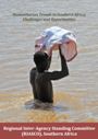 |
| WMO | 2013 | HMNDP Final Declaration (Arabic) The Final Declaration of the High Level Meeting on National Drought Policy, held on 11-15 March 2013 in Geneva, Switzerland. All Governments around the world are encouraged to develop and implement National Drought Management Policies, with the assistance of WMO, UNCCD and FAO, as well as all other related UN agencies and initiatives. |  |
| UNCCD | 2013 | Advocacy Policy Framework on the Thematic Issue of Drought, Incuding Water Scarcity This draft advocacy policy framework (APF) on drought was compiled by thesecretariat of the United Nations Convention to Combat Desertification (UNCCD). Along with decision 9/COP.10, the APF on drought provides the UNCCDsecretariat with tools and approaches for assisting country Parties in addressing key droughtissues and concerns. The overarching goal of this APF is to promote the development andadoption of policies that reduce societal vulnerability to drought. It aims to promoteenabling national policies that meet the challenges presented by drought in the drylands.The APF is intended to help countries respond to these challenges by developingnational drought management policies (NDMPs) and a broad array of related national laws,regulations and programmes for supporting, funding and mitigating the impacts of droughton humans, animals, industry, agriculture and the environment. This APF allows thesecretariat to interact with and advocate to countries' policymakers to develop and adoptrelevant drought management policies at country level.The APF is not intended to provide any content or any specific recommended policyposition. The specifics of an NDMP are country-dependent and need to be worked out bythe countries concerned with the full participation of all interested and affectedstakeholders. The legal implications of the proposed drought policy and the consistencybetween the emerging policy and the policies of other sectors must be taken intoconsideration. |  |
| UNFPA, IIED | 2013 | Climate Vulnerability and Adaptation in the Semarang Metropolitan Area: A Spatial and Demographic Analysis This technical briefing addresses: (i) the relationship between population dynamics and vulnerability to climate change in Semarang, a city located in Central Java, Indonesia, which faces hazards such as drought, land subsidence, landslides and floods, many of which are likely to become more severe and frequent as a result of climate change; and (ii) the related need to develop more targeted and effective adaptation policies and actions. The document presents demographic and spatial analysis indicating areas in which exposure to climate-related hazards coincides with social and demographic characteristics that exacerbate vulnerability. It is intended to be used to target policies and initiatives toward reducing the impacts of climate change more effectively. It is the fourth in a series of technical briefings prepared by UNFPA and IIED on urbanization and emerging population issues. | 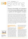 |
| UNISDR-ROAS | 2013 | Factsheet: Overview of Disaster Risk Reduction in the Arab Region This publication provides a short overview of disaster risk reduction in the Arab region. It focuses on the major risks, why in particular cities are at risk and what are the drivers of disaster risk in the region. Further, the factsheet provides information about the achievements and challenges for the future. |  |
| UNU, MunichRE | 2013 | From Social Vulnerability to Resilience: Measuring Progress toward Disaster Risk Reduction This Source edition as a product of the seventh Summer Academy comprises seven scientific papers from participants originating from different countries and working in various disciplines debating issues associated with social vulnerability and resilience. The seven papers address various aspects of integrating social, environmental and infrastructure elements in understanding vulnerability and resilience. They represent new and innovative approaches to vulnerability and resilience metrics, with an eye towards informing policy. 1) Atzl and Keller offer in their paper a conceptual framework on infrastructure vulnerability utilizing a systems perspective. 2) Hummell provides an overview of the availability of research and data on hazard exposure and vulnerability in Brazil. 3) Carrera et al. examined the integration of social vulnerability and flood risk exposure in the Po River Basin as a methodological proof of concept for compliance with EU Flood Risk Management Directive 2007/60/EC. 4) Ignacio and Henry illustrated the intersection of social and biophysical vulnerability to riverine flash flooding in the Philippines. 5) Hagenlocher used four climate-related variables (seasonal rainfall, temperature patterns, drought occurrences and major flood events) in the Sahel region to identify and delineate hotspots of cumulative climate change impacts. 6) Borderon also took an innovative approach to exposure assessment examining the problem of urban malaria in Dakar 7) A methodological contribution on social vulnerability index construction was provided by Siagian et al. who used a model based clustering method with minimum message length (MML) criterion. |  |
| UNU-EHS | 2013 | Alert and Warning Frameworks in the Context of Early Warning Systems: A Comparative Review This UNU-EHS InterSections underlines the need to access the topic of early warning from different viewpoints as a way to provide policy relevant advice concerning early warning systems to Member States, and to contribute to the efforts of the United Nations in addressing international cooperation and development of generally applicable standards. This essay complements other UNU-EHS early warning system-related publications and articles. It aims to offer options and suggestions to those involved in the design and routine operation of such systems. It considers: (i) early warning frameworks for hydro-meteorological hazards, including severe weather in general, tropical cyclones, hurricanes and typhoons, severe thunderstorms, floods, winter storms/extreme cold, extreme heat, tornadoes, droughts and food insecurity; (ii) early warning frameworks in the case of geological hazards and dam failure, such as earthquakes, volcanic activity, tsunamis, landslides and snow avalanches; (iii) early warning frameworks in the case of dam break; (iv) early warning frameworks in the case of biological hazards, with influenza and locust swarms; and (v) early warning frameworks with a multi-hazard approach. |  |
| UNW-DPC | 2013 | Draft Concept Note: Joint WMO/UNCCD/FAO/UNW-DPC National Drought Management Policies Initiative This Concept Note describes the rationale, objectives, target groups and implementation mechanism of the National Drought Management Policies Initiative (NDMPI), jointly undertaken by WMO, UNCCD, FAO, and UNW-DPC in 2013-2014. The goal of NDMP is to increase the capacities within the target countries on the development and implementation of risk based National Drought Management Policies, based on the identification of national to local levels needs. |  " " |
| UNW-DPC | 2013 | Proceedings of the Regional Workshop on Capacity Development to Support National Drought Management Policies for for Eastern European Countries Launched in March 2013 on the margins of the High-level Meeting on National Drought Policy (HMNDP) in Geneva, Switzerland, the UN-Water initiative on Capacity Development to Support National Drought Management Policies (NDMP) is a collaborative effort to help drought-prone countries formulate and adopt effective, risk-based national drought management policies through the targeted development of capacities among the various stakeholders dealing with drought at all levels. The present proceedings cover the outcomes of the regional workshop for Eastern European Countries, which took place in Bucharest, Romania from 9 to 11 July 2013. |  |
| USDA | 2013 | The Role of Conservation Programs in Drought Risk Adaptation This report evaluates the extent to which farms facing higher levels of drought risk are more likely to participate in conservation programs, and finds a strong link between drought risk and program participation. It examines drought risk adaptation, defined as the choices that farmers make in response to drought risk exposure, and addresses the policy uncertainty by examining the role of drought risk within agricultural conservation programs and considering potential changes in conservation program design, such as adjustments in contract ranking criteria or changes in eligibility requirements. |  |
| WB | 2013 | Transforming Agriculture in the Sahel: What would it take? This background paper was released on the eve of two major agriculture summits in Mauritania and Senegal. It argues that drought, flooding and other weather extremes are likely to increase the pressures on pastoralism to survive as a way of life and livelihoods, given that the Sahel will continue to be one of the world's regions most seriously affected by climate change. It makes the case for African countries and communities in the Sahel and the international development community to help protect and expand pastoralism on behalf of the more than 80 million people living in the Sahel who rely on it as a major source of food and livelihoods. It proposes innovations for agriculture transformation and resilience, which would include the development of cross-sectoral early warning systems for overall resource management, disaster preparedness, mitigation, relief, and reconstruction efforts in a collaborative effort to address floods, droughts, locusts, and other hazards. | |
| WMO | 2013 | HMNDP Final Declaration (English) The Final Declaration of the High Level Meeting on National Drought Policy, held on 11-15 March 2013 in Geneva, Switzerland. All Governments around the world are encouraged to develop and implement National Drought Management Policies, with the assistance of WMO, UNCCD and FAO, as well as all other related UN agencies and initiatives. |  |
| ODI | 2013 | When Disasters and Conflicts Collide: Improving Links Between Disaster Resilience and Conflict Prevention From 2005-2009, more than 50% of people affected by 'natural' disasters lived in fragile and conflict-affected states. Recently, a number of high profile disasters in fragile and conflict-affected states have increased attention on the concurrence of disasters and conflict, and there is an expectation that disasters and conflict will coincide more in the future.This report focuses on the links between conditions of vulnerability and risks associated with the nexus of natural disasters, conflict and fragility. It also recognises that any given context will be mired by an even more complex array of intersecting risks. For example, in 2011, drought, and food and political insecurity in East Africa contributed to a full-scale humanitarian crisis. A combination of natural hazards, conflict and fragility provided a recipe for human suffering.The evidence base for the "natural" disasters-conflict interface is challenging: it is fragmented and contested, with a number of studies highlighting directly opposing lines of arguments. This suggests that the complexity of conflict and disaster dynamics can only be understood when grounded in specific contexts. Examples are therefore provided in the report from disaster risk reduction in Afghanistan, resilience building in the Sahel region, community based risk reduction in Karamoja and national risk reduction in Nepal. |  |
| WMO | 2013 | HMNDP Final Declaration (Chinese) The Final Declaration of the High Level Meeting on National Drought Policy, held on 11-15 March 2013 in Geneva, Switzerland. All Governments around the world are encouraged to develop and implement National Drought Management Policies, with the assistance of WMO, UNCCD and FAO, as well as all other related UN agencies and initiatives. |  |
| RICECLIMA | 2013 | Alleviating climate change in rural Bangladesh through efficient agricultural interventions Rice is the staple food in Bangladesh and crucial for the food security in the country. The alluvial soil deposits, through an extensive river network across Bangladesh, have contributed to a fertile land with high rice productivity potential. However, the frequent occurrence of floods, salinity and drought has repeatedly threatened the food security especially in the rural areas. Climate change is anticipated to aggravate the frequency and intensity of extreme weather events in Bangladesh by significantly impacting rice production. Noteworthy studies have proposed potential responsive measures by concentrating either on the technical or economic efficiency of the suggested interventions. This paper presents an outranking multicriteria approach enriched with a Geometrical Analysis for Interactive Assistance for a better reflection of the appropriate interventions to improve rice production on a farm basis. The drought prone areas of Rajshahi and saline prone areas of Barisal regions were chosen for the study. The results indicated that water storage systems were prioritised in Rajshahi whereas the introduction of improved varieties in Barisal was of the highest importance. |  |
| CLIMATE COMMISSION | 2013 | The critical decade: extreme weather Climate change is already increasing the intensity and frequency of many extreme weather events in Australia including drought, heat wave, bush fire and rainfall. For example a long-term drying trend is affecting the south-west corner of Western Australia, which has experienced a 15% drop in rainfall since the mid 1970s. |  |
| JGR | 2012 | Continental-scale water and energy flux analysis and validation for the North American Land Data Assimilation System project phase 2 (NLDAS-2): 1. Intercomparison and application of model products Results are presented from the second phase of the multiinstitution North American Land Data Assimilation System (NLDAS-2) research partnership. In NLDAS, the Noah, Variable Infiltration Capacity, Sacramento Soil Moisture Accounting, and Mosaic land surface models (LSMs) are executed over the conterminous U.S. (CONUS) in realtime and retrospective modes. These runs support the drought analysis, monitoring and forecasting activities of the National Integrated Drought Information System, as well as efforts to monitor large-scale floods. NLDAS-2 builds upon the framework of the first phase of NLDAS (NLDAS-1) by increasing the accuracy and consistency of the surface forcing data, upgrading the land surface model code and parameters, and extending the study from a 3-year (1997–1999) to a 30-year (1979–2008) time window. As the first of two parts, this paper details the configuration of NLDAS-2, describes the upgrades to the forcing, parameters, and code of the four LSMs, and explores overall model-to-model comparisons of land surface water and energy flux and state variables over the CONUS. Focusing on model output rather than on observations, this study seeks to highlight the similarities and differences between models, and to assess changes in output from that seen in NLDAS-1. The second part of the two-part article focuses on the validation of model-simulated streamflow and evaporation against observations. The results depict a higher level of agreement among the four models over much of the CONUS than was found in the first phase of NLDAS. This is due, in part, to recent improvements in the parameters, code, and forcing of the NLDAS-2 LSMs that were initiated following NLDAS-1. However, large inter-model differences still exist in the northeast, Lake Superior, and western mountainous regions of the CONUS, which are associated with cold season processes. In addition, variations in the representation of sub-surface hydrology in the four LSMs lead to large differences in modeled evaporation and subsurface runoff. These issues are important targets for future research by the land surface modeling community. Finally, improvement from NLDAS-1 to NLDAS-2 is summarized by comparing the streamflow measured from U.S. Geological Survey stream gauges with that simulated by four NLDAS models over 961 small basins. |  |
| AJ | 2012 | Agricultural Reference Index for Drought (ARID) Several drought indices are available to compute the degree of drought to which crops are exposed. They vary in complexity, generality, and the adequacy with which they represent processes in the soil, plant, and atmosphere. Agricultural Reference Index for Drought (ARID) was developed as a reference index to approximate the water stress factor that is used to affect growth and other physiological processes in crop simulation models. Using RMSE, Willmott d index, and modeling efficiency (ME) as performance measures, ARID was evaluated using soil water contents in the root zone measured daily in two grass fields in Florida. The ability of ARID was assessed through comparison with the water deficit index (WSPD) of the Decision Support System for Agrotechnology Transfer (DSSAT) CERES-Maize model. Seven other drought indices were compared with WSPD to identify the most appropriate agricultural drought index. Values of each index were computed for full canopy cover periods of maize (Zea mays L.) crops for 16 locations in the U.S. Southeast. Using periodic values, the performance of each index was assessed in terms of its correlation (r) with and departure from WSPD. The ARID reasonably predicted soil water contents (RMSE = 0.01–0.019, d index = 0.92–0.94, ME = 0.66–0.73) and adequately approximated WSPD (r = 0.90, RMSE = 0.15). Among the indices compared, ARID mimicked WSPD the most closely (RMSE smaller by 1–83%, r larger by 1–630%) and captured weather fluctuation effects the most accurately. Results indicated that ARID may be used as a simple index for quantifying drought and its effects on crop yields. |  |
| ZOI | 2012 | Climate Change in Eastern Europe: Belarus, Moldova, Ukraine This publication explores the impacts of climate change on Belarus, Moldova and Ukraine. The three countries of Eastern Europe will not be affected as strongly as many other parts of Eurasia, yet they will see more of severe floods and forest fires, decreasing water reserves in the south, and gradual changes in biodiversity, agriculture and food security.The countries have only started to address these challenges: national policies remain week and the general public is hardly aware of the problem. Meanwhile the industrialized Eastern Europe contributes to the global emissions of greenhouse gases, thus affecting more vulnerable parts of the world.The report was launched at the 7th Ministerial conference "Environment for Europe" in Astana in September 2011. |  |
| PASM | 2012 | Investigation of scaling properties in monthly streamflow and Standardized Streamflow Index time series in the Ebro Basin (Spain) Scaling behaviors in monthly streamflow and Standardized Streamflow Index (SSI) of 11 gauging stations in Ebro basin (Spain) were analyzed: four located in the mainstream and seven in tributaries. The time span is from 1950 to 2005. The methods used are the power spectrum and the detrended fluctuation analysis. All the streamflows are signaled by the presence of the yearly oscillation, which also plays the role of crossover between two regions: for frequencies smaller than the yearly cycle (or timescales higher than 1 year) the dynamics is approximately random, while for frequencies higher than the yearly frequency (or timescales smaller than 1 year) the dynamics is persistently correlated. The SSI shows approximately similar characteristics, although the annual oscillation is not evidenced. Except for a few peculiar features, the power spectrum and the detrended fluctuation analysis (DFA) have shown similar results for all the streamflow and SSI time series, indicating a universal scaling behavior over the Ebro basin. |  |
| ADB | 2012 | Drying Up: What to do about Droughts in the People's Republic of China This publication addresses the issue of droughts and water management in the People's Republic of China (PRC) for environmentally sustainable development. It consolidates the highlights from several recent ADB strategic studies that relate to improving disaster risk management and water resources management in the PRC, and represents current policy direction in the Ministry of Water Resources, with whom ADB worked closely in developing this knowledge product. One interesting finding from these studies is that drought management in the PRC follows the reactive mode of its flood management system, which limits official uses of disaster relief funds until after an emergency is declared. |  |
| BROOKINGS | 2012 | The Year that Shook the Rich: A Review of Natural Disasters in 2011 This Review provides a general overview of the natural disasters which occurred in 2011 and of the humanitarian community's response to them. In accordance with the title, the Review looks at the experience of developed countries with natural disasters in 2011. It was a particularly bad year for developed countries as evidenced by the Japanese earthquake/tsunami/nuclear accident, the earthquake in Christchurch, New Zealand, floods in Australia, and tornadoes, hurricanes and drought in the United States. These (and other) disasters remind us that natural hazards affect all regions of the world and even rich countries have much to learn about both disaster risk reduction and disaster response. The Review then looks at the intersection of drought, famine and conflict, with a particular focus on the Horn of Africa in 2011. Finally the reprt closes with a contribution about the impact of natural disasters on one particularly vulnerable - and resourceful - sector of society: the elderly. |  |
| CCC | 2012 | Cimate Change: is the UK preparing enough for flooding and water scarcity? The Adaptation Sub-Committee (ASC) has a statutory duty to report regularly toParliament on the UK Government's progress in delivering its adaptation programme.In our first two reports, we developed and piloted a toolkit to assess progress in preparingfor climate change, including use of adaptation indicators.In this report we apply the toolkit at a national level to two of the largest risks to emergefrom the UK's first Climate Change Risk Assessment (CCRA): flooding and water scarcity.1Many of the effects of climate change in the UK will be felt through changes in thewater cycle. Climate change is likely to increase the frequency and severity of floods anddroughts. Without action to prepare, this could lead to increasing costs and unnecessarydamage and disruption. |  |
| CLCF | 2012 | Food Security: Near future projections of the impact of drought in Asia Understanding how weather will impact on food production inthe near future is of great importance. This reportis both timely and significant for three reasons. First, this reportfocuses on the 2020s whereas the majority of existing researchprojects drought to the 2050s and beyond. This gives itimmediacy for policy makers. Second, the methodologydemonstrates that impact predictions are possible by couplingclimatic modelling with socio-economic drivers, and where thereare indications of changing risk then that can drive mitigationand adaptation strategies. Third, the results highlight areaswhere risks are high, and thus the overall potential for impacts,locally and globally. This report emphasises that there arestrong gains to be made through "systems thinking", coupling both environmental risks with and assessment of society's ability to cope with them. |  |
| GovAustr | 2012 | Drought in Australia This report is one of a series of reports that explore the context, policy and management ofdrought and water management in China and Australia. The series examines importantdifferences and similarities in the way drought and water is managed in the two countries,including how different agricultural management practices and food security issues lead todifferent management paradigms. The series contributes to a plan for collaboration between theproject partners; ABARES and China's Remote Sensing Technology Application Center. Thisreport explores the context of drought in Australia, the evolution of Australian drought policyand the role of government in providing information to help manage climate risks. |  |
| GovUK | 2012 | Reducing Risk of Future Disasters: Priorities for Decision Makers This report offers a strategic overview of the present and future potential of science to inform and enhance disaster risk reduction (DRR) over the next three decades. It considers disasters whose primary causes are natural hazards. Its focus is on disasters that occur in developing countries, but lessons from past disasters in developed countries are also drawn upon. It explores the diversity of impacts, and the extent to which these are, or should be, considered by decision makers but does not review in detail the scale of past and present disasters. The hazards considered include those that are rapid-onset such as major earthquakes, volcanoes, floods and hurricanes and those that are slow-onset such as droughts and infectious disease epidemics. They are divided for ease into hydrometerological (storms, floods and droughts), geophysical (earthquakes, volcanoes, landslides and tsunami) and biological (disease outbreaks in human, plants and animals). While the focus is on those hazards that cause the majority of mortality and economic loss, the conclusions of the report are applicable to a wider range. |  |
| IEG | 2012 | Adapting to Climate Change: Assessing the World Bank Group Experience This evaluation draws lessons from World Bank Group experience with adaptation to both current levels of climate variability and ongoing climate change. It reviews the impact of longer-standing efforts to deal with climate variability, for instance via drought relief, sustainable land management, and flood control. The evaluation also looks at how, and how well, the World Bank Group has incorporated climate change risks into the design and appraisal of long-lived infrastructure. It assesses early lessons from a new crop of activities that explicitly grapple with climate adaptation at the national level. |  |
| ILO | 2012 | The Demand for Microinsurance: A Literature Review Examining the demand for microinsurance in low income countriesThis paper reviews literature to examine why the demand for and renewal rates of microinsurance are low, although microinsurance may significantly protect the poor against adverse shocks. It reviews theoretical and empirical evidence on the factors influencing demand for insurance in low-income countries.The paper considers two categories of insurance, namely, contracts insuring the subscriber against the risk of incurring medical expenses, and insurance contracts against the loss of harvest. Findings include:Lack of trust in the institution delivering insurance, or in the specifics of the product may significantly decrease uptake;Frequency of payouts, quality of the product, and liquidity constraints affect demand;Demand seems to be negatively correlated with risk aversion;Lack of knowledge about the nature and technical characteristics of microinsurance products is not sufficient to account for low demand;Demand responds to changes in the price of the product, with a higher take up when the premium becomes more affordable.The paper recommends further research on exploiting complementarities between formal and informal practices, building trust in insurance, and the problem of low renewal rates. |  |
| IPCC | 2012 | Managing the Risks of Extreme Events and Disasters to Advance Climate Change Adaptation This Special Report explores the challenge of understanding and managing the risks of climate extremes to advance climate change adaptation. Weather- and climate-related disasters have social as well as physical dimensions. As a result, changes in the frequency and severity of the physical events affect disaster risk, but so do the spatially diverse and temporally dynamic patterns of exposure and vulnerability. Some types of extreme weather and climate events have increased in frequency or magnitude, but populations and assets at risk have also increased, with consequences for disaster risk. Opportunities for managing risks of weather- and climate-related disasters exist or can be developed at any scale, local to international. Some strategies for effectively managing risks and adapting to climate change involve adjustments to current activities. Others require transformation or fundamental change. |  " " |
| IRW | 2012 | Feeling the Heat: The Human Cost of Poor Preparation for Disasters This report calls for more commitment to Disaster Risk Reduction (DRR). As climate change bites, natural disasters such as floods, drought and tropical storms are becoming more frequent and severe. The people paying the heaviest price are the world's poorest communities, particularly in Sub-Saharan Africa and South Asia. With the global economy stagnating, the international community can ill afford to throw ever-increasing amounts of emergency aid at the countries affected by these disasters. In 2010 the world spent 23 times as much on emergency relief for the ten developing countries hit hardest by disasters as it spent on disaster prevention and preparedness, despite research that money spent on disaster prevention saves in the long run. |  |
| NCCARF | 2012 | Recovery from Disaster: Resilience, Adaptability and Perceptions of Climate Change Focused on four disaster-impacted communities: Beechworth and Bendigo (VIC) and Ingham and Innisfail (QLD) this report makes recommendations for emergency management and local government policies.Disasters disrupt multiple levels of socio-cultural systems in which lives are embedded. The study used Bronfenbrenner's bioecological systems theory to analyse individual and, by proxy, community resilience. The theory provided a comprehensive framework to evaluate the interacting factors that support resilience across different disaster sites and communities. While Bronfenbrenner's theory has been used extensively, the authors believe that this is the first time it has been used to model disaster resilience.The project aimed to:1) Identify private and public sector groups' beliefs, behaviours and policies that have supported community resilience to a disaster event;2) Examine the commonalities of the experience for the four types of disaster and the possible impact of their respective intensities, duration and perceived frequency, as well as how well communities cope with the unexpected;3) Assess the degree of community resilience in each of four study sites in disaster affected areas; and4) Construct a model with findings to help implement appropriate and equitable emergency management policies and mitigation strategies for climate change events.A key hypothesis underpinning the research was that individuals remaining in the disaster impacted communities were likely to be resilient to disaster. |  |
| NDMC | 2012 | Managing Drought Risk on the Ranch: A Planning Guide for Great Plains Ranchers Drought is a normal part of climate...it will happen again. Fortunately, there are things you can do before, during, and after drought to reduce your risk. Ranchers are increasingly implementing new ways to better prepare for and respond to drought.The information, strategies and resources in this handbook are designed to provide livestock producers in the Great Plains region with information on how to incorporate management strategies to reduce the threat drought poses to livestock and forage operations. |  |
| NECSI | 2012 | The Food Crises : The US Drought Recent droughts in the midwestern United States threaten to cause global catastrophe driven bya speculator ampliï¬ed food price bubble. Here we show the eï¬ect of speculators on food prices usinga validated quantitative model that accurately describes historical food prices. During the last sixyears, high and ï¬uctuating food prices have lead to widespread hunger and social unrest. Whilethe spring of 2012 had a relative dip in the food prices, a massive drought in the American midwestin June and July threatens to trigger another crisis. In a previous paper, we constructed a modelthat quantitatively agreed with food prices and demonstrated that, while the behavior could not beexplained by supply and demand economics, it could be parsimoniously and accurately described bya model which included both the conversion of corn into ethanol and speculator trend following. Anupdate to the original paper in February 2012 demonstrated that the model previously publishedwas predictive of the ongoing price dynamics, and anticipated a new food crisis by the end of 2012if adequate policy actions were not implemented. Here we provide a second update, evaluatingthe eï¬ects of the current drought on global food prices. We ï¬nd that the drought may trigger theexpected third food price bubble to occur sooner, before new limits to speculation are scheduledto take eï¬ect. Reducing the amount of corn that is being converted to ethanol may address theimmediate crisis. Longer term, market stabilization requires limiting ï¬nancial speculation. |  |
| NIDM, GIZ | 2012 | Environmental Legislation for Disaster Risk Management 'Environmental Legislation for Disaster Risk Management', training module is based on the analysis of global context of environmental laws, policies and approaches of integrating environment and disaster risk management. This module cites examples of legal and policy framework from across the world, along with special references to the Indian legal framework and disaster management.This module provides an overview on environmental legislation, and how the existing legal framework for environment management can be used for disaster risk management. It has been sub-divided into three learning units and focuses on Officials from SDMA, State department of environment, science and technology, Planning Board, Land Use Board, urban development, factories, water resources, forest, agriculture, state pollution control boards and faculty members of Institutes involved in similar trainings. |  |
| Oxfam | 2012 | Extreme Weather, Extreme Prices: the Costs of Feeding a Warming World Our failure to slash greenhouse gas emissions presents a future of greater food price volatility, with severe consequences for the precarious lives and livelihoods of people in poverty.Climate change is making extreme weather'like droughts, floods and heat waves'much more likely. As the 2012 drought in the US shows, extreme weather means extreme food prices. Our failure to slash greenhouse gas emissions presents a future of greater food price volatility, with severe consequences for the precarious lives and livelihoods of people in poverty. |  |
| OXFAM, WFP | 2012 | R4 Rural Resilience Initiative quarterly report: Apr 2012 - Jun 2012 R4 represents a new kind of partnership, bringing public- and private-sector actors together in a strategic, large-scale initiative to innovate and develop better tools to help the most vulnerable people build resilient livelihoods. R4 promises to leverage the respective strengths of its partners: Oxfam America's capacity to build innovative partnerships and the World Food Programme's global reach and extensive capacity to support government-led safety nets for the most vulnerable people. This partnership will enable thousands more poor farmers and other food-insecure households to manage weather vulnerability through an affordable, comprehensive risk management program that builds long-term resilience.By combining HARITA's successful model for participatory design and capacity building with the World Food Programme's global capacity, R4 will help accelerate the scale-up and testing of this innovative approach in Ethiopia, Senegal, and two other countries in the next five years. R4 also constitutes a first step toward developing a sustainable insurance market for poor people, an essential factor in ensuring farmers' livelihoods and food security, and in improving farmers' resilience over the long term.In this report we share information on project expansion in Ethiopia for the 2012 agricultural season and present outputs of the national level analysis conducted in Senegal in preparation of the pilot roll-out in 2013. |  |
| SIWI | 2012 | Feeding a Thirsty World: Challenges and Opportunities for a Water and Food Secure Future This report provides input into the discussions at the 2012 World Water Week in Stockholm and its special focus on water and food security. This report presents the latest thinking and new approaches to emerging and persistent challenges to achieve food security in the 21st century, including the use of early warning systems to bolster food security by reducing damages caused to agriculture by water scarcity and drought. It focuses on critical issues that have received less attention in the literature to date, such as: food waste, land acquisitions, gender aspects of agriculture, and early warning systems for agricultural emergencies. It also offers perspectives on how to better manage water and food linkages. |  |
| UNCCD | 2012 | Desertification: a visual synthesis This book is intended as a basic information kit that tells "the story" of desertification, land degradation and drought at the global scale, together with a comprehensive set of graphics. The book indicates trends as they have taken place over the last decades, combining and connecting issues, and present priorities. It also provides information on the United Nations Convention to Combat Desertification (UNCCD) and how it works to forge a global partnership to reverse and prevent desertification/land degradation and to mitigate the effects of drought in affected areas in order to support poverty reduction and environmental sustainability. |  |
| UNCCD | 2012 | Water scarcity and desertification UNCCD Thematic Fact Sheet Series. The challenges and threats of water scarcity to dryland populations are set to increase in magnitudeand scope. As the world's population has swollen to well over 6 billion people, some countries havealready reached the limits of their water resources. With the existing climate change scenario, almosthalf the world's population will be living in areas of high water stress by 2030, including between 75million and 250 million people in Africa. In addition, water scarcity in some arid and semi-arid placeswill displace between 24 million and 700 million people (WWDR 2009). |  |
| UNCCD | 2012 | Zero Net Land Degradation At the UN Conference on Sustainable Development (Rio+20), world leaders agreed "to strive to achieve a land-degradation neutral world".This UNCCD policy brief 'A Sustainable Development Goal for Rio+20: Zero Net Land Degradation' provides a snapshot of the world's land, explains causes and impacts of land degradation and suggests pathways to land-degradation neutrality. The brief reveals that sustainable land-use is a prerequisite for ensuring future water, food and energy security. Given the increasing pressure on land from agriculture, forestry, pasture, energy production and urbanization, urgent action is needed to halt land degradation.The brief calls the world leaders to agree a sustainable goal on land: zero net land degradation. To achieve this goal, degradation of productive land should be avoided and already degraded lands need to be restored. The proposed goal is underlined by the following targets: zero net land degradation by 2030, zero net forest degradation by 2030 and drought preparedness policies implemented in all drought-prone countries by 2020.UNCCD Executive Secretary Luc Gnacadja launched the report during the press briefing on 23 May in Berlin. |  |
| UNDP | 2012 | Drought Risk Management - Practitioner's Perspectives from Africa and Asia This publication is one of the main outputs from our activities of the Africa-Asia Drought Risk Management Peer Assistance Network. Drought is not a new phenomenon: a large part of Africa and Asia have been facing increased climate variability and extreme events. The terms such as risk reduction, vulnerability reduction and resilience building are increasingly becoming the new hot topic being highlighted at various drought discussion fora. The fact that the regions continue to have repeated drought crisis every few years and that the situation continues to exacerbate proves that a durable solution has not yet been fully put in pace. The report reviewed the current institutional and programmatic landscape in the realm of drought risk management (DRM) in the two regions and mapped out some of the main DRM capacity gaps and gap-filling opportunities. It highlights the priority areas to which the inter-regional south-south cooperation could add values, based upon the interviews with key individuals in both continents, an online survey of some 400 people working in drought related fields and the First Africa-Asia Drought Adaptation Forum held in Bangkok, Thailand, in June 2011. |  |
| WRI | 2012 | The Connection between Climate Change and Recent Extreme Weather Events The United States has been experiencing ongoing extreme heat, droughts, and wildfires. This fact sheet examines the connection between climate change and these recent extreme weather events. |  |
| NHESS | 2012 | Development of a Combined Drought Indicator to detect agricultural drought in Europe This study proposes a drought indicator that combines the Standardized Precipitation Index (SPI), the anomalies of soil moisture and the anomalies of the fraction of Absorbed Photosynthetically Active Radiation (fAPAR). Computed at the European level, the Combined Drought Indicator (CDI) gives a synthetic and synoptic overview of the drought situation using a classification scheme. Derived from the integration of the three individual indices, this classification scheme is composed of three warning levels: "watch" when a relevant precipitation shortage is observed, "warning" when this precipitation shortage translates into a soil moisture anomaly, and "alert" when these two conditions are accompanied by an anomaly in the vegetation condition. The design of the CDI includes the study of the relationship between the three individual indices. To achieve this, the SPI-3 (3-month SPI) was computed using the precipitation data obtained from a set of weather stations located in different agricultural areas of Europe, while the soil moisture and fAPAR data were extracted from the pixels of the respective grids surrounding these stations. The CDI is assessed for the main drought episodes of Europe between 2000 and 2011, using reported data from different sources, such as the EM-DAT Emergency Events Database and Eurostat annual yield estimates. The capability of the CDI to serve for drought early warning is evaluated as well as its robustness against false alarms. The indicator has been spatially implemented for the entire continent using different information layers of the European Drought Observatory. These layers correspond to SPI-3 grids derived from interpolated weather station precipitation data, anomalies of fAPAR from the MERIS Global Vegetation Index and anomalies of soil moisture obtained using the LISFLOOD distributed hydrological model. Maps of the CDI obtained for the European drought event in spring 2011 are shown and discussed, evaluating its operational applicability. To conclude, the main limitations of the indicator are presented and possible avenues for improvement are discussed. |  |
| UNESCO | 2012 | Disaster Risk Reduction in School Curricula: Case Studies from Thirty Countries This publication captures key national experiences in the integration of disaster risk reduction (DRR) in the curriculum, identifying good practice, noting issues addressed or still lacking, and reviewing learning outcomes. The study researched DRR related curriculum development and integration, pedagogy, student assessment, teacher professional development and guidance, learning outcomes and policy development, planning and implementation aspects covering thirty countries.It asserts that while education systems are greatly affected by disaster, they are also key to reducing risk and strengthening disaster resilience. Quality education can deliver life-saving and life sustaining knowledge, skills, and attitudes that protect children and young people during and after emergencies. |  |
| WMO | 2012 | Guide to Agricultural Meteorological Practices : Chapter 6, Agrometeorological Forecasting Agrometeorological forecasting covers all aspects of forecasting in agricultural meteorology. Therefore, the scope of agrometeorological forecasting very largely coincides with the scope of agrometeorology itself. In addition, all on-farm and regional agrometeorological planning implies some form of impact forecasting, at least implicitly, so that decision support tools and forecasting tools largely overlap (Dingkuhn et al., 2003; Motha et al., 2006). In the current chapter, the focus is on crops, but attention will also be given to sectors that are often neglected by the agrometeorologist, such as those occurring in plant and animal protection. " |  |
| UNISDR | 2012 | Disaster reduction in Africa: UNISDR informs. Special Issue on Drought Risk Reduction 2012 This special issue looks at drought risk reduction through the lens of the Hyogo Framework of Action (HFA), the global framework for disaster risk reduction. It features the excellent work being done throughout the African region and underscores the necessary holistic approach to achieve better resilience to drought in the future. |  |
| UNISDR | 2012 | City Resilience in Africa: A Ten Essentials Pilot This publication reports on the outcomes of a pilot project to 'operationalize' the Making Cities Resilient Campaign in three cities in Africa ' Narok and Kisumu in Kenya and Moshi in Tanzania, commenced in 2012 by the UNISDR regional office for Africa in Nairobi, Kenya. It also describes disaster prevention activities undertaken by pilot cities, and provides assessment and analysis of city resilience according to the Ten Essentials for Making Cities Resilient: 1. Institutional and administrative frameworks; 2. Financing and Resources; 3. Multi-Hazard Risk Assessment ' Know Your Risk; 4. Infrastructure Protection, Upgrading and Resilience; 5. Protect Vital Facilities: Education and Health, (Food and Water) supplies; 6. Building Regulations and Land Use Planning; 7. Training, Education and Public Awareness; 8. Environmental Protection and Strengthening of Ecosystems; 9. Effective Preparedness, Early Warning and Response; 10. Recovery and Rebuilding Communities.The report suggests broad actions for building city resilience in each pilot city, and also presents general recommendations for UNISDR and resilient cities campaign. It contributes to a better understanding of the Ten Essentials framework in a local African city context.In 2010, the UN Office for Disaster Risk Reduction (UNISDR) launched a global resilient cities campaign with the specific focus on improving urban cities' capacity to withstand and recover from natural disasters. The campaign is guided by three central principles to "know more; invest wiser; and build safer", which are grounded in the five priorities of the Hyogo Framework for Action 2005-2015 (HFA). |  |
| UNISDR | 2012 | Drought Contingency Plans and Planning in the Greater Horn of Africa This paper is a UNISDR contribution towards effective Drought Contingency Planning (DCP) for stakeholders and partners implementing drought risk reduction programmes in the Greater Horn of Africa (GHA). It attempts to convert findings, concepts and guidelines into a guidance document from critical gaps to bridge general drought preparedness, contingency planning and early response. The paper points out that although 'Drought Contingency Plan' and 'Drought Contingency Planning' are used interchangeably, they are not identical. With respect to this review a few conceptual and operational definitions of terms and concepts related to drought are highlighted. Whereas the contingency planning process, guidelines and evaluation have been studied at the national government and inter-agency levels, there has been little research and examination on the critical gaps in contingency plans and planning for implementing partners for effective drought preparedness and response at community levels. In an attempt to bridge the gap in the drought contingency planning process and content, the paper propose a framework and steps for combined considerations summarized in Table 5 and a contingency planning model in Figure 10. A continuum model is also proposed as a dynamic and participatory contingency planning and funding process that will work for the GHA. The paper also includes a guidance note for effective drought contingency planning, summarized in Annex 1. |  |
| UNISDR | 2012 | Safari's Encounter with Coastal and Marine Hazards: UNISDR Africa Educational Series This booklet targets primary school children to sensitize them to the causes, impacts and mitigation of coastal and marine hazards, such as cyclone, tsunami, storm surge and flood, as well as other natural hazards such as drought, oil spill, 'red tide' and 'brown tide', and city fire. |  |
| UNISDR | 2012 | Training Package on Natural Hazards and Early Warning for Training of Trainers' in Kenya The overall aim of the training package is to increase awareness on natural hazards and disaster risk reduction (DRR) to key stakeholders with knowledge on disaster management to empower the actors to support their organizations in developing disaster resilient programs and projects. This training manual is for use in DRR training aimed at building the capacity of sub-national government officials, NGOs, academia and other actors responsible for delivering, implementing, planning, researching or coordinating programs/policies and projects by raising awareness on DRR issues. The knowledge shared through this toolkit will help participants increase their knowledge of preparedness, response, recovery, rehabilitation and development projects programs that incorporate DRR concerns. At the same time, the package also aims at raising awareness of DRR practitioners on various hazards in Kenya, their potential impacts, temporal and spatial distribution and possible mitigation measures. |  |
| UNU | 2012 | Where the Rain Falls: Climate Change, Food and Livelihood Security, and Migration The 'Where the Rain Falls' research explores the interrelationships among rainfall variability, food and livelihood security1, and human mobility in a diverse set of research sites in eight countries in Asia, Africa and Latin America. While climate change affects nearly all aspects of food security ' from production and availability, to the stability of food supplies, access to food, and food utilization ' the Rainfalls research focused on linkages between shifting rainfall patterns and food production and the stability of food supplies.The central focus of the 'Where the Rain Falls' initiative was to explore the circumstances under which households in eight case study sites in Latin America, Africa, and Asia use migration as a risk management strategy when faced with rainfall variability and food and livelihood insecurity. Climate change is likely to worsen the situation in parts of the world that already experience high levels of food insecurity. The consequences of greater variability of rainfall conditions ' less predictable seasons, more erratic rainfall, unseasonable events or the loss of transitional seasons ' havesignificant repercussions for food security, the livelihoods of millions of people, and the migration decisions of vulnerable households. In order to make informed decisions about adaptation planning, development, and a transition to a more climate-resilient future, policymakers and development actors need a better understanding of the linkages among changes in the climate, household livelihood and food security profiles, and migration decisions. |  |
| UNU | 2012 | World Risk Report 2012: Focus - Environmental Degradation and Disasters The WorldRiskIndex seeks answers to thefollowing questions:(i) How probable is an extreme natural event,and will it affect people?(ii) How vulnerable are the people to the naturalhazards?(iii) To what extent can societies cope with acutedisasters?(iv) Is a society taking preventive measures toface natural hazards to be reckoned with inthe future?The concept of the WorldRiskIndex, withits modular structure, was developed jointlyby scientists and development experts. Thecalculation of the Index, which the UnitedNations University Institute for Environmentand Human Security, Bonn (UNU-EHS), hasbeen commissioned to perform by AllianceDevelopment Works, is carried out via thefour components:(i) Exposure towards natural hazards such asearthquakes, cyclones, flooding, drought andsea level rise(ii) susceptibility depending on infrastructure,nutrition, housing situation and economicframework conditions(iii) coping capacities depending on governance,disaster preparedness and early warning,WorldRiskReport 2012 ] 7medical services and social and materialcoverage(iv) adaptive capacities relating to forthcomingnatural events, to climate change and to otherchallenges. |  |
| WB | 2012 | Disaster Risk Financing and Insurance in Sub-Saharan Africa This report is a preliminary effort to present a body of knowledge on the state of disaster risk financing and insurance in Sub-Saharan Africa. It aims to contribute to a strengthened understanding and collective knowledge within Sub-Saharan Africa on disaster risk financing and insurance, and to encourage open dialogue between stakeholders on how strategies can best be developed to increase financial resilience against natural disasters. It is targeted at policy-makers and actors in the international community with an interest in this agenda. In the context of this report, disaster risk financing and insurance refers to instruments and mechanisms at the macro, market and micro level that provide financial resources to assist with response and recovery efforts in the aftermath of a disaster. This report focuses on natural disasters, which we can describe as unforeseen events driven by natural phenomena that cause serious disruption of the functioning of a community or a society causing widespread human, material, economic and/or environmental losses which overwhelm the capacity of the affected community or society. It discusses rapid onset disasters such as cyclones, earthquakes and floods but also slow onset events such as drought. Sub-Saharan African countries are highly exposed to a wide range of adverse natural events, with hydro-meteorological hazards impacting the largest number of people. Disaster risk financing and insurance (DRFI) has been highlighted by the African union, regional economic communities and individual countries as an area for regional financial cooperation. |  |
| WB | 2012 | Turn Down the Heat: Why a 4 Degree Warmer World Must Be Avoided A new report synthesizing the latest scientific knowledge on global warming warns we're on a path to a 4 degree Celsius warmer world by the end of the century'with huge implications for humanity. |  |
| WMO | 2012 | Policy Document: National Drought Management Policy Policy Document of the High Level Meeting on National Drought Policy (HMNDP). This document sets out to outline the goals and essential elements of national drought management policies (NDMPs) |  |
| WMO | 2012 | Policy Document: National Drought Management Policy (Arabic) Policy Document of the High Level Meeting on National Drought Policy (HMNDP). This document sets out to outline the goals and essential elements of national drought management policies (NDMPs). |  |
| WMO | 2012 | Policy Document: National Drought Management Policy (Spanish) Documento de política de Reunión de alto nivel de políticas nacionales sobre la sequía. El presente documento tiene por objeto esbozar los objetivos y los elementos esenciales de las políticas nacionales de gestión de sequías. |  |
| WMO | 2012 | Policy Document: National Drought Management Policy (French) Document directif de la Réunion de haut niveau sur les politiques nationales en matière de sécheresse. Le présent document a pour but de décrire les objectifs et les éléments essentiels des politiques nationales de gestion de la sécheresse. |  |
| WMO | 2012 | Policy Document: National Drought Management Policy (Russian) ÐÑогÑаммнÑй докÑÐ¼ÐµÐ½Ñ Ð¸Ð· СовеÑание вÑÑокого ÑÑÐ¾Ð²Ð½Ñ Ð¿Ð¾ наÑионалÑной полиÑике воÑноÑении заÑÑÑ Ð¸ (СÐУÐÐÐ). РнаÑÑоÑÑем докÑменÑе излагаÑÑÑÑ Ñели и оÑновнÑе ÑлеменÑÑ Ð½Ð°ÑионалÑной полиÑики по боÑÑбе Ñ Ð·Ð°ÑÑÑ Ð¾Ð¹ (ÐÐÐÐ). |  |
| WMO | 2012 | Science Document: Best Practices on National Drought Management Policy (Arabic) Science Document of the High Level Meeting on National Drought Policy (HMNDP).The key elements in a national drought management policy fall under the following areas: (a) Promoting standard approaches to vulnerability and impact assessment, (b) Implementing effective drought monitoring and early warning systems, (c) Enhancing preparedness and mitigation actions, (d) Implementing emergency response and recovery measures that reinforce national drought management policy goals, (e) Understanding the cost of inaction The document contains the proposed elements in each of the five areas. |  |
| UNEP | 2012 | Early Warning Systems: A State of the Art Analysis and Future Directions This report provides an inventory of existing early warning systems, organised according to the type of natural hazards, such as earthquake, landslide, tsunami, volcano, wildfire, flood, drought, storm and cyclone, differentiating between rapid and slow onset events and spanning developing as well as developed countries. The report introduces basic concepts behind early warning systems, including the policy and operational aspects; looks at the role of earth observation in these systems; describes existing systems for several hazards; and presents gaps that remain in spite of improvements in scientific knowledge and technology, future perspectives and a global multi-hazard approach to early warning.It concludes with recommendations for strengthening the capacity for early warning, with specific reference to developing regions. Suggestions include expanding the geographical coverage of systems, improving prediction capabilities, developing warning infrastructures and promoting education programmes on disaster preparedness. |  |
| WMO | 2012 | Climate Information for Disaster Risk Reduction This fact sheet presents disaster risk reduction as one of the high priorities for the development of the Global Framework for Climate Services, to meet both the growing needs and opportunities to increase disaster resilience. It describes the considerable achievements that could be realized with an appropriate use of meteorological, hydrological and climate information as part of a comprehensive multi-sector, multi-hazard, and multi-level (local to global) approach.It highlights the cases of investment in meteorological services and early warning systems in Shanghai and Cuba, as well as the use of financial risk transfer and weather indexed insurance mechanisms against drought and floods in Ethiopia and Malawi, as good practices. | 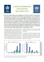 |
| WMO | 2012 | Standardized Precipitation Index User Guide (Russian) С годами бÑли ÑазÑабоÑÐ°Ð½Ñ Ð¸ иÑполÑзовалиÑÑ Ð¼ÐµÑеоÑологами и климаÑологами вÑегомиÑа многие индекÑÑ Ð·Ð°ÑÑÑ Ð¸. ÐÑи индекÑÑ Ð²Ð°ÑÑиÑовалиÑÑ Ð¾Ñ ÑÐ°ÐºÐ¸Ñ Ð¿ÑоÑÑÑÑ Ð¸Ð½Ð´ÐµÐºÑов,как пÑоÑÐµÐ½Ñ Ð½Ð¾ÑмалÑнÑÑ Ð¾Ñадков и пÑоÑенÑилей оÑадков, до ÑÐ°ÐºÐ¸Ñ Ð±Ð¾Ð»ÐµÐµ ÑложнÑÑ Ð¸Ð½Ð´ÐµÐºÑов, как Ð¸Ð½Ð´ÐµÐºÑ Ð¸Ð½ÑенÑивноÑÑи заÑÑÑ Ð¸ ÐалмеÑа. Ðднако ÑÑенÑе в СоединеннÑÑ Ð¨ÑаÑÐ°Ñ ÐмеÑики пÑиÑли к заклÑÑениÑ, ÑÑо Ð¸Ð½Ð´ÐµÐºÑ Ð´Ð¾Ð»Ð¶ÐµÐ½ бÑÑÑ Ð¿ÑоÑÑÑм, легким длÑÑаÑÑеÑа и ÑÑаÑиÑÑиÑеÑки ÑооÑвеÑÑÑвÑÑÑим и знаÑимÑм. Ðомимо ÑÑого, пониманиеÑазлиÑного воздейÑÑÐ²Ð¸Ñ Ð´ÐµÑиÑиÑа на подземнÑе водÑ, Ð²Ð¾Ð´Ð¾Ñ ÑанилиÑа, влажноÑÑÑпоÑвÑ, ÑнежнÑй покÑов и ÑеÑной поÑок, пÑивело к ÑомÑ, ÑÑо в 1993 г. амеÑиканÑкиеÑÑенÑе Ðакки, ÐоÑÑкен и ÐлÑйÑÑ ÑазÑабоÑали ÑÑандаÑÑизиÑованнÑй Ð¸Ð½Ð´ÐµÐºÑ Ð¾Ñадков(СÐÐ). |  |
| WMO | 2012 | Standardized Precipitation Index User Guide (French) Au fil des ans, les météorologues et les climatologues ont mis au point et utilisé partout dans lemonde de nombreux indices de sécheresse, allant des plus simples, notamment le pourcentagede la normale des précipitations ou les centiles de précipitations, aux plus complexes, tel l'indicede sécheresse de Palmer. Aux Ãtats-Unis d'Amérique, des spécialistes de la question ont prisconscience du fait qu'un indice devait être simple, facile à calculer et statistiquement adapté etsignificatif. De plus, la compréhension des différents effets que peuvent avoir des déficits deprécipitations sur les eaux souterraines, sur le volume stocké dans les réservoirs, sur l'humidité dusol, sur le manteau neigeux et sur l'écoulement des cours d'eau a conduit les scientifiquesaméricains McKee, Doesken et Kleist à mettre au point, en 1993, l'indice de précipitationsnormalisé (indice SPI). |  |
| WMO | 2012 | Standardized Precipitation Index User Guide (Spanish) Con el curso de los años los meteorólogos y climatólogos de todo el mundo han creado yutilizado muchos índices de sequía, que varían de unos índices sencillos, como el porcentaje deprecipitación normal y los percentiles de precipitación, a otros más complicados, como el Ãndicede severidad de sequía de Palmer. No obstante, los científicos de Estados Unidos comprendieronque los índices debían ser sencillos y fáciles de calcular y tener pertinencia y significado desde elpunto de vista estadístico. Además, el entendimiento de que los déficits de precipitación teníandiferentes impactos en las aguas subterráneas, el almacenamiento de agua en reservorios, lahumedad del suelo, los bancos de nieve y los caudales fluviales llevó a los científicosestadounidenses McKee, Doesken y Kleist a elaborar en 1993 el Ãndice normalizado deprecipitación (SPI). |  " " |
| WMO | 2012 | Standardized Precipitation Index User Guide (English) Over the years, many drought indices were developed and used by meteorologists andclimatologists around the world. Those ranged from simple indices such as percentage of normalprecipitation and precipitation percentiles to more complicated indices such as the PalmerDrought Severity Index. However, scientists in the United States realized that an index needed tobe simple, easy to calculate and statistically relevant and meaningful. Moreover, theunderstanding that a deficit of precipitation has different impacts on groundwater, reservoirstorage, soil moisture, snowpack and streamflow led American scientists McKee, Doesken andKleist to develop the Standardized Precipitation Index (SPI) in 1993. |  |
| WMO | 2012 | Standardized Precipitation Index User Guide (Arabic) Over the years, many drought indices were developed and used by meteorologists andclimatologists around the world. Those ranged from simple indices such as percentage of normalprecipitation and precipitation percentiles to more complicated indices such as the PalmerDrought Severity Index. However, scientists in the United States realized that an index needed tobe simple, easy to calculate and statistically relevant and meaningful. Moreover, theunderstanding that a deficit of precipitation has different impacts on groundwater, reservoirstorage, soil moisture, snowpack and streamflow led American scientists McKee, Doesken andKleist to develop the Standardized Precipitation Index (SPI) in 1993. |  |
| WMO | 2012 | Science Document: Best Practices on National Drought Management Policy (Russian) ÐаÑÑнÑй докÑÐ¼ÐµÐ½Ñ Ð¸Ð· СовеÑание вÑÑокого ÑÑÐ¾Ð²Ð½Ñ Ð¿Ð¾ наÑионалÑной полиÑике в оÑноÑении заÑÑÑ Ð¸. ÐÑновнÑе ÑлеменÑÑ Ð½Ð°ÑионалÑной пÑогÑÐ°Ð¼Ð¼Ñ Ð±Ð¾ÑÑÐ±Ñ Ñ Ð·Ð°ÑÑÑ Ð¾Ð¹ оÑноÑÑÑÑÑ Ðº ÑледÑÑÑим облаÑÑÑм: a) РазвиÑие ÑÑандаÑÑнÑÑ Ð¿Ð¾Ð´Ñ Ð¾Ð´Ð¾Ð² к оÑенке ÑÑзвимоÑÑи и поÑледÑÑвий b) ÐнедÑение ÑÑÑекÑивнÑÑ ÑиÑÑем мониÑоÑинга заÑÑÑ Ð¸ заблаговÑеменного пÑедÑпÑÐµÐ¶Ð´ÐµÐ½Ð¸Ñ c) УÑиление гоÑовноÑÑи и Ð¼ÐµÑ ÑмÑгÑÐµÐ½Ð¸Ñ Ð¿Ð¾ÑледÑÑвий d) ÐÑÑÑеÑÑвление Ð¼ÐµÑ ÑеагиÑÐ¾Ð²Ð°Ð½Ð¸Ñ Ð½Ð° ÑÑезвÑÑайнÑе ÑиÑÑаÑии и воÑÑÑановлениÑ, коÑоÑÑе подкÑеплÑÑÑ Ñели наÑионалÑной пÑогÑÐ°Ð¼Ð¼Ñ Ð±Ð¾ÑÑÐ±Ñ Ñ Ð·Ð°ÑÑÑ Ð¾Ð¹ e) Ðонимание ÑÐµÐ½Ñ Ð±ÐµÐ·Ð´ÐµÐ¹ÑÑÐ²Ð¸Ñ ÐокÑÐ¼ÐµÐ½Ñ ÑодеÑÐ¶Ð¸Ñ Ð¿ÑедлагаемÑе ÑлеменÑÑ Ð² каждой из пÑÑи облаÑÑей. |  |
| WMO | 2012 | Science Document: Best Practices on National Drought Management Policy (French) Document scientifique de la Réunion de haut niveau sur les politiques nationales en matière de sécheresse. Les éléments essentiels d'une politique nationale de gestion de la sécheresse entrent dans les catégories suivantes: a) Promotion de méthodes normalisées d'évaluation de la vulnérabilité et des impacts; b) Mise en place de systèmes efficaces de suivi et d'alerte précoce; c) Renforcement des activités de préparation et d'atténuation; d) Ãtablissement de mécanismes d'intervention d'urgence et de relèvement qui appuient les objectifs de la politique nationale de gestion de la sécheresse; e) Appréciation du coût de l'inaction. Le document contient les mesures que l'on propose d'inclure dans chacun de ces volets. |  |
| WMO | 2012 | Science Document: Best Practices on National Drought Management Policy (Spanish) Documento científico de la Reunión de alto nivel sobre políticas nacionales contra la sequía. Los elementos clave de una política nacional para la gestión de la sequía se incluyen en las siguientes esferas de actividad: a) Fomentar enfoques normalizados para evaluar la vulnerabilidad y las repercusiones b) Utilizar sistemas eficaces de vigilancia y alerta temprana de la sequía c) Mejorar las medidas de preparación y atenuación d) Aplicar medidas de respuesta y socorro de emergencia que refuercen la consecución de los objetivos de la política nacional para la gestión de la sequía e) Comprender el coste de la inacción El documento contiene los elementos que se proponen en cada una de las cinco esferas. |  |
| UNEP | 2012 | Global Environment Outlook 5 As a significant contribution to the 2012 United Nations Conference on Sustainable Development (Rio+20), the fifth Global Environment Outlook (GEO-5) builds on previous reports, continuing to provide analyses of the state, trends and outlook for, and responses to, environmental change, including extreme events from storm, flood and drought, to the Fukushima disaster in 2011. It also adds new dimensions through its assessment of progress towards meeting internationally agreed goals, such as the development of programmes for mitigating the effects of extreme water-related events, and identifying gaps in their achievement (Chapters 2'6), on analysing promising response options that have emerged in the regions (Chapters 9'15), and presenting potential responses for the international community (Chapters 16'17). Furthermore, for the first time, GEO-5 suggests that there should be a fundamental shift in the way environmental issues are analysed, with consideration given to the drivers of global change, rather than merely to the pressures on the environment. |  |
| WMO | 2012 | Science Document: Best Practices on National Drought Management Policy Science Document of the High Level Meeting on National Drought Policy (HMNDP).The key elements in a national drought management policy fall under the following areas: (a) Promoting standard approaches to vulnerability and impact assessment, (b) Implementing effective drought monitoring and early warning systems, (c) Enhancing preparedness and mitigation actions, (d) Implementing emergency response and recovery measures that reinforce national drought management policy goals, (e) Understanding the cost of inaction The document contains the proposed elements in each of the five areas. | |
| UNFCCC | 2012 | Uganda: NAPA Project Profile This paper outlines nine National Action Plan for Adaptation (NAPA) priority projects in Uganda: 1. Community Tree Growing Project 2. Land Degradation Management Project 3. Strengthening Meteorological Services 4. Community and Water Sanitation Project 5. Water for Production Project 6. Drought Adaptation Project 7. Vectors, Pests and Disease Control Project 8. Indigenous Knowledge (IK) and Natural Resources Management Project 9. Climate Change and Development Planning Project |  |
| SEACI | 2012 | Climate and water availability in south-eastern Australia The south-eastern Australia has experienced a range of climate extremes in recent times including droughts and floods. These conditions reflect both the natural variability of the climate system, as well as an underlying drying trend whcih appears to be partly attributable to climate change. |  |
| UNEP | 2011 | Livelihood Security: Climate Change, Migration and Conflict in the Sahel This joint study has two objectives: to analyze the historical climate trends in the region, identify hotspots and determine the potential implications for livelihoods which depend on natural resources; and to provide recommendations for improving conflict and migration sensitivity in adaptation planning, investments and policies across the region. The study, which covers 17 countries in the Sahel and West Africa, was released on 5 December 2011.Using an innovative mapping process to analyze trends in temperature, rainfall, drought and flooding over the past 40 years, this report provides an important contribution to policy-makers and practitioners seeking to ground adaptation policies and investments in a sound understanding of the nature and scale of historical climate trends in the Sahel, and their impacts on livelihoods. |  |
| UNISDR | 2011 | Drought Vulnerability in the Arab Region: Case Study - Drought in Syria, ten years of scarce water (2000-2010) This report addresses drought, which is considered the major disaster occurring in the Arab region, where the total people affected between the years 1970-2009 by drought is of about 38.09 million. The report focuses on Syria, considered one of the most economically affected countries by drought in the region. The case study provides information on historical droughts in the country between 2000-2010, including data on frequency, vulnerabilities and lessons learned with drought impacts. |  |
| BAMS | 2011 | The Lincoln Declaration on Drought Indices: Universal Meteorological Drought Index Recommended Drought experts from nearly two dozen nations, including from all six regions of the World Meteorological Organization (WMO), were brought together for the Inter-Regional Workshop on Indices and Early Warning Systems for Drought, which was a four-day workshop focused on developing standards for drought indices and guidelines for drought early warning systems (DEWS). The motivation behind this workshop came out of the primary recommendations from the February 2009 International Workshop on Drought and Extreme Temperatures in Beijing, China, where one of the main recommendations was for the WMO to identify methods and marshal resources to develop standards for agricultural drought indices. |  |
| WMO | 2011 | Integrated Drought Management Programme - Concept Note The IDMP will promote an approach that moves drought management practicesfrom reactive, representing the crisis management to more proactive droughtmanagement based on risk management principles. It will provide global coordinationfor efforts towards integration of science, policy and implementationby strengthening drought monitoring, drought risk assessment, development ofdrought prediction; drought early warning services and sharing best practices atthe local, national and regional levels. The IDMP will advocate and facilitateintegration of responses by various agencies from various sectors such aswater, land, agriculture, ecosystems, and energy on one hand and droughtaffectedsectors on the other. At the same time it will strive for parallel andinteractive vertical integration of science, policy and society through droughtmonitoring, risk assessment prediction and management through mitigation,community preparedness and response; and regional, national, provincial andmunicipal (village) level strategies. |  |
| WMO, GMU, ESTC, NDMC, USDA | 2011 | Towards a Compendium on National Drought Policy - Proceedings of an Expert Meeting In July 2011, WMO, together with the George Mason University, the United States Department ofAgriculture (USDA), and the U.S. National Drought Mitigation Center (NDMC) of the University ofNebraska-Lincoln organized an Expert Meeting on the Preparation of a Compendium on NationalDrought Policy.Fourteen papers presented at the Expert Group Meeting are brought together in this volume.These papers present an overview of national drought policies; the elements of national droughtpolicies; drought plans in selected countries; the integrated drought information systems, and theproposed elements in the Compendium on National Drought Policy. |  |
| JC | 2011 | Evaluation of drought indices based on thermal remote sensing of evapotranspiration over the continental United States The reliability of standard meteorological drought indices based on measurements of precipitation is limited by the spatial distribution and quality of currently available rainfall data. Furthermore, they reflect only one component of the surface hydrologic cycle, and they cannot readily capture nonprecipitation-based moisture inputs to the land surface system (e.g., irrigation) that may temper drought impacts or variable rates of water consumption across a landscape. This study assesses the value of a new drought index based on remote sensing of evapotranspiration (ET). The evaporative stress index (ESI) quantifies anomalies in the ratio of actual to potential ET (PET), mapped using thermal band imagery from geostationary satellites. The study investigates the behavior and response time scales of the ESI through a retrospective comparison with the standardized precipitation indices and Palmer drought index suite, and with drought classifications recorded in the U.S. Drought Monitor for the 2000–09 growing seasons. Spatial and temporal correlation analyses suggest that the ESI performs similarly to short-term (up to 6 months) precipitation-based indices but can be produced at higher spatial resolution and without requiring any precipitation data. Unique behavior is observed in the ESI in regions where the evaporative flux is enhanced by moisture sources decoupled from local rainfall: for example, in areas of intense irrigation or shallow water table. Normalization by PET serves to isolate the ET signal component responding to soil moisture variability from variations due to the radiation load. This study suggests that the ESI is a useful complement to the current suite of drought indicators, with particular added value in parts of the world where rainfall data are sparse or unreliable. | |
| UNISDR, AUC | 2011 | Extended Programme of Action for the Implementation of the Regional Strategy for Disaster Risk Reduction (2006-2015) and Declaration of the 2nd African Ministerial Conference on Disaster Risk Reduction 2010 This report includes the extended Programme of Action for the implementation of the Africa Regional Strategy for disaster risk reduction (2006-2015) and the recommendations of the second African Ministerial Declaration on disaster risk reduction held in Nairobi, Kenya, 14-16 April 2010. It is aimed at substantially reducing the social, economic and environmental impacts of disasters on African people and economies, thereby facilitating the achievement of the Millennium Development Goals (MDGs) and other development aims in Africa. The conference was organised by the African Union Commission (AUC) with the support and collaboration of the United Nations International Strategy for Disaster Reduction (UNISDR) and the Government of Kenya, Ministry of State of Special Programme (MOSSP). |  |
| AMS | 2011 | The Lincoln Declaration on Drought Indices The Lincoln Declaration on Drought Indices is a document summarizing the findings and principal recommendations of the Interregional Workshop on Indices and Early Warning Systems for Drought, which took place in Lincoln, Nebraska, USA on 8-11 December 2009. The workshop reviewed the drought indices currently in use in different regions of the world to explain meteorological, agricultural and hydrological droughts, assessed the capacity for collecting information on the impacts of drought, reviewed the current and emerging technologies for drought monitoring and discussed the need for consensus standard indices for describing different types of droughts. |  |
| C2ES | 2011 | Extreme Weather and Climate Change: Understanding the Link, Managing the Risk Thousands of record-breaking weather events worldwide bolster long-term trends of increasingheat waves, heavy precipitation, droughts and wildfires. A combination of observed trends, theoretical understanding of the climate system, and numerical modelingdemonstrates that global warming is increasing the risk of these types of events today.Debates about whether single events are 'caused' by climate change are illogical, but individualevents offer important lessons about society's vulnerabilities to climate change. Reducingthe future risk of extreme weather requires reducing greenhouse gas emissions andadapting to changes that are already unavoidable. |  |
| EMG | 2011 | Global Drylands: a UN System-wide Response This report focuses on: (i) tackling the underlying causes of land degradation, and (ii) strengthening the capacity of dryland populations to mitigate and adapt to environmental change, including climate change. It illustrates the many ways in which the UN system is identifying opportunities to mainstream the drylands agenda into the policy-making process. It states that decades of investments in the Horn of Africa, in the form of risk reduction strategies, formal and informal safety nets and humanitarian interventions have begun to reduce vulnerability and enhance capacity for disaster management. |  |
| GEF | 2011 | Land, Water, and Forests: Assets for Climate resilient Development in Africa One third of all African people live today in drought-prone areas, and 250 million are exposed to drought every year. "Land, Water, and Forests" is a publication that covers the topics of land degradation, deforestation, desertification and water scarcity in the cases of the Congo Basin, Lake Chad and the Sahel region. |  |
| GovAustr | 2011 | Approaches for generating climate change scenarios for use in drought projetions - a review This report describes approaches used for constructing climate projections from a set of climate model simulations for use in drought projections, particularly in Australia. The description includes the pros and cons of each approach with respect to the calculation process, data that are produced, and discussion of the main sources of uncertainty. Although the main focus is on research and approaches that are applied in Australia, the report also briefly discusses approaches applied elsewhere in the world. |  |
| NDMC | 2011 | Comparison of Major Drought Indices There are several indices that measure how much precipitation for a given period of time has deviated from historically established norms. Although none of the major indices is inherently superior to the rest in all circumstances, some indices are better suited than others for certain uses. The National Drought Mitigation Center is using a newer index, the Standardized Precipitation Index, to monitor moisture supply conditions. Distinguishing traits of this index are that it identifies emerging droughts months sooner than the Palmer Index and that it is computed on various time scales. Most water supply planners find it useful to consult one or more indices before making a decision. This paper is an introduction to each of the major drought indices in use in the United States and in Australia. |  |
| NOREF | 2011 | Water and Energy Dynamics in the Greater Himalayan region: Opportunities for Environmental Peacebuilding The water crisis in the Greater Himalayas constitutes an enormous challenge for the region and a growing, if still under-reported, concern in the West. Elements of the crisis include floods and droughts, unpredictable changes in the timing of water flows, hydropower rivalries and persistently unsafe drinking water. Population growth, urbanisation, and consumption and dietary changes are key drivers of the growing demand for irrigation, hydropower and industrial water use. But blame for scarcity and pollution problems often lies in extremely poor water and ecosystem management practices across the region. For domestic change to take place, greater transparency and public awareness are essential, yet difficult to achieve. Climate change will increasingly exacerbate these already observable problems and add new ones in the form of sealevel rise, changing monsoon patterns and the shrinking of glaciers. Pakistan's massive 2010 floods provided an unwelcome preview of a global warming-dominated future. This report looks at a variety of approaches to this critical problem. Specific actions that can be taken vary across the region and include the following: land reform, a reconsideration of subsidy policies, better maintenance and repair of water infrastructure, investments in wastewater treatment, rainwater harvesting and general water conservation technologies, and crop diversification, substituting less water-intensive crops. |  |
| OXFAM | 2011 | Horn of Africa Risk Transfer for Adaptation (HARITA) quarterly report: Apr 2011 - Jun 2011 For the 1.3 billion people living on less than a dollar a day who depend on agriculture for theirlivelihoods, vulnerability to weather-related shocks is a constant threat to security and well-being.As climate change drives an increase in the frequency and intensity of natural hazards, the challengesfaced by food-insecure communities struggling to improve their lives and livelihoods will alsoincrease. The question of how to build rural resilience against weather-related risk is critical for addressingglobal poverty.In response to this challenge, Oxfam America, together with local and international partners,1 hasdeveloped a holistic risk management framework to enable poor farmers in Ethiopia to strengthentheir food and income security through a combination of improved resource management (risk reduction),microcredit ('smart' risk taking), risk transfer (insurance), and risk reserves (savings). The Hornof Africa Risk Transfer for Adaptation (HARITA) project implemented in Ethiopia is the first exampleof this pioneering approach. | |
| OXFAM | 2011 | Horn of Africa Risk Transfer for Adaptation (HARITA) quarterly report: Oct 2011 - Dec 2011 For the 1.3 billion people living on less than a dollar a day who depend on agriculture for theirlivelihoods, vulnerability to weather-related shocks is a constant threat to security and well-being.As climate change drives an increase in the frequency and intensity of natural hazards, the challengesfaced by food-insecure communities struggling to improve their lives and livelihoods will alsoincrease. The question of how to build rural resilience against weather-related risk is critical for addressingglobal poverty.In response to this challenge, Oxfam America, together with local and international partners,1 hasdeveloped a holistic risk management framework to enable poor farmers in Ethiopia to strengthentheir food and income security through a combination of improved resource management (risk reduction),microcredit ('smart' risk taking), risk transfer (insurance), and risk reserves (savings). The Hornof Africa Risk Transfer for Adaptation (HARITA) project implemented in Ethiopia is the first exampleof this pioneering approach. | |
| THELANCET | 2011 | Humanitarian Response Inadequate in Horn of Africa Crisis This report describes the crisis from Kenya's refugee camps and Wajir in the north, as millions of people in the Horn of Africa are affected by the devastating drought and famine. The famine in Somalia that has sent a tide of refugees into the Dadaab refugee camps 100 km across the border in Kenya has recently drawn international attention, but in fact the problem has been building for years, and reached a crucial point months ago. |  |
| UF | 2011 | Pastoral Pathways: Climate Change Adaptation Lessons from Ethiopia The report attempts to create an in-depth understanding of the stressors that influence people's livelihoods in order to address on-going and future challenges, recognizing that pastoralists have considerable knowledge and experience in dealing with climatic variability, expected to increase with climate change. However, the environmental and societal stresses experienced today are driven in part by global processes, and the traditional ways of coping with climatic variability will be insufficient in addressing climatic changes.In this report, the vulnerability context, multiple stressors and local adaptation strategies of pastoralists in Afar and Somali regions are investigated in order to identify the social, environmental and development processes that shape adaptation options in both areas. The report takes as a starting point the recognition that pastoral communities are custodians of the local environment, and calls for a shift in development and political structures if socially and environmentally sustainable pathways are to be found. |  |
| UNCCD, Korea Forest Service, Korea Green Promotion Agency | 2011 | Combating Desertification and Land Degradation: Proven Practices from Asia and the Pacific Asia and the Pacific, for the purposes of this book, encompasses a vast territory extending fromMongolia in the north to New Zealand in the south; from the Cook Islands in the east to Kuwait in thewest (Map 1). The environmental diversity of Asia and the Pacific is therefore vast, and is contrasted bythe region's coldest and hottest deserts, verdant tropical rainforests, extensive steppe, desert steppe,grassland and rangelands, mountains and plains. It is this great variation in geography, topographyand climate that provides the rich and unique diversity found in the region's ecosystems. There is greatdisparity too in the ethnicity of its people's and the economic status of its nations.The pressures on these rich natural resources and environmental systems have, however, beencontinuously increasing over the past few decades. Rapid population growth, urbanization, risingeconomic output and consumptive lifestyles, coupled with an increasing incidence of poverty, have allcontributed to the region's struggle to mitigate desertification and arrest and/or reverse landdegradation in all of its forms.Clearly, it is not possible to give a detailed account of the efforts to combating land degradation anddesertification in all of its forms by each and every nation in this vast geographic region. Instead, wehave selected specific examples and case studies from across the region that exemplify the variousapproaches from labor intensive, low technology solutions to large-scale measures that rely more ontechnology. The main purpose of the book is to provide information about successes, inspire others andacknowledge the work of those whose efforts have achieved success. |  |
| GECAFS | 2010 | Access to food in a changing climate This report examines the potential impact of future climate change for the food security of vulnerablegroups in the UK. Food security is a critical element of societal stability and prosperity, and itsattainment is potentially influenced by climate in many ways. |  |
| FAFO | 2010 | Climate Change to Conflict? Lessons from Southern Ethiopia and Northern Kenya This report represents an attempt to understand the interplay between environmental/climatic factors and conflict dynamics in the Horn of Africa. It shows that climatic change and local political dynamics may intensify the competition for scarce water and pasture and the degradation of natural resources, and in the worst cases cause violent conflict. |  |
| UNCCD | 2010 | Financing to Combat Desertification, Land Degradation and the Effects of Drought - Thematic Factsheet This fact sheet discusses the costs and benefits of financing to combat desertification, land degradation, and the effects of drought. The fact sheet explains the necessity of funding to ensure socio-economic resilience through climate change, and introduces the Global Mechanis (GM) which aims to mobilize financial resources. |  |
| UNDP | 2010 | Climate Risk Management Climate-related hazards, including drought, floods,cyclones, sea-level rise and extreme temperatures,have enormous impact on the socio-economicdevelopment of a society. The frequency,magnitude and duration of damaging climateconditions are changing. It is now widelyunderstood that efforts to address the impacts ofadverse climatic conditions on human developmentmust be undertaken within the context of a longertermvision of development. UNDP is supporting awide range of countries to manage risks related toclimate variability and change through the ClimateRisk Management Technical Assistance SupportProject (TASP). |  |
| WB, NDCC | 2010 | An Empirical Analysis of the Effects of Climate Variables on National Level Economic Growth The influence of climate on economic growth is a topic of growing interest. Few studies have investigated the potential role that climate hazards and their cumulative effects have on the growth prospects for a country. Due to the relatively stationary spatial patterns of global climate, some regions and countries are more prone to climate hazards and climate variability than others. This study uses a precipitation index that preserves the spatial and temporal variability of precipitation and differentiates between precipitation maximums (such as floods) and minimums (such as droughts). The authors develop a year and country fixed effects regression model to test the influence of climate variables on measures of economic growth and activity. The results indicate that precipitation extremes (floods and droughts) are the dominant climate influence on economic growth and that the effects are significant and negative. The drought index is associated with a highly significant negative influence on growth of growth domestic product, while the flood index is associated with a negative influence on growth of gross domestic product and lagged effects on growth. Temperature has little significant effect. These results have important implications for economic projections of climate change impacts. In addition, adaptation strategies should give new consideration to the importance of water resources given the identification of precipitation extremes as the key climate influence on historical growth of gross domestic product. |  |
| WMO | 2010 | Agricultural Drought Indices - Proceedings of an Expert Meeting WMO, together with the National Drought Mitigation Center (NDMC) and the School of Natural Resources of the University of Nebraska'Lincoln (USA), organized the Inter-Regional Workshop on Indices and Early Warning Systems for Drought at the University of Nebraska in December 2009. The Lincoln Declaration on Drought Indices recommended that a working group with representatives from different regions around the world and observers from UN agencies and research institutions (and water resource management agencies for hydrological droughts) be established to further discuss and recommend, by the end of 2010, the most comprehensive index to characterize agricultural drought.Accordingly, WMO and the United Nations International Strategy for Disaster Reduction (UNISDR), in collaboration with the Hydrographical Confederation of Segura River Basin and the State Agency for Meteorology of Spain (AEMET), organized the Expert Group Meeting on Agricultural Drought Indices in Murcia, Spain, June 2-4, 2010. The meeting reviewed drought indices currently used around the world for agricultural drought and assessed the capability of these indices to accurately characterize the severity of droughts and their impacts on agriculture.Fifteen papers presented at the expert group meeting are brought together in this volume. These papers present an overview of agricultural drought indices; the strengths, weaknesses, and limitations of different agricultural drought indices currently in use in selected countries; the integration of crop, climate, and soil issues in agricultural drought indices; and a summary and recommendations on agricultural drought indices. |  |
| JC | 2010 | A multi-scalar drought index sensitive to global warming: the Standardized Precipitation Evapotranspiration Index The authors propose a new climatic drought index: the standardized precipitation evapotranspiration index (SPEI). The SPEI is based on precipitation and temperature data, and it has the advantage of combining multiscalar character with the capacity to include the effects of temperature variability on drought assessment. The procedure to calculate the index is detailed and involves a climatic water balance, the accumulation of deficit/surplus at different time scales, and adjustment to a log-logistic probability distribution. Mathematically, the SPEI is similar to the standardized precipitation index (SPI), but it includes the role of temperature. Because the SPEI is based on a water balance, it can be compared to the self-calibrated Palmer drought severity index (sc-PDSI). Time series of the three indices were compared for a set of observatories with different climate characteristics, located in different parts of the world. Under global warming conditions, only the sc-PDSI and SPEI identified an increase in drought severity associated with higher water demand as a result of evapotranspiration. Relative to the sc-PDSI, the SPEI has the advantage of being multiscalar, which is crucial for drought analysis and monitoring. |  |
| IJRS | 2010 | Land Surface Water Index (LSWI) response to rainfall and NDVI using the MODIS vegetation index product For more than 20 years the Normalized Difference Vegetation Index (NDVI) has been widely used to monitor vegetation stress. It takes advantage of the differential reflection of green vegetation in the visible and near-infrared (NIR) portions of the spectrum and provides information on the vegetation condition. The Land Surface Water Index (LSWI) uses the shortwave infrared (SWIR) and the NIR regions of the electromagnetic spectrum. There is strong light absorption by liquid water in the SWIR, and the LSWI is known to be sensitive to the total amount of liquid water in vegetation and its soil background. In this study we investigated the LSWI characteristics relative to conventional NDVI-based drought assessment, particularly in the early crop season. The area chosen for the study was the state of Andhra Pradesh located in the Indian peninsular. The Moderate Resolution Imaging Spectroradiometer (MODIS) Vegetation Index (VI) product from the Aqua satellite was used in the study. The analysis was carried out for the years 2002 (deficit year) and 2005 (normal year) using the NDVI from the MODIS VI product and deriving the LSWI using the NIR and SWIR reflectance available with the MODIS VI product. The response of LSWI to rainfall, observed in the rate of increase in LSWI in the subsequent fortnights, shows that this index could be used to monitor the increase in soil and vegetation liquid water content, especially during the early part of the season. The relationship between the cumulative rainfall and the current fortnight LSWI is stronger in the low rainfall region (<500 mm), while the one-fortnight lagged LSWI had a stronger relationship in the high rainfall region (>500 mm). The relationship between LSWI and the cumulative rainfall for the entire state was mixed in 2002 and 2005. The strength of the relationship was weak in the high rainfall region. When LSWI was regressed directly with NDVI for three LSWI ranges, it was observed that the NDVI with the one-fortnight lag had a strong relationship with the LSWI in most of the categories. |  |
| GovIndia | 2010 | National Disaster Management Guidelines: Management of Droughts These guidelines place emphasis on riskmanagement, rather than following thetraditional approach of crisis management,where the emphasis is on reactive emergencyresponse measures. Developing vulnerabilityprofiles for regions, communities, populationgroups, and others will provide criticalinformation on the vulnerability of regions andcommunities together with the causes. Thisinformation, when integrated into the planningprocess, can enhance the outcome of theprocess by identifying and prioritizing specificareas, where progress can be made in riskmanagement. |  |
| SAARC | 2010 | SAARC Workshop on Drought Risk Management in South Asia In this context the South Asian Association for Regional Cooperation (SAARC) Disaster Management Centre, New Delhi organised a SAARC Workshop on Drought Risk Management in Kabul, Afghanistan on 8-9 August 2010 in collaboration with the Afghanistan National Disaster Management Authority. The Workshop reviewed the progress made by each country of the region for drought risk management and analyzed the strength, weakness and critical gaps in the existing systems. The Workshop felt that although drought risk management is the primary responsibility of the respective national and local governments, the countries of the region would stand to gain immensely by collaboration with each other. The Workshop identified five broad areas of regional cooperation and recommended a Road Map for Drought Risk Management in South Asia. |  |
| TEARFUND | 2010 | Investing in Communitites: The Benefits and Costs of Building Resilience for Food Security in Malawi This publication reports on a community-based cost benefit analysis of a disaster risk reduction (DRR) and food security programme in a Malawian agricultural community. The aim of this study is to assess programme activities for their cost-effectiveness and to gather evidence to help inform programming decisions taken by Tearfund, their partners and other NGOs. A second key aim is to inform policy-relevant recommendations to help convince governments, donors and UN agencies to act in a timely way and with appropriate interventions to address food insecurity, given the growing threat from drought and other hazards. A field research was done in collaboration with the Church of Central Africa Presbyterian (CCAP), Synod of Livingstonia, a development organisation working in Malawi which is currently finishing a major DRR programme that is the focus of this study. |  |
| UNCCD | 2009 | Down to Earth: a simplified guide to the Conventionto Combat Desertification, why it is necessary and what is important and different about it The international community pressed for a treaty to tackle the growing physical and human crisis of desertification at the 1992 Earth Summit in Rio de Janeiro. The Convention to Combat Desertification, the first legally binding international agreement on the problem, was agreed on in 1994. It promotes a bottom-up approach that starts with the people actually affected by the crisis and replaces the concept of aid with one of partnership. This publication provides a simplified and accessible guide to this important agreement. |  |
| WRM | 2009 | Assessment of hydrological drought revisited A variety of indices for characterising hydrological drought have been devised which, in general, are data demanding and computationally intensive. On the contrary, for meteorological droughts very simple and effective indices such as the Standardised Precipitation Index (SPI) have been used. A methodology for characterising the severity of hydrological droughts is proposed which uses an index analogous to SPI, the Streamflow Drought Index (SDI). Cumulative streamflow is used for overlapping periods of 3, 6, 9 and 12 months within each hydrological year. Drought states are defined which form a non-stationary Markov chain. Prediction of hydrological drought based on precipitation is also investigated. The methodology is validated using reliable data from the Evinos river basin (Greece). It can be easily applied within a Drought Watch System in river basins with significant storage works and can cope with the lack of streamflow data. |  |
| AFED | 2009 | Impact of Climate Change on Arab Countries The 2009 AFED report has been designed to provide information to governments,business, academia and the public about the impact of climate change onthe Arab countries, and encourage concrete action to face the challenge. Thereport analyzes the Arab response to the urgent need for adaptation measures,and uses the latest research findings to describe the vulnerabilities of natural andhuman systems in the Arab world to climate change and the impacts on each sectorof human activity. The systems selected for this study include: coastal areas,food production, fresh water, human health, bio-diversity, in addition to theconsequences on housing, transport, and tourism. In an attempt to help shapeadequate policies, the report discusses options for a post-Kyoto regime and outlinesthe state of international negotiations in this regard. |  |
| UNCCD | 2009 | Benefits of Sustainable Land Management In our era of escalating crisis and economic downturn,where the 2007-2008 food crisis is now a dormant but 'forgotten crisis' and where governments are strivingto implement bailout policies with little attention tothe potentials of land and soils, it is of crucial importanceto highlight the 'Benefits of Sustainable LandManagement' policies.Desertification, land degradation and drought affectmore than 2 billion people and the situation mightworsen due to the unsustainable use of soil and waterunder present scenarios of climate change. The UNCCD10-year strategy points out the importance of science,knowledge sharing systems and awareness raising tosupport policymakers in reversing this trend. Sustainableland management practices, including sustainableagriculture, provide important local, regional and global benefits. They also contribute positively to fundamentalecosystem services such as regulating water cycles,sequestering carbon, and helping to preserve agrobiodiversity.This document aims to highlight local, regional and globalbenefits of sustainable land management (SLM). |  |
| IWMI | 2009 | Mapping Drought Patterns and Impacts: A Global Perspective This study examines the global patterns and impacts of droughts through the mapping of several drought-related characteristics ' either at a country level or at regular grid scales. Characteristics cover various aspects of droughts ' from global distribution of meteorological and hydrological drought risks to social vulnerability and indices related to water infrastructure. The maps are produced by integrating a number of publicly available global datasets. The subsequent discussion of maps allows a number of policy-relevant messages to be extracted. |  |
| ODI | 2009 | Adapting to Climate Change in the Water Sector Climate change that warms the atmosphere and oceans will change major weather systems, with greater likelihood of extremes ' droughts and floods ' in different parts of the world. These changes will, in turn, affect human livelihoods, particularly those dependent on direct access to natural assets. Rain-fed agriculture, human settlement patterns and movement, water supplies, sanitation and irrigation will all be affected, leading to changes in human health, wealth and security. On the demand side, as populations grow and move ' and as their income levels increase or decrease ' their demand for water resources will change.Taken together, these changes will present major challenges to future management of water resources for human and ecosystem development.This Background Paper, one of four prepared for World Water Day 2009, calls for more sensitive analysis, combined with stronger scenario planning that takes as its starting point the development needs of populations. What will demand be, and why, in time and space across different sectors, and what are the likely 'bads' to avoid and 'goods' to support? |  |
| UNCCD, UNDP, UNEP | 2009 | Climate change in the African drylands: options and opportunitites for adaptation and mitigation This paper aims to illuminate often unrealized opportunities for climate change adaptation in the African drylands. The paper is divided into four sections: (i) section one explains the effects of climate change in the African drylands; (ii) section two discusses the different adaptation options for arid zones, semi-arid zones, and dry sub-humid zones in the African drylands; (iii) section three discusses the effects of climate change, such as land degradation, desertification, and drought, and links the effects to opportunities for adaptation; (iv) and section four concludes the paper with a summary of their recommendations and findings related to climate change adaptation in the drylands. |  |
| CAWCR | 2009 | Australian Water Availability Project (AWAP): CSIRO Marine and Atmospheric Research Component: Final Report for Phase 3 This report presents the state and trend of the terrestrial water balance of the Australian continent, using model data fusion methods. The project determines past and present state of soil moisture and all water fluxes including rainfall, transpiration, soil evaporation, surface runoff and deep drainage. |  |
| UNISDR | 2009 | Drought risk reduction framework and practices With the aim of guiding the implementation of the Hyogo Framework Framework (HFA) in respect to drought, this document elaborates a framework for understanding drought and vulnerability to drought, and provides guidance on actions to reduce the risks associated with drought. It discusses drought policy and governance, risk identification and early warning, awareness and knowledge management, and effective mitigation and preparedness measures. These framework elements are illustrated with practical examples, techniques, and extensive background information. This document is intended to assist national governments and local communities, as well as international, regional and donor communities, to address the root causes of drought-related disasters, and to reduce drought impacts and the consequences for human welfare and food insecurity. This document has been developed by the UNISDR secretariat in cooperation with the National Drought Mitigation Center (University of Nebraska-Lincoln, USA) and other partners, on the basis of current thinking and practice in many countries. |  |
| FAO | 2008 | Coping with water scarcity - An action framework for agriculture and food security The report aims to provide a conceptual framework to address food security under conditions ofwater scarcity in agriculture. It has been prepared by a team of FAO staff and consultants in theframework of the project 'Coping with water scarcity ' the role of agriculture', and has beendiscussed at an Expert Consultation meeting organized in FAO, Rome, during the period 14'16December 2009 on the same subject. It was subsequently edited and revised, taking account ofdiscussions in the Expert Consultation and materials presented to the meeting.The purpose of the Expert Consultation was to assist FAO to better design its water scarcityprogramme. In particular, the experts were requested to provide recommendations on the rangeof technical and policy options and associated principles that FAO should promote as part of anagricultural response to water scarcity in member countries. |  |
| FAO | 2008 | The Near East Drought Planning Manual: Guidelines for Drought Mitigation and Prepardness Planning In 2004, the FAO Agriculture and Land and Water Use Commission for the Near East (ALAWUC) met and discussed progress achieved in developing strategies for drought mitigation and prepardness planning in the Near East Region. Based on these discussions, they developed a list of recommendations for future actions to enhance drought risk reduction efforts. One of the recommendations made by the Commission was for the creation of guidelines to assist countries in the preparation and implementation of national action programs for combating drought. This guide was developed to help address this need. |  |
| UNCCD, gtz, FMECD Germany | 2008 | Desertification - Coping with Today's Global Challenges This report from the High-Level Policy Dialogue (HLPD) held in Bonn on May 27, 2008, under the official title 'Coping with Today's Global Challenges in the Context of the Strategy of the United Nations Convention to Combat Desertification' discusses ways to forge the necessary global partnership, provides the right global institutional platform and enacts the reforms that The Strategy calls for, with a view to consolidating understanding within the context of the Convention's strategic orientations. It contains the key messages, along with the conclusions of the Chairperson with the purpose of helping policy- and decision-makers take full account of the discussions in Bonn and facilitate work towards The Strategy's successful implementation. |  |
| GISRS | 2008 | The Vegetation Drought Response Index (VegDRI): a new integrated approach for monitoring drought stress in vegetation The development of new tools that provide timely, detailed-spatial-resolution drought information is essential for improving drought preparedness and response. This paper presents a new method for monitoring drought-induced vegetation stress called the Vegetation Drought Response Index (VegDRI). VegDRI integrates traditional climate-based drought indicators and satellite-derived vegetation index metrics with other biophysical information to produce a 1 km map of drought conditions that can be produced in near-real time. The initial VegDRI map results for a 2002 case study conducted across seven states in the north-central United States illustrates the utility of VegDRI for improved large-area drought monitoring. |  |
| FAO, NDMC | 2008 | A Review of Drought Occurrence and Monitoring and Planning Activities in the Near East Region In response to the droughts that hit some parts of Africa and Asia between 1998 and 2001, the Near East countries in March 2000 requested FAO assistance at national and regional levels in the formulation of long-term drought management strategies. Since then, drought preparedness has constituted one of the focus areas for the FAO Regional Office for the Near East. Moreover, FAO adopted drought as a 'Priority Area for interdisciplinary Action' at the global level. This report presents a brief overview of FAO's drought-related activities and achievements in the Near East and the current situation of drought preparedness in the region. Many of the activities have been carried out jointly with other organizations and research institutions active in the field of drought, particularly the National Drought Mitigation Center (NDMC) of the University of Nebraska, USA. |  |
| WMO | 2007 | Climate Information for Adaptation and Development Needs This brochure gives an overview of (i) human and natural drivers of climate change, (ii) direct observations of recent climate change, (iii) projections of future climate change, (iv) climate change and desertification and (v) action taken by WMO to address climate change and desertification |  |
| MA | 2007 | Spatial Distribution of Climatic Indices in Northern Greece Results of research work concerning the spatial estimation of precipitation and air temperature and the representation of different climatic indices, which assess the climate of a region in northern Greece, are reported. The climatic indices used were the Johansson Continentality Index, the Kerner Oceanity Index, the De Martonne Aridity Index and the Pinna Combinative Index. Data from 15 meteorological stations located in northern Greece during the period 1965–1995 were analysed and processed on a monthly basis and graphs of precipitation and temperature were constructed for use in agricultural applications. Köppen's classification was also investigated for the 15 stations. GIS interpolation techniques, such as the inverse distance weighted (IDW) function, were used for the areal estimation of the above mentioned parameters in northern Greece and an evaluation of the climate indices was made, based on the results. |  |
| SERRA | 2007 | Streamflow drought time series forecasting Drought is considered to be an extreme climatic event causing significant damage both in the natural environment and in human lives. Due to the important role of drought forecasting in water resources planning and management and the stochastic behavior of drought, a multiplicative seasonal autoregressive integrated moving average (SARIMA) model is applied to the monthly streamflow forecasting of the Zayandehrud River in western Isfahan province, Iran. After forecasting 12 leading month streamflow, four drought thresholds including streamflow mean, monthly streamflow mean, 2-, 5-, 10- and 20-year return period monthly drought and standardized streamflow index were chosen. Both observed and forecasted streamflow showed a drought period with different severity in the lead-time. This study also demonstrates the usefulness of SARIMA models in forecasting, water resources planning and management. |  |
| IRI | 2007 | Climate risk management in Africa: Learning from practice, Climate and Society No. 1 The inaugural issue, called Climate Risk Management in Africa: Learning from practice, describes current efforts that are helping societies better adapt, and shows that when climate information successfully reaches vulnerable populations, it can be used to improve livelihoods and economies, and even save lives. The report was launched on January 30th during a special session of the 8th African Union Heads-of-State Summit held in Addis Ababa, Ethiopia. It details five examples on how climate risks are being effectively managed in Africa. |  |
| WMO | 2007 | Climate change and desertification This brochure gives an overview of (i) human and natural drivers of climate change, (ii) direct observations of recent climate change, (iii) projections of future climate change, (iv) climate change and desertification and (v) action taken by WMO to address climate change and desertification |  |
| WB | 2006 | Hazards of nature, risks to development: An IEG Evaluation of World Bank Assisance for Natural Disasters This evaluation of the World Bank's experience with natural disasters was done be the Independent Evaluation Group-World Bank at the request of the Bank's Board of Executive Directors. Natural disasters are affecting development in many countries, setting back hard-won development gains. This report is a comprehensive review of disaster preparedness and response. The report calls for new thinking that integrates predictable disaster risks into development programs. It concludes that it is possible to anticipate where many natural disasters will strike, yet expresses concerns that the World Bank's disaster assistance efforts are underutilizing these vital lifesaving forecasts. |  |
| WMO | 2006 | Drought Monitoring and Early Warning: Concepts, Progress and Future Challenges (Spanish) Como parte de sus actividades de aplicación para el Año Internacional de los Desiertos y la Desertificación, la OMM ha preparado este folleto para explicar los diferentes conceptos y los retos de los sistemas de alerta rápida y de control y la sequía. Este folleto también detalla los progresos considerables que se han realizado sobre estos temas en algunos países propensos a la sequía, poniendo de relieve varios estudios de casos de todo el mundo. |  |
| WMO | 2006 | Commission for Agricultural Meteorology (CAgM): The First Fifty Years Agricultural meteorology as an accepted term first came into use in the 1920s. In its first 40 years, the science developed in the western world, Japan, India and China. However, since the 1980s, the field of agricultural meteorology has seen significant developments and modifications. Since the 1960s, the regions where it has been applied have increased, but water balances and evaporation in temperate climates became, and have remained, the most treated subjects. However, with increasing application in the developing world with its more abundant weather and climate disasters, the definition needed to be widened to include tropical agrometeorology. |  |
| WMO | 2006 | Preventing and Mitigating Natural Disasters One of the major goals of WMO, NMHSs, and their systems, programmes and activities and their partners in disaster-prevention and mitigation communities is to reduce the number of deaths, injuries and damage caused by severe weather, climate and water events. They give individuals, decision makers and other partners the information they need for awareness building, planning, preparedness and, when necessary, for recovery and rehabilitation efforts. This year, WMO would like to propose a different story from the ones so often making the headlines-one in which the human element takes centre stage. It is a story of confidence, planning, empowerment, positive action and hope. It is reflected in this booklet, dedicated to make disaster mitigation a reality. The contents of this booklet therefore include information on national action plans for coping with natural hazards, planning and preparation for different timescales, planning for environmental emergencies and climate change, and finally preparedness and saving lives. |  |
| UNEP | 2006 | Hydropolitical Vulnerability and resilience along International Waters: Africa This is the first report in a series of assessment reports in different geographic regions on hydropolitical vulnerability and resilience along international waters. It presents a comprehensive assessment of the hydropolitical vulnerability of Africa's international waters. It also presents concrete and comprehensive data on the cooperative agreements, in-place and those being developed, in the major water-basins on the continent. These will deal with the hydropolitical vulnerabilities and develop sustainable resilience and provide informed policies at the regional, sub-regional and national levels. |  |
| UNCCD | 2006 | Ten African Experiences: Implementing the Unitef Nations Convention to Combat Desertification in Africa This publication showcases experiences from various African sub-regions to illustrate the complexity of the problems that African countries face and the multi-faceted approaches that can be adopted to ensure sustainable development. |  |
| UNDP | 2006 | Making Progress on Evironmental Sustainability: Lessons and Recommendations from a review of over 150 MDG Country Reports Environmental sustainability shows weak progress towards the targets and insufficient monitoring capacity and systems. While the Millennium Development Goals (MDGs) framework offers advantages in being managed as a group of interrelated targets, Millennium Development Goal 7 on environmental sustainability warrants particular attention given the weaknesses both in monitoring and in overall progress. |  |
| SDC | 2006 | Coping with Drought With a view to joining forces with the world's nations and international institutions, the Swiss Agency for Development and Cooperation (SDC) decided to present some of the ways in which it supports rural communities, local organisations, national technical services, research institutions, and networks and platforms specialised in elaborating the kind of innovation that local populations in arid and semi-arid regions need in dealing with increasingly difficult living conditions. This experience - sometimes based on long-term partnerships - illustrates how numerous the possibilities are of improving living conditions in regions that are more or less severely affected by drought. |  |
| NDMC | 2006 | Drought Indices Most water supply planners find it useful to consult one or more indices before making a decision. What follows is an introduction to each of the major drought indices in use in the United States and in Australia. The National Drought Mitigation Center is using a newer index, the Standardized Precipitation Index, to monitor moisture supply conditions. Distinguishing traits of this index are that it identifies emerging droughts months sooner than the Palmer Index and that it is computed on various time scales. " | |
| UNDP | 2006 | Human Development Report 2006: Beyond scarcity, power, poverty and the global water crisis The 2006 Human Development Report focuses on water and human development. Water is central to the realization of human potential. It is a source of life for people and for the planet. Clean water and sanitation have a profound bearing on health and human dignity. Inequalities in access to clean water for drinking and to water as a productive input, reinforce wider inequalities in opportunity. With competition for water intensifying, there is a danger that poor and vulnerable communities will become increasingly marginalized. The twin challenge facing governments and donors is to accelerate progress towards universal access to water and sanitation; and to ensure that water management policies strengthen the rights of poor households to access water resources. |  |
| WMO | 2006 | Impacts of Desertification and Drought and other Extreme Meteorological Events The report starts with an overview of the desertfication and drought and then summarizes the assessment of desertification, drought And other extreme meteorological events. Next, the report gives an overview of the implementation of the United Nations Convention to Combat Desertification (UNCCD) and methods to mitigate the effects of drought. In conjuction with this chapter, the Annex provides a summary of the National Action Programme for India. Then, the report summarizes the actions to be taken by the National Meteorological and Hydrological Services (NMHS) for the UNCCD. There is a brief chapter on a proposed structure for an expert system on extreme meteorological events. The last chapter provides conclusions and recommendations of the Working Group. |  |
| WMO | 2006 | Drought Monitoring and Early Warning: Concepts, Progress and Future Challenges As part of its implementation activities for the International Year of Deserts and Desertification, WMO has prepared this brochure to explain the various concepts and challenges of drought monitoring and early warning systems. This brochure also details the considerable progress that has been made on these issues in some droughtprone countries by highlighting several case studies from around the world. |  |
| WMO | 2006 | Drought Monitoring and Early Warning: Concepts, Progress and Future Challenges (French) Dans le cadre de ses activités de mise en Åuvre de l'Année Internationale des Déserts et de la Désertification, l'OMM a préparé cette brochure pour expliquer les différents concepts et enjeux de la surveillance de la sécheresse et des systèmes d'alerte précoce. Cette brochure détaille également les progrès considérables qui ont été accomplis sur ces questions dans certains pays sujettes à la sécheresse en mettant en évidence plusieurs études de cas provenants du monde entier. |  |
| UN-Water | 2006 | Coping with water scarcity - A strategic issue and priority for system-wide action UN'Water is the mechanism coordinating the actions of the United Nations (UN) system aimed at implementing the agenda set by the Millennium Declaration and the World Summit on Sustainable Development (WSSD) in all aspects related to freshwater. UN'Water has grown out of many years of extensive collaboration and partnership among the UN agencies. These efforts have helped to achieve significant progress and to bring water and water-related issues to the top of the political agenda. UN'Water has identified coping with water scarcity as part of the strategic issues and priorities requiring joint action. This note presents the UN'Water joint plan of action (PoA) for this thematic initiative and describes its elements. |  |
| IJC | 2005 | The Effect of the Length of Record on the Standardized Precipitation Index Calculation The effect of the length of record on the standardized precipitation index (SPI) calculation was investigated by examining correlation coefficients, the index of agreement, and the consistency of dry/wet event categories between SPI values derived from different precipitation record lengths. The effect was also illustrated by comparing SPI values derived from different lengths of record in some severe drought and flood years, and by comparing drought intensities based on SPI values temporally and spatially. Furthermore, the reason for the SPI value discrepancy was explored by investigating the changes of the shape and scale parameters of the gamma distribution when different lengths of record were involved. The gamma distribution is a frequency distribution of climatological precipitation time series and is the basis of the SPI calculation used in this analysis. The results show that SPI values computed from different lengths of record are highly correlated and consistent when the gamma distributions of precipitation over the different time periods are similar. However, the SPI values are significantly discrepant when the distributions are different. It is recommended that the SPI user should be aware of the numerical difference of the SPI values if different lengths of record are used in interpreting and making decisions based on SPI values. |  |
| UNEP | 2005 | Facing the Facts: Assessing the Vulnerability of Africa's Water Resources to Environmental Change Africa's high dependence on natural resources makes its people vulnerable to environmental change. Acknowledging this, UNEP and START initiated a study in Feb. 2003 - (Vulnerability of Water Resources to Environmental Change in Afica). In the publication 4 regional groups of researchers address the vulnerability issue in Southern, Eastern, Western and Northern Africa by means of selected river/lake/groundwater,basins according to natural (physiographic) anthropogenic (socio-economic) and management criteria. The basin was selected as a key unit for assessment because it balances resource protection and utilisation and it considers all components of the hydrological cycle. Finally, the assessments undertaken clearly show that water resounces in Africa are at risk, now and even more in the future. |  |
| SIWI, UNEP | 2005 | Challenges of Water Scarcity: A Business Case for Financial Institutions Water scarcity currently affects many regions of the world. Without a significant reversal of economic and social trends, it will become more acute over time. Although water is considered a renewable resource, in many parts of the world, water resources have become so depleted or contaminatedthat they are unable to meet ever-increasing demands. The challenges are more acutely felt in developing countries where 95% of the world's new population is born each year. This has become a major factor impeding economic development, and also business operations. This report, based on areview of close to 20 cases of projects and investments mainly in Africa and Latin America, and supplemented with interviews with practitioners from both development and commercial financial institutions, concludes that there is a business case for improving risk management tools, which canspecifically be related to the risks borne by water scarcity. While each organization must relate to water in its own capacity, the business case for the financial sector comes from acknowledging the potential risks associated with water scarcity and seeking possible opportunities for mitigating these risks. |  |
| WMO | 2005 | Climate and Land Degradation Over 250 million people are directly affected by desertification. In addition, some one billion people in over 100 countries are at risk. These people include many of the world's poorest, most marginalized, and politically weak citizens. Hence combating desertification is an urgent priority in global efforts to ensure food security and the livelihoods of millions of people who inhabit the drylands of the world. |  |
| AFM | 2005 | Development and evaluation of Soil Moisture Deficit Index (SMDI) and Evapotranspiration Deficit Index (ETDI) for agricultural drought monitoring Drought is one of the major natural hazards that bring about billions of dollars in loss to the farming community around the world each year. Drought is most often caused by a departure of precipitation from the normal amount, and agriculture is often the first sector to be affected by the onset of drought due to its dependence on water resources and soil moisture reserves during various stages of crop growth. Currently used drought indices like the Palmer Drought Severity Index (PDSI) and Standardized Precipitation Index (SPI) have coarse spatial (7000–100,000 km2) and temporal resolution (monthly). Hence, the distributed hydrologic model SWAT was used to simulate soil moisture and evapotranspiration from daily weather data at a high spatial resolution (16 km2) using GIS. Using this simulated data the drought indices Soil Moisture Deficit Index (SMDI) and Evapotranspiration Deficit Index (ETDI) were developed based on weekly soil moisture deficit and evapotranspiration deficit, respectively. SMDI was computed at four different levels, using soil water available in the entire soil profile, then soil water available at the top 2 ft. (SMDI-2), 4 ft. (SMDI-4), and 6 ft. (SMDI-6). This was done because the potential of the crop to extract water from depths varies during different stages of the crop growth and also by crop type. ETDI and SMDI-2 had less auto-correlation lag, indicating that they could be used as good indicators of short-term drought. The developed drought indices showed high spatial variability (spatial standard deviation ∼1.00) in the study watersheds, primarily due to high spatial variability of precipitation. The wheat and sorghum crop yields were highly correlated (r > 0.75) with the ETDI and SMDI's during the weeks of critical crop growth stages, indicating that the developed drought indices can be used for monitoring agricultural drought. |  |
| EW | 2005 | Establishing a drought index incorporating evapotranspiration A new general drought index is proposed for the assessment of meteorological drought severity. The new index called Reconnaissance Drought Index, RDI, is based on cumulative values of precipitations and potential evapotranspiration. Three expressions of RDI are given: the initial, the normalised and the standardised. The standardised RDI can be directly compared to the Standardised Precipitation Index (SPI) which is widely used. The new index has certain advantages when compared to SPI since it is more representative of the deficient water balance conditions than an index based only on precipitation. | |
| UNCCD | 2005 | Women of the Earth: Nurturing the future Case studies from all over the world about the inputs of women management of natural resources and their impact in the combat against desertification. |  |
| WB | 2005 | Natural Disaster Risk Management in the Philippines: Enhancing Poverty Alleviation through Disaster Reduction The Philippines by virtue of its geographic circumstances is highly prone to natural disasters, such as earthquakes, volcanic eruptions, tropical cyclones and floods, making it one of the most disaster prone countries in the world. This report seeks to document the impacts of natural disasters on the social and economic development of the Philippines; assess the country's current capacity to reduce and manage disaster risk; and identify options for more effective management of that risk. The Philippine institutional arrangements and disaster management systems tend to rely on a response, or reactive approach, in contrast to a more effective proactive approach, in which disasters are avoided, by appropriate land-use planning, construction and other pre-event measures which avoid the creation of disaster-prone conditions. To evolve to a more proactive role, it is important that a national framework for comprehensive disaster risk management be prepared and implemented. The framework should incorporate the essential steps of integrated risk management, which include risk identification, risk reduction, and risk sharing/financing. The study identified some specific areas under these key themes that would need to be addressed to improve the current system, discussed through the study. The study also found that currently, the Government and individual households bear the majority of costs caused by natural disasters. More effective options for financing disaster risk, and relieving the burden of disasters from the public sector should be explored, including the idea of a catastrophe insurance pool, and/or contingent credit facilities. Also found was that, despite the high hazard risk in the Philippines, the insurance coverage for residential dwellings' catastrophes is almost non-existent. It is stipulated the Bank should examine the ongoing portfolio to identify how its projects can support the goal of disaster risk reduction. In addition, the Bank should consider more direct support to the development of an integrated disaster management risk approach, through the provision of technical assistance and lending. |  |
| UNCCD | 2005 | Promotion of Traditional Knowledge: A Compilation of UNCCD Documents and Reports from 1997-2003 This publication aims to contribute to an understanding of traditional knowledge and how its application can minimize land degradation and desertification in arid and semi-arid zones and dry sub-humid zones. It is primarily intended to help those following the UNCCD process to take into account the development of traditional knowledge issues in the context of the work of the Committee on Science and Technology of the UNCCD. The document offers the fundamental information that may be useful to government officials, non-governmental organizations and academic institutions. The publication is organized in three sections and presents the relevant COP decisions, the official CST reports from the Ad hoc panels, followed by consultants' reports. |  |
| GreenFacts | 2005 | Facts On Desertification This Millennium Ecosystem Assessment (MA) report synthesizes and integrates findings related to desertification from the four MA Working Groups: Conditions and Trends, Scenarios, Responses and Sub-global Assessments, in response to requests for information received through the U.N. Convention to Combat Desertification, (UNCCD).Involving some 1,360 of the world's leading experts, the MA is a partnership among several international organizations, including the Convention on Biological Diversity, U.N. Convention to Combat Desertification, Ramsar Convention on Wetlands, Convention on Migratory Species, five UN agencies (WHO , FAO , UNESCO , UNEP , UNDP ), the World Bank, and IUCN . |  |
| DFID | 2004 | Disaster risk reduction: a development concern, a scoping study on links between disaster risk reduction, poverty and development This Scoping Study is part of DFID's strategic effort to assess the significance of disaster risk in its development work. It aims to explore evidence on linkages between poverty alleviation, development and disaster risk reduction, and to establish why disaster risk reduction is often not part of development policy and planning. It is aimed primarily at development professionals within DFID and other bilateral donor agencies, and is intended to contribute to the development of a disaster reduction strategy for DFID in the near future. There is convincing evidence that the number and seriousness of disasters is increasing, and that poor countries and poor communities are disproportionately affected. The recorded number of disasters, the number of people they affect and the property losses they cause have risen dramatically each decade since reliable records began in 1960. This conclusionremains valid even though reporting of disasters is incomplete, definitions are inconsistent and the data must be treated with caution. |  |
| FAO | 2004 | Drought impact mitigation and prevention in the Limpopo River Basin, A situation analysis: Land and Water Discussion Paper 4 In southern Africa, more frequent exposure to drought events causes agricultural production to be out of equilibrium with the seasonal conditions, representing an inability on the part of most smallholders to adjust land use to climate variability. Thus, managing for drought is about managing for the risks associated with agriculture, and managing for climate variability must become the norm rather than the exception. Farmers must either increase agricultural productivity or develop alternative sources of income if their livelihoods are to be sustained. The situation analysis presented in this report aims to provide readers with an understanding of the people and their environment in the Limpopo River Basin in southern Africa, covering parts of the four countries of Botswana, Mozambique, South Africa and Zimbabwe. It examines the biophysical, socio-economic and institutional characteristics of the basin and captures details of past programmes and practices. It concludes with a section on lessons learned and proposes options and strategies for sustainable development, with a focus on drought impact mitigation. |  |
| IUCN | 2004 | Enhancing Social Sustainability in Activities to Combat Desertification: A Manual Reflection In West Africa, desertification threatens the living conditions of over 250 million people. The results of projects to combat desertification undertaken over the last 40 years or so have been mixed. One reason for this is probably that technical or technological approaches have taken precedence over the sociological approach. This manual is intended to bring the reader back to the social dimensions of the fight against desertification, focusing on sustainable management of natural resources in arid, semi-arid and sub-humid environments. |  |
| IUCN | 2004 | Reducing West Africa's vulnerability to climate impacts on water resources, wetlands and desertification: elements for regional strategy for prepardness and adaptation West African is among the most vulnerable regions to climate change worldwide. The often disastrous impact variability and extreme events over the past thirty years is a striking illustration and a harbinger of this vulnerability. It is therefore urgent that decision-makers and the general public in West Africa be fully sensitized on the climatic challenges facing the region and actions to be taken, to enhance the region's level of preparedness in order to cope with predictable impacts of climate variability and change and the associated extreme events. |  |
| UNCCD | 2004 | African Renewable Energies Network on Combating Desertification In Africa the energy issues fell within a framework, which includes numerous otherchallenges facing the continent, notably: economic growth, poverty eradication, and thefight against desertification.Indeed, in the African context, the nexus Energy-Desertification-Poverty may beaddressed first and foremost in terms of water and wood fuel supply, processing andconservation of farming products, stock-breeding, as well as in terms of mechanisation ofrural development.Thus, any attempt to improve access by African populations to energy services within aperspective of combating desertification and mitigating the effects of drought requiresindeed an increased use of renewable energies.The set up of the Thematic Network (TPN5) within the framework of the RegionalAction Programme to Combat Desertification belongs in the logical, which aim atcontributing to the development of renewable energies in Africa. |  |
| UNCCD | 2004 | Preserving our common ground: UNCCD Ten years on June 17, 2004 marks the tenth anniversary of the adoption of the United Nations Convention to Combat Desertification. To commemorate this special anniversary, the secretariat has produced a publication highlighting the unique aspects and work of the Convention since its inception. Titled 'Preserving our common ground: UNCCD Ten years on', this publication encompasses a range of articles representing themes strategic to the UNCCD process. The main article, 'Securing a global common good', exemplifies the Convention as a potential tool yet to be fully utilized to address acute social, economic and political issues intrinsically linked to the effects of desertification and drought. Insight is also provided on the many organs vital to the Convention's efficacy such as the UNCCD Secretariat, the Global Environment Facility and the Global Mechanism. |  |
| UNEP | 2004 | Lake Chad Bassin This report presents the assessment of the Lake Chad Basin, which is located in one of the poorest and most drought prone regions in the World. Climatic variability and poor water governance has threatened the ecological and socio-economic integrity of the region. The past and present status and future prospects are discussed, and the transboundary issues traced back to their root causes. Policy options have been recommended that aim to address these driving issues and reverse the environmental degradation trends witnessed in the region over the past 30 years. |  |
| WRR | 2004 | An aggregate drought index: assessing drought severity based on fluctuations in the hydrologic cycle and surface water storage An aggregate drought index (ADI) has been developed, and evaluated within three diverse climate divisions in California. The ADI comprehensively considers all physical forms of drought (meteorological, hydrological, and agricultural) through selection of variables that are related to each drought type. Water stored in large surface water reservoirs was also included. Hydroclimatic monthly data for each climate division underwent correlation-based principal component analysis (PCA), and the first principal component was deseasonalized to arrive at a single ADI value for each month. ADI time series were compared against the Palmer Drought Severity Index (PDSI) to describe two important droughts in California, the 1976–1977 and 1987–1992 events, from a hydroclimatological perspective. The ADI methodology provides a clear, objective approach for describing the intensity of drought and can be readily adapted to characterize drought on an operational basis. |  |
| UNISDR | 2004 | Water and risk in Africa: A school's guide Water and Risk... These two words may look strange one next to the other. Indeed, water is generally helpful. But it is also true that water can be harmful: too little water is risk of drought, too much water is risk of flood, water - too scarce - is risk of conflict, water - impure - is risk of disease. Worse, these risks can lead to disasters. They can destroy property and ... life. Yet, this should not always be the case. There is much we can do. Each of us, teachers and students, we can take action. In fact, we should take action because when it is a matter of life and death, we should not expectothers to do it for us. It is in the light of the above concern that the present booklet entitled Water and Risk in Africa - A School's Guide has been produced. This booklet seeks to help you to know more about risks and disasters related to water, and also about what to do to protect lives and property. It seeks to help you, as a teacher, to help your students to be risk aware and learn to protect their own lives and property. Still better, it also seeks to help you, as a school student, to help your family, your relatives and your friends to protect their own lives and property. |  |
| WMO | 2004 | Water and Disasters - Be informed and be prepared To reduce the risk of water-related disasters, the theme of World Water Day (WWD), 22 Mar 2004, the watchword is to "be informed and be prepared" says Michel Jarraud, Secretary-General of the World Meteorological Organization (WMO) in a special WWD booklet. The booklet provides information on the science behind floods, droughts, hurricanes and other natural and man-made disasters, their impact and what can be done to deal with them. The effects of disasters are felt most by the poor: they are the most vulnerable and need longer to recover. The burden of disease associated with inadequate or poorly-managed water resources is increased when natural or man-made disasters occur. Almost two billion people - one-third of humanity - were affected by natural disasters in the last decade of the 20th century, 86% of them by floods and droughts. This makes it all the more important to safeguard water and sanitation systems against disasters and to take emergency measures when they break down. |  |
| JRL | 2004 | The Strength of El Niño and the Spatial Extent of Tropical Drought During El Niño events, several spatially coherent, nearly synchronous droughts typically develop in teleconnected tropical land areas. These droughts, reflected in below-average tropical mean land area precipitation, are frequently accompanied by multiple and wide ranging impacts. Here it is shown, based on precipitation observations for the past half-century, that there is a remarkably robust relationship between El Niño strength and the spatial extent of drought in the global tropics. Not reported previously, drought covers more than twice the land area in strong versus weak El Niños and in many areas severe drought is shown to be more likely during El Niño than for all other times. The results provide insight into large-scale tropical rainfall variability and have implications for future droughts under global warming scenarios. |  |
| JC | 2004 | A self-calibrating Palmer Drought Severity Index The Palmer Drought Severity Index (PDSI) has been used for more than 30 years to quantify the long-term drought conditions for a given location and time. However, a common critique of the PDSI is that the behavior of the index at various locations is inconsistent, making spatial comparisons of PDSI values difficult, if not meaningless. A self-calibrating Palmer Drought Severity Index (SC-PDSI) is presented and evaluated. The SC-PDSI automatically calibrates the behavior of the index at any location by replacing empirical constants in the index computation with dynamically calculated values. An evaluation of the SC-PDSI at 761 sites within Nebraska, Kansas, Colorado, Wyoming, Montana, North Dakota, and South Dakota, as well as at all 344 climate divisions shows that it is more spatially comparable than the PDSI, and reports extreme wet and dry conditions with frequencies that would be expected for rare conditions. |  |
| JC | 2004 | A self-calibrating Palmer Drought Severity Index The Palmer Drought Severity Index (PDSI) has been used for more than 30 years to quantify the long-term drought conditions for a given location and time. However, a common critique of the PDSI is that the behavior of the index at various locations is inconsistent, making spatial comparisons of PDSI values difficult, if not meaningless. A self-calibrating Palmer Drought Severity Index (SC-PDSI) is presented and evaluated. The SC-PDSI automatically calibrates the behavior of the index at any location by replacing empirical constants in the index computation with dynamically calculated values. An evaluation of the SC-PDSI at 761 sites within Nebraska, Kansas, Colorado, Wyoming, Montana, North Dakota, and South Dakota, as well as at all 344 climate divisions shows that it is more spatially comparable than the PDSI, and reports extreme wet and dry conditions with frequencies that would be expected for rare conditions. | |
| ISPRS | 2004 | Various Drought Indices for Monitoring Drought Condition in Aravalli Terrain of India. Drought is a natural hazard that has significant impact on economic, agricultural, environmental, and social aspects. The western regions of India (Rajasthan and Gujarat provinces) have suffered with severe droughts at many times in the past. In the present work, multi-sensors data have been used to deduce surface and meteorological parameters (vegetation index, temperature, evapotranspiration) of Aravalli region for the years 1984 - 2000 together with actual ground data (rainfall, temperature, ground water level) for detailed drought analysis. Using various surface and meteorological parameters, numerous drought indices have been computed and maps of various drought indices have been generated through GIS based interpolation. The Standardised Precipitation Index (SPI) has been used to quantify the precipitation deficit. A Standardised Water-level Index (SWI) has been developed to assess ground water recharge deficit. Vegetative drought index has been calculated using NDVI values obtained from Global Vegetation Index (GVI) of NOAA AVHRR data. Spatial and temporal variations in meteorological, hydrological, and vegetative droughts in the Aravalli terrain have been analysed and correlated for monsoon and non-monsoon seasons during the years 1984 -2000. The results show that none of the drought indices follows any particular spatial and temporal patterns in this hilly terrain of western Indian region. The detailed analysis reveals that meteorological, hydrological and vegetative droughts are not linearly inter related. These indices have been further compared with the vegetation and temperature condition indices approach followed by NOAA. The study shows that combination of various indices offer better understanding and better monitoring of drought conditions for hilly, semi-arid terrain like Aravalli of western India. |  |
| BAMS | 2004 | The Global Land Data Assimilation System A Global Land Data Assimilation System (GLDAS) has been developed. Its purpose is to ingest satellite- and ground-based observational data products, using advanced land surface modeling and data assimilation techniques, in order to generate optimal fields of land surface states and fluxes. GLDAS is unique in that it is an uncoupled land surface modeling system that drives multiple models, integrates a huge quantity of observation-based data, runs globally at high resolution (0.25°), and produces results in near–real time (typically within 48 h of the present). GLDAS is also a test bed for innovative modeling and assimilation capabilities. A vegetation-based “tiling” approach is used to simulate subgrid-scale variability, with a 1-km global vegetation dataset as its basis. Soil and elevation parameters are based on high-resolution global datasets. Observation-based precipitation and downward radiation and output fields from the best available global coupled atmospheric data assimilation systems are employed as forcing data. The high-quality, global land surface fields provided by GLDAS will be used to initialize weather and climate prediction models and will promote various hydrometeorological studies and applications. The ongoing GLDAS archive (started in 2001) of modeled and observed, global, surface meteorological data, parameter maps, and output is publicly available. |  |
| JGR | 2004 | The multi-institution North American Land Data Assimilation System (NLDAS): utilizing multiple GCIP products and partners in a continental distributed hydrological modelling system Results are presented from the multi-institution partnership to develop a real-time and retrospective North American Land Data Assimilation System (NLDAS). NLDAS consists of (1) four land models executing in parallel in uncoupled mode, (2) common hourly surface forcing, and (3) common streamflow routing: all using a 1/8° grid over the continental United States. The initiative is largely sponsored by the Global Energy and Water Cycle Experiment (GEWEX) Continental-Scale International Project (GCIP). As the overview for nine NLDAS papers, this paper describes and evaluates the 3-year NLDAS execution of 1 October 1996 to 30 September 1999, a period rich in observations for validation. The validation emphasizes (1) the land states, fluxes, and input forcing of four land models, (2) the application of new GCIP-sponsored products, and (3) a multiscale approach. The validation includes (1) mesoscale observing networks of land surface forcing, fluxes, and states, (2) regional snowpack measurements, (3) daily streamflow measurements, and (4) satellite-based retrievals of snow cover, land surface skin temperature (LST), and surface insolation. The results show substantial intermodel differences in surface evaporation and runoff (especially over nonsparse vegetation), soil moisture storage, snowpack, and LST. Owing to surprisingly large intermodel differences in aerodynamic conductance, intermodel differences in midday summer LST were unlike those expected from the intermodel differences in Bowen ratio. Last, anticipating future assimilation of LST, an NLDAS effort unique to this overview paper assesses geostationary-satellite-derived LST, determines the latter to be of good quality, and applies the latter to validate modeled LST. |  |
| UNISDR | 2004 | Water and risk in Africa: a community leader's guide This booklet is written to help you, as a leader in your community, to have a better understanding of the complexe nature of water and its influence on our lives. Empowered with this knowledge, you can become pro-active in initiating steps within your community which can reduce the risk from waterrelated disasters. |  |
| EDC | 2004 | Hydrological Drought The main scope of this book is to provide the reader with a comprehensive review of processes and estimation methods for streamflow and groundwater drought. It includes a qualitative conceptual understanding of drought features and processes, a detailed presentation of estimation methods and tools, practical examples and key aspects of operational practice. The drought phenomenon and its diversity across the world are illustrated using a global set of daily streamflow series, whereas regional and local aspects of drought are studied using a combination of hydrological time series and catchment information. The book concludes with human impacts, ecological issues and examples of procedures for designing and operating water resources schemes. |  |
| MetSerMalawi | 2003 | Drought case study for Malawi Extreme climate events such as droughts are very common in Malawi and yet their impacts are generally not well factored into the long term National Development Plan. Good examples of the potential hazards of extreme climatic events have been demonstrated by the impacts of the 1948/49 and 1991/92 droughts. The overall objective of this study is therefore to assess historical droughts that had detrimental effects on the economy. Specifically it aims at developing thematic mapping of areas affected by droughts so as to identify vulnerable zones and to identify profiles of notable droughts in terms of areas affected, their impact and responsive measures. The study finds that: - it is evident that drought is recurrent in Malawi and occurs at various intervals and severity - the frequency is higher in some areas while other areas experience drought less often - that drought impacts are felt most by the rural poor and that these people look up to government and donors for coping mechanisms - not all the droughts in Malawi were El Nino induced. As a way forward, the paper suggests that: - since the study has been based on 55 years of temporal and spatial rainfall analysis, there is a need to increase the number of years so as to establish whether drought is a phenomena of recent years or not. - the next updated study should produce a more comprehensive socio-economic analysis. |  |
| UNCCD | 2003 | Agency Collaboration for UNCCD Implementation, Current Situation and Lessons Learned This joint publication of the Facilitation Committee of the Global Mechanism for the UNCCD CoP-6, (25 Aug - 5 Sept 2003, Havana, Cuba), presents short briefs by Committee members highlighting their commitment to CCD process and its implementation. It concludes by providing some lessons learnt from collaboration between members through a matrix of successful collaborative efforts to date. |  |
| WRM | 2003 | Water release policy effects on the shortage characteristics for the Shihmen reservoir system during droughts Drought-induced shortages are inevitable because of unexpected abnormal dry weather and the increasing need for water resources. Therefore, assessment of possible shortage conditions for a specific water supply system is an essential component in water resources planning and management. In this study, the shortage characteristics for the Shihmen Reservoir in Taiwan are investigated. A description of the reservoir yield in terms of the shortage frequency, magnitude, and duration is developed first. The derived reservoir yield description under a given operating policy and demand includes the reliability, total shortage rate, frequency, single period shortage, event shortage duration and magnitude, and interarrival time of shortage events. Hedging is a common measure adopted in reservoir operation that involves accepting a small current deficit to reduce future severe shortages. The reservoir supply index is then developed to trigger hedging in this study. The shortage characteristics for different lead-time hedging rules show that the derived reservoir supply index is a useful indicator for triggering hedging and the differences among reservoir performance for various release policies are easily compared using the derived reservoir yield description in terms of probabilistic shortage characteristics. |  |
| DWC | 2003 | Climate changes the water rules This report provides a wealth of information aboutclimate change and variability. It also offers a first evercompendium of specific adaptation strategies forwater managers and decision-makers to draw uponand a first overview of international support initiativeson water and climate. |  |
| ADB | 2003 | Kazakhstan - Issues and Approaches to Combat Desertification The ADB RETA 5941, cofinanced by the Asian Development Bank (ADB) and the GlobalMechanism (GM), aims to provide technical assistance to the Central Asian Republics (CARs) tofacilitate the implementation of the National Action Programs (NAPs) to combat desertification. Theoutcomes and activities of the RETA would serve to enhance the operations of a growing strategicpartnership of donors interested in working together with the CARs to strengthen the implementation ofthe UNCCD in Central Asia. |  |
| IFAS | 2003 | Programme of concrete actions on improvement of environmental and socio-economic situation in the Aral Sea Basin for the period of 2003-2010 (ASBP-2) The basic data of the Aral Sea crisis, the review and the analysis of the realized projects and programs on the countries of region for the period 1994-2003 are reflected in this book. There is given the analysis of a present situation of environmental and social and economic conditions in the region of the Aral Sea Basin and priority directions on their improvement in the ASBP-2 for the period 2003-2010. There are all 58 projects on 14 priority directions on improvement of environmental and social and economic situations of the Aral Sea Basin for the period of 2003-2010 with definition of term of their execution, an estimated cost of their realization and the basic executors of projects are resulted in detail in the Appendix. |  |
| IFRC | 2003 | Ethiopian droughts: reducing the risk to livelihoods through cash transfer In October 2000, the Ethiopian Red Cross Society (ERCS) initiated a programme to reduce vulnerability to drought. It distributed cash totalling US$760,000 to 62,000 people in South Wollo, Ethiopia. In return, recipients had to work on 'Employment Generation Schemes' (EGS), which focused on road construction and environmental protection. This case study looks at the impacts of this programme and the lessons learned from it. It was found that distributing cash instead of food allowed the ERCS to help those affected by drought to protect their livelihoods. | |
| IFRC | 2003 | Drought in El Salvador: response and mitigation Irregular rains from 1998 until winter 2001 ' particularly in the east of El Salvador ' seriously damaged the crops of families on subsistence incomes. Other natural disasters and an economic crisis further aggravated the situation. To reverse the effects of the drought, the Spanish Red Cross, the Salvadorean Red Cross Society and the Regional Delegation created the Drought Response and Mitigation Project with on overall objective: 'To increase the capacity of subsistence farmers in the east of the country to better respond to and recuperate from future unfavourable climatic conditions'. This case study looks at the impacts of this programme and the lessons learned from it. |  |
| IFAS | 2003 | IFAS, The way to regional cooperation: the collection of articles devoted to Aral Sea Basin Problems The given book contents the statement of the President of the Republic of Tajikistan and articles of members of IFAS Board, members of Executive Committee of IFAS, the Chairman of the Executive Committee of IFAS and heads of its branches in the Aral Sea Basin countries and experts who stood at sources of IFAS formation. There are Aral Sea crisis, its global influence on environment and an economic situation of the Aral Sea Basin and, especially, in zone of Pryaralye, the ways and methods of mitigation of influence of this crisis on region and its population are reflected in these articles and statements. The book is issued for wide layers of the population and experts of branches of a national economy. |  |
| AMS | 2002 | The Drought Monitor The Drought Monitor is a working example of a cooperative effort between federal and nonfederal entities, which provides timely assistance to decision makers faced with a potential natural disaster. The product serves as a tool in helping them depict the intensity, spatial extent, and potential impacts of drought across the country. Ultimately, management and application decisions must be made by the users. The goal, however, has been to provide the best available product in a timely fashion to describe the complex nature of drought and its impacts in a simple way so that it can be understood by the users. The increasing visibility and use of the product illustrates that the Drought Monitor is on its way to achieving that goal. |  |
| UNCCD | 2002 | Making a difference The Convention has been particularly successful in securing the participation of local communities in the decisionmaking and implementation processes, without which enduring and effective changes needed to fight land degradation and desertification would not be possible. This publication is a collection of stories that good examples of how local communities in different parts of the world have each sought to tackle the problem of land degradation and desertification in partnership with non-governmental organizations, international organizations and other institutions. While some have just started to fight the problem, others are collecting and enjoying the fruits of their successful projects, ready and eager to replicate their experiences in other communities. |  |
| AMS | 2002 | Beginning a New Era of Drought Monitoring across North America Drought experts from the United States, Canada, and Mexico met at the National Climatic Data Center in Asheville, North Carolina, for a threeday workshop in late April 2002 to discuss the U.S. Drought Monitor program and to develop a plan for initiating a new program of drought monitoring for North America. The new drought monitoring program is part of a broader effort to improve the monitoring and assessment of climate extremes across the continent through a cooperative effort that was established in 2001 between the three countries. |  |
| FAO | 2002 | Water Resources Planning and Management for Drought Mitigation This paper looks at water resources management from the perspective of being a tool for bothpreparation to and mitigation of drought. The focus is on water use in agriculture in the Near Eastregion and elsewhere. It analyzes briefly past experiences and their success as well as shortfalls toachieve proper drought preparedness and mitigation, then makes proposals of measures to addressexisting constraints, through changes in policy, regulations, institutions and practices. |  |
| BAMS | 2002 | The Drought Monitor The Drought Monitor was started in spring 1999 in response to a need for improved information about the status of drought across the United States. It serves as an example of interagency cooperation in a time of limited resources. The Drought Monitor process also illustrates the creative use of Internet technologies to disseminate authoritativeinformation about drought and to receive regional and local input that is in turn incorporated into the product. This paper describes the Drought Monitor and the interactive process through which it is created. |  |
| AMS | 2002 | A Review of Twentieth-Century Drought Indices Used in the United States Many quantitative measures of drought have been developed in the United States, based on the sector and location affected, the particular application, and the degree of understanding of the phenomena. The complex water balance model developed by W. Palmer in the mid-twentieth century was a turning point in the evolution of drought indices. While an improvement over simple early twentieth-century measures, the Palmer Index suffers from some inherent weaknesses. Post-Palmer solutions include modern indices, such as the Surface Water Supply Index and the Standardized Precipitation Index, and the Drought Monitor. By focusing on the evolution of U.S. drought indices, this paper provides insight into how our understanding of drought has changed during the past hundred years. |  |
| UNCCD | 2002 | Global Alarm: Dust and Sandstorms from the World's Drylands After a devastating dust storm that swept across Northern China in 2000, there was much interest in examining and analyzing experiences with dust storm mitigation, prevention, forecasting and control. What has emerged from the writings collected in this publication is that sand and dust storms are both a symptom and cause of desertification. They are often an early warning that things are going wrong. Combating these storms demands political, social, biological, economic, educational and engineering approaches as well as the physical effort that has dominated efforts in the past. This publication provides an analysis of the factors contributing to dust and sandstorms and also provides examples of how the menace can be brought under control through a series of measures, ranging from mechanical interventions and bio-remediation to policy change and legislative back up. |  |
| AMS | 2002 | The Quantification of Drought: An Evaluation of Drought Indices The purpose of this paper is to evaluate the most prominent indices for each form of drought by applying a weighted set of six evaluation criteria. Ultimately, the drought indices are ranked in terms of usefulness for the assessment of drought severity. Application of weighted selection criteria determines that the overall superior drought indices'of the subset of drought indices discussed in this paper'are rainfall deciles, total water deficit, and computed soil moisture for the meteorological, hydrological, and agricultural drought forms, respectively. For meteorological drought, the SPI also emerges as a highly valuable estimator of drought severity. |  |
| HP | 2002 | Grid‐cell‐based Crop Water Accounting for the Famine Early Warning System Rainfall monitoring is a regular activity of food security analysts for sub-Saharan Africa due to the potentially disastrous impact of drought. Crop water accounting schemes are used to track rainfall timing and amounts relative to phenological requirements, to infer water limitation impacts on yield. Unfortunately, many rain gauge reports are available only after significant delays, and the gauge locations leave large gaps in coverage. As an alternative, a grid-cell-based formulation for the water requirement satisfaction index (WRSI) was tested for maize in Southern Africa. Grids of input variables were obtained from remote sensing estimates of rainfall, meteorological models, and digital soil maps. The spatial WRSI was computed for the 1996–97 and 1997–98 growing seasons. Maize yields were estimated by regression and compared with a limited number of reports from the field for the 1996–97 season in Zimbabwe. Agreement at a useful level (r = 0·80) was observed. This is comparable to results from traditional analysis with station data. The findings demonstrate the complementary role that remote sensing, modelling, and geospatial analysis can play in an era when field data collection in sub-Saharan Africa is suffering an unfortunate decline. |  |
| RSE | 2002 | Overview of the radiometric and biophysical performance of the MODIS vegetation indices We evaluated the initial 12 months of vegetation index product availability from the Moderate Resolution Imaging Spectroradiometer (MODIS) on board the Earth Observing System-Terra platform. Two MODIS vegetation indices (VI), the normalized difference vegetation index (NDVI) and enhanced vegetation index (EVI), are produced at 1-km and 500-m resolutions and 16-day compositing periods. This paper presents an initial analysis of the MODIS NDVI and EVI performance from both radiometric and biophysical perspectives. We utilize a combination of site-intensive and regionally extensive approaches to demonstrate the performance and validity of the two indices. Our results showed a good correspondence between airborne-measured, top-of-canopy reflectances and VI values with those from the MODIS sensor at four intensively measured test sites representing semi-arid grass/shrub, savanna, and tropical forest biomes. Simultaneously derived field biophysical measures also demonstrated the scientific utility of the MODIS VI. Multitemporal profiles of the MODIS VIs over numerous biome types in North and South America well represented their seasonal phenologies. Comparisons of the MODIS-NDVI with the NOAA-14, 1-km AVHRR-NDVI temporal profiles showed that the MODIS-based index performed with higher fidelity. The dynamic range of the MODIS VIs are presented and their sensitivities in discriminating vegetation differences are evaluated in sparse and dense vegetation areas. We found the NDVI to asymptotically saturate in high biomass regions such as in the Amazon while the EVI remained sensitive to canopy variations. |  |
| IRI | 2001 | The Drought and Humanitarian Crisis in Central and Southwest Asia: A Climate Perspective A persistent multi-year drought in Central and Southwest Asia has affected close to 60 million people as of November 2001. Chronic political instability in many parts of this region and the recent military action in Afghanistan have further complicated the situation. This report provides a climatic perspective on the severity and spatial extent of the ongoing drought and its social and economic impacts. The target audience for this report includes national, regional and international policymakers, humanitarian relief agencies, members of the research community as well as others with a general interest in Central and Southwest Asia and the causes and consequences of the persistent drought in the region. The report discusses underlying climatic mechanisms that might explain the causes for the persistent drought, and presents seasonal climate forecasts and their implications for the region. |  |
| IJC | 2001 | An evaluation of the Standardized Precipitation Index, the China-Z Index and the Statistical Z-score The Standardized Precipitation Index (SPI) was developed to detect drought and wet periods at different time scales, an important characteristic that is not accomplished with typical drought indices. More and more users employ the SPI to monitor droughts. Although calculation of the SPI is easier than other drought indices, such as the Palmer Drought Index, it is still relatively complex. In China, an index called the China-Z Index (CZI) has been used since 1995 by the National Climate Centre of China to monitor moisture conditions across the country. The calculation of this index is easier than the SPI. A third index, the statistical Z-Score, can also be used to monitor droughts. This paper evaluates the SPI, CZI and Z-Score on 1-, 3-, 6-, 9- and 12-month time scales using monthly precipitation totals for four locations in China from January 1951 to December 1998 representing humid and arid climates, and cases of drought and flood. Advantages and disadvantages for the application of each index are compared. Study results indicate that the CZI and Z-Score can provide results similar to the SPI for all time scales, and that the calculations of the CZI and Z-Score are relatively easy compared with the SPI, possibly offering better tools to monitor moisture conditions. |  |
| WMO | 2001 | Weather, Climate and Food Security In the area of food security, the scientific programmes and activities of WMO, including its Agricultural Meteorology Programme, Climate Information and Prediction Services (CLIPS) project and Hydrology and Water Resources Programme, are addressing a number of important issues related to weather, climate and water in collaboration with other United Nations organizations, such as the Food and Agriculture Organization of the United Nations (FAO) and the United Nations Educational, Scientific and Cultural Organization (UNESCO), and other relevant regional and international organizations. This booklet, which is dedicated to the 'World Food Summit - 5 years later', illustrates WMO's role in contributing to the achievement of food security for all nations. |  |
| WMO | 2001 | The Aral Sea: Water, climate, and environmental change in Central Asia The situation in and around the Aral Sea is one of the worst human-made environmental crises of the 20th century. This flip book reveals the history behind this slow-onset, creeping environmental problem and hopes to help prevent similar situations in future. |  |
| GovIndia | 2001 | National Action Programme to Combat Desertification, in the Context of UNCCD: Volume I, Status of desertification Contents:- Introduction,- Status of drylands and desertification in the world,- India-General profile, land use classification and land use pattern,- Desertification monitoring and assessment and drought early warning,- Factors, processes and impacts of desertification,- Measures to combat desertification and mitigate the effects of drought,- Policy, strategy and legislative framework,- Planning, programmes and institutional framework,- Monitoring mechanisms,- Technologies for combating desertification |  |
| BAMS | 2001 | Operational space technology for global vegetation assessments The main goal of global agriculture and the grain sector is to feed 6 billion people. Frequent droughts causing grain shortages, economic disturbances, famine, and losses of life limit the ability to fulfill this goal. To mitigate drought consequences requires a sound early warning system. The National Oceanic and Atmospheric Administration (NOAA) has recently developed a new numerical method of drought detection and impact assessment from the NOAA operational environmental satellites. The method was tested during the past eight years, adjusted based on users' responses, validated against conventional data in 20 countries, including all major agricultural producers, and was accepted as a tool for the diagnosis of grain production. Now, drought can be detected 4–6 weeks earlier than before, outlined more accurately, and the impact on grain reduction can be predicted long in advance of harvest, which is most vital for global food security and trade. This paper addresses all these issues and also discusses ENSO impacts on agriculture. |  |
| Stahl | 2001 | Hydrological Drought, a Study across Europe (Dissertation) Aiming at a better understanding of drought causes and processes, the present study investigated hydrological drought characteristics in space and time and their large-scale atmospheric driving forces in Europe. On the basis of daily streamflow data of more than 600 European rivers for 1962-1990, two types of events were defined: streamflow drought, defined by a seasonally constant threshold and streamflow deficiency, defined by a new varying threshold level method. By the means of cluster analysis, the 602 streamflow deficiency series across Europe were classified into 19 regions. A regional streamflow deficiency index (RDI) provided a parameter describing how strong a region is affected by streamflow deficiency. This index allowed a first assessment of the space-time characteristics of the major dry spells in Europe in 1962-90. Regions such as Spain, SE-UK, S-Scandinavia and N-Germany show a tendency to persistent dry spells while the index fluctuates more strongly in other regions. Anomalies of atmospheric circulation patterns (Europaeische Grosswetterlagen) during severe regional streamflow deficit were analysed. The grouped circulation patterns (CP) provide an adequate input for a new model to predict the regional streamflow deficiency index. |  |
| UNIVERSITY of OSLO | 2000 | Drought Event Definition In this report different drought classification systems are summarised. A separate chapter discusses at-site drought definitions. These include definitions applicable to quantify temporal and spatial variations in meteorological droughts in terms of lack of precipitation, as well as hydrological droughts in terms of streamflow and groundwater deficits. A separate section addresses water resources management aspects. Droughts are regional in nature and regional drought event definitions are discussed separately. The report is a contribution to the European Commission supported project "Assessment of the Regional Impact of Droughts in Europe" (ARIDE). |  " " |
| WMO | 2000 | Early Warning Systems for Drought Prepardness and Drought Management Effective drought early warning systems are an integral part of efforts worldwide to improve drought preparedness. Timely and reliable data and information must be the cornerstone of effective drought policies and plans in pursuit of the goal of improving the effectiveness of drought early warning systems. |  |
| WMO, UNDP/UNSO | 2000 | Coping with Drought in Sub-Saharan Africa: Better Use of Climate Information Despite Sub-Saharan Africa's natural and human potential to support the livelihood of its people, recurrent droughts, coupled with poor governance, conflicts, and poverty have exposed certain communities to food insecurity. The effects of such disasters may often override past development gains. The drought crisis, as portrayed by the global media, has triggered mainly short-term emergency responses that target symptoms but hardly address root causes. This report captures the results of a workshop held at Kadoma Ranch, in Zimbabwe, from 4-6 October 1999. The workshop focused on the outcome of a survey on accessibility and use of climate information, as well as on recommendations for a programme to address farmers' needs for information on climate and drought. |  |
| WMO, UNESCO | 1999 | Proceedings of the WMO/UNESCO Sub-Forum on Science and Technology Support of Natural Disaster Reduction, Geneva, 6-8 July 1999 The Sub-Forum on Science and Technology in Support of Natural Disaster Reduction was jointly organized by WMO and UNESCO. It formed a major component of the 1999 IDNDR Programme Forum 'Partnerships for a Safer World in the 21st Century', a keynote event of the concluding phase of the International Decade for Natural Disaster Reduction. The Sub-Forum's objectives were to review the current state of science and technology in support of natural disaster reduction, to identify needs for additional research and capacity building efforts, and to consider ways to further enhance science andtechnology support for global natural disaster reduction efforts during the 21st century. The lectures included the following topics: tropical cyclones, extratropical storms, severe convective storms and tornadoes, drought, extreme temperatures, dust and sand storms, forest and bush fires, floods, avalanches, landslides, seismic risk and earthquakes, tsunami and coastal storm surges, and volcanoes. |  |
| NDMC | 1999 | The Basics of Drought Planning: A 10-Step Process The National Drought Mitigation Center (NDMC) has developed a guide to drought planning titled The Basics of Drought Planning: A 10-Step Process. This NDMC white paper is a good starting point for those new to drought planning. One of the biggest challenges in successful drought planning is getting all the right groups of people to communicate effectively with one another. |  |
| IDNDR | 1999 | Indian Experiences and Initiatives India is a large country and has had more than its share of major natural hazards like drought, floods, earthquakes and cyclones throughout its history of civilization. The ten years period of the International Decade for Natural Disaster Reduction (IDNDR), therefore, came as a good opportunity for the country to look back at what had been done in the past, take new initiatives during the Decade, and plan ahead for reducing the impact of the natural hazards on its people, settlements and economic development. Various initiatives are being taken by the Government of India with active and ongoing collaboration of leading research institutions, autonomous bodies, universities, policy analysis agencies, non-governmental organisations, bilateral aid agencies, multilateral financial institution, and most importantly the community based organisations. |  |
| JC | 1999 | Objective quantification of drought severity and duration Common weaknesses of current drought indexes were analyzed. First, most of the current indexes are not precise enough in detecting the onset, end, and accumulated stress of drought. Second, they do not effectively take into account the aggravating effects of runoff and evapotranspiration, which build up with time. Third, they have a limited usefulness in monitoring ongoing drought because they are based on a monthly time step. Fourth, most of them fail to differentiate the effects of drought on surface and subsurface water supply. A new series of indexes are proposed to solve these weaknesses and to improve drought monitoring. In the new indexes, daily, rather than monthly, time steps are used. A new concept, effective precipitation (EP), the summed value of daily precipitation with a time-dependent reduction function, is proposed as a basic tool. Three additional indexes complement EP. The first index is each day’s mean of EP (MEP). This index shows climatological characteristics of precipitation as a water resource for a station or area. The second index is the deviation of EP (DEP) from the MEP. The third index is the standardized value of DEP (SEP). By using these three indexes, consecutive days of negative SEP, which can show the onset, the ending date, and the duration of a water deficit period is categorized. | |
| WMO | 1999 | Early warning systems for drought and desertification: Role of national Meteorological and Hydrological Services This brochure describes the growing menace of drought and desertification. It highlights the importance of early warning systems, giving guiding principles for effective early warning. Some systems in use by national meteorological and hydrological services are described. |  |
| JAWRA | 1999 | Accepting the Standardized Precipitation Index: A Calculation Algorithm The Palmer Drought Severity Index (PDSI) has been calculated for about 30 years as a means of providing a single measure of meteorological drought severity. It was intended to retrospectively look at wet and dry conditions using water balance techniques. The Standardized Precipitation Index (SPI) is a probability index that was developed to give a better representation of abnormal wetness and dryness than the Palmer indices. Before the user community will accept the SPI as an alternative to the Palmer indices, a standard method must be developed for computing the index. Standardization is necessary so that all users of the index will have a common basis for both spatial and temporal comparison of index values. If different probability distributions and models are used to describe an observed series of precipitation, then different SPI values may be obtained. This article describes the effect on the SPI values computed from different probability models as well as the effects on dry event characteristics. It is concluded that the Pearson Type III distribution is the "best" universal model, and that the reliability of the SPI is sample size dependent. It is also concluded that because of data limitations, SPIs with time scales longer than 24 months may be unreliable. An internet link is provided that will allow users to access Fortran 77 source code for calculating the SPI. |  |
| JAWRA | 1998 | Comparing the Palmer Drought Index and the Standardized Precipitation Index The Palmer Drought Index (PDI) is used as an indicator of drought severity, and a particular index value is often the signal to begin or discontinue elements of a drought contingency plan. The Standardized Precipitation Index (SPI) was recently developed to quantify a precipitation deficit for different time scales. It was designed to be an indicator of drought that recognizes the importance of time scales in the analysis of water availability and water use. This study compares historical time series of the PDI with time series of the corresponding SPI through spectral analysis. Results show that the spectral characteristics of the PDI vary from site to site throughout the U.S., while those of the SPI do not vary from site to site. They also show that the PDI has a complex structure with an exceptionally long memory, while the SPI is an easily interpreted, simple moving average process. |  |
| FAO | 1998 | Pastoralism, Drought, Early Warning and Response The majority of current Early Warning Systems (EWS) are not capable of detecting drought stress on pastoralists nor capable of providing adequate information for intervention to support pastoralists during a drought. This paper will identify the reasons for this failure and outline implications to make the early warning and response process more appropriate for the pastoral sector. A theoretical framework on 'entitlements' will be used for this purpose. EWS need to put more emphasis on monitoring 'determinants of entitlements', such as markets, assets, rights and opportunities to change livelihoods, instead of monitoring only rainfall, vegetation and crop production. Decentralised early warning and response capacities have many more advantages for this purpose than centralised ones. |  |
| USDC | 1998 | Experimental Indices for Monitoring Global Drought Conditions Two new related indices (the Cumulative Moisture Anomaly Index, CMAI, and the Soil Moisture Anomaly Index, SMAI) for monitoring moisture on a global basis have been described and some early experimental results shown. We have argued that their relative simplicty of computation from basic moisture budget considerations may make them more universally useful and interpretable than the well known PSDI and CMI. but acknowledge that much work still needs to be done, especially with regard to variable soil moisture capacity, in order to make the new indices truly useful for the monitoring of global drought conditions. |  |
| WMO | 1997 | Climate, Drought and Desertification The United Nations Convention to Combat Desertification (UNCCD) is a major outcome of the Earth Summit held in Rio de Janeiro in June 1992. Following the signing of the Convention in Paris in October 1994, this innovative document came into force on 26 December 1996. The ratification of the Convention by 11 2 countries, some of which are not directly affected by desertification, signifies the importance accorded by the international community to this global problem. |  |
| WMO | 1997 | Extreme Agrometeorological Events Report of CAgM-X Working Group on Extreme Agrometeorological Events, which was composed of the following rapporteurs: (a) Rapporteur on measures to monitor and predict the effects of agricultural drought, (b) Rapporteur on agrometeorological inputs to measure to alleviate the effects of drought and to combat desertification, (c) Rapporteur on agrometeorological information for locust control, (d) Rapporteur on agrometeorological information for the monitoring of the spread of animal disasters and (d) Rapporteur on the specific aspects of natural disaster which affect agricultural production and forecasts, particularly wildfires, hurricanes and severe local storms. |  |
| BAMS | 1997 | Global drought watch from space Drought is the most damaging environmental phenomenon. During 1967–91, droughts affected 50% of the 2.8 billion people who suffered from weather-related disasters. Since droughts cover large areas, it is difficult to monitor them using conventional systems. In recent years the National Oceanic and Atmospheric Administration has designed a new Advanced Very High Resolution Radiometer- (AVHRR) based Vegetation Condition Index (VCI) and Temperature Condition Index (TCI), which have been useful in detecting and monitoring large area, drought-related vegetation stress. The VCI was derived from the Normalized Difference Vegetation Index (NDVI), which is the ratio of the difference between AVHRR-measured near-infrared and visible reflectance to their sum. The TCI was derived from the 10.3–11.3-mm AVHRR-measured radiances, converted to brightness temperature (BT). Algorithms were developed to reduce the noise and to adjust NDVI and BT for land surface nonhomogeneity. The VCI and TCI are used to determine the water- and temperature-related vegetation stress occuring during drought. This paper provides the principles of these indices, describes data processing, and gives examples of VCI–TCI applications in different ecological environments of the world. The results presented here are the first attempt to use both NDVI and thermal channels on a large area with very diversified ecological resources. The application of VCI and TCI are illustrated and validated by in situ measurements. These indices were also used for assessment of drought impact on regional agricultural production in South America, Africa, Asia, North America, and Europe. For this purpose, the average VCI–TCI values for a given region and for each week of the growing season were calculated and compared with yields of agricultural crops. The results showed a very strong correlation between these indices and yield, particularly during the critical periods of crop growth. |  |
| IDNDR | 1997 | Report on Early Warning for Hydrometeorological Hazards including Drought This report of the Working Group on Early Warning Capabilities for Geological Hazards summarizes global experience and reviews the current state of knowledge and practice on the subject. |  |
| RSE | 1996 | NDWI—a Normalized Difference Water Index for remote sensing of vegetation liquid water from space The normalized difference vegetation index (NDVI) has been widely used for remote sensing of vegetation for many years. This index uses radiances or reflectances from a red channel around 0.66 μm and a near-IR channel around 0.86 μm. The red channel is located in the strong chlorophyll absorption region, while the near-IR channel is located in the high reflectance plateau of vegetation canopies. The two channels sense very different depths through vegetation canopies. In this article, another index, namely, the normalized difference water index (NDWI), is proposed for remote sensing of vegetation liquid water from space. NDWI is defined as (ϱ(0.86 μm) − ϱ(1.24 μm))(ϱ(0.86 μm) + ϱ(1.24 μm)), where ϱ represents the radiance in reflectance units. Both the 0.86-μm and the 1.24-μm channels are located in the high reflectance plateau of vegetation canopies. They sense similar depths through vegetation canopies. Absorption by vegetation liquid water near 0.86 μm is negligible. Weak liquid absorption at 1.24 μm is present. Canopy scattering enhances the water absorption. As a result, NDWI is sensitive to changes in liquid water content of vegetation canopies. Atmospheric aerosol scattering effects in the 0.86–1.24 μm region are weak. NDWI is less sensitive to atmospheric effects than NDVI. NDWI does not remove completely the background soil reflectance effects, similar to NDVI. Because the information about vegetation canopies contained in the 1.24-μm channel is very different from that contained in the red channel near 0.66 μm, NDWI should be considered as an independent vegetation index. It is complementary to, not a substitute for NDVI. Laboratory-measured reflectance spectra of stacked green leaves, and spectral imaging data acquired with Airborne Visible Infrared Imaging Spectrometer (AVIRIS) over Jasper Ridge in California and the High Plains in northern Colorado, are used to demonstrate the usefulness of NDWI. Comparisons between NDWI and NDVI images are also given. |  |
| IJSR | 1996 | Monitoring regional drought using the Vegetation Condition Index NDVI (Normalized Difference Vegetation Index) images generated from NOAA AVHRR GVI data were recently used to monitor large scale drought patterns and their climatic impact on vegetation. The purpose of this study is to use the Vegetation Condition Index (VCI) to further separate regional NDVI variation from geographical contributions in order to assess regional drought impacts. Weekly NDVI data for the period of July 1985 to June 1992 were used to produce NDVI and VCI images for the South American continent. NDVI data were smoothed with a median filtering technique for each year. Drought areas were delineated with certain threshold values of the NDVI and VCI. Drought patterns delineated by the NDVI and VCI agreed quite well with rainfall anomalies observed from rainfall maps of Brazil. NDVI values reflected the different geographical conditions quite well. Seasonal and interannual comparisons of drought areas delineated by the VCI provided a useful tool to analyse temporal and spatial evolution of regional drought as well as to estimate crop production qualitatively. It is suggested that VCI data besides NDVI may be used to construct a large scale crop yield prediction model. |  |
| BAMS | 1995 | Droughts of the late 1980s in the United States as derived from NOAA polar-orbiting satellite data Drought is one of the most adverse and powerful weather-related disasters that occur every year across a portion of the United States. The consequences of droughts quite often can be devastating. To mitigate these consequences, droughts require careful monitoring. Recently, NOAA's National Environmental Satellite Data and Information Service developed a new Advanced Very High Resolution Radiometer-based vegetation condition index (VCI) that showed good results when it was used for drought detection and tracking. The VCI is a vegetation index with reduced noise and is adjusted for land climate, ecology, and weather conditions. This index provides a quantitative estimate of weather impact on vegetation and also measures vegetation conditions. Several large-area experiments showed that the VCI had excellent ability to detect drought and to measure the time of its onset and its intensity, duration, and impact on vegetation. The VCI provides accurate drought information not only for the cases with well-defined, prolonged, widespread, and very strong droughts, but also for very localized, short-term, and ill-defined droughts. The advantages of this index compared to conventional ground data are in providing more comprehensive, timely, and accurate drought information. This paper describes the methodology and technical principles used to derive the vegetation condition index, explores data processing, and gives many examples of VCI application for drought monitoring in the United States during 1985–90. The spatial and temporal patterns of VCI-derived drought were in a very good agreement with the identical patterns identified from precipitation and yield anomalies. |  |
| ASR | 1995 | Application of vegetation index and brightness temperature for drought detection In recent years the National Oceanic and Atmospheric Administration (NOAA) has designed a new AVHRR-based Vegetation Condition Index (VCI) that has showed to be useful for drought detection and tracking. Validations showed that the VCI has excellent ability to detect drought and to measure time of its onset, intensity, duration, and impact on vegetation. The VCI provides accurate drought information not only for well-defined, prolonged, widespread, and intensive droughts, but also for very localized, short-term, and non well-defined droughts. In addition to the VCI, the AVHRR-based observations in thermal bands were used to develop the Temperature Condition Index (TCI). This index was used to determine temperature-related vegetation stress and also stress caused by an excessive wetness. This paper provides principles of these indices, describes data processing, and gives examples of VCI/TCI application in different ecological environments of the United States. |  |
| UNCCD | 1995 | There is no rug big enough to sweep the desert under (Lupo Alberto) This comic book tells of drought on an animal farm. Albert the fox and his chicken girlfriend Martha present various ways of mitigating the effects of drought and combating desertification to the other animals. These include careful water management, sustainable agricultural practices, and conservation of forest cover. |  |
| AJ | 1993 | A Crop-specific Drought Index for corn. II. Application in drought monitoring and assessment How drought is perceived, and defined, determines the likely response of decision makers to a drought event. Since drought response is usually based on some type of assessment of the severity and duration of the event, a critical element of a drought response strategy lies in the incorporation of objective and reliable impact assessment techniques. However, a long-standing problem in responding to past droughts has been the lack of reliable techniques for monitoring the drought event and assessing probable impacts. This paper describes a new method to reliably monitor and assess weather's probable impact on corn (Zea mays L.) yields, on a crop reporting district (CRD) level, any time during the growing season. The 1990 growing season was used to demonstrate the ability of the crop-specific drought index (CSDI) to monitor and assess the condition of East Central Nebraska's corn crop every 10 days, starting 17 June, until a definitive projected CSDI value became established. A 3-wk hot and dry spell (24 mm of rainfall during the 3-wk period 28 June–17 July) that immediately preceded silking resulted in a 17 July CSDI assessment, based on the climatological record of the CRD, that projected yields to be only 63% of the maximum yield previously attained in this CRD. However, a substantial rainfall event during the week of silking alleviated the stressful conditions, and by the beginning of the early grain fill period (blister stage), a 6 August CSDI assessment projected the final CSDI value to within 3% of the actual CSDI (projected and actual yields were 86 and 83%, respectively, of the maximum yield previously attained in Nebraska's East Central CRD). The results of this study demonstrate that the CSDI can monitor and assess weather's impact on corn yields on a CRD level. |  |
| AJ | 1993 | A Crop-specific Drought Index for corn. I. Model development and validation Most popular indices in use today that address agricultural drought [e.g., the Palmer Drought Severity Index (PDSI) and the Crop Moisture Index (CMI)J do not consider specific crop responses to the drought event. Thus, values produced by indices such as the PDSI and CMI cannot be directly linked to drought impacts on crop production and yield since each crop responds differently to moisture and heat stress. This paper presents a new drought index that, unlike other drought indices, is specific to a single crop (corn—Zea mays L.) and takes into consideration water use during specific periods of growth. The Crop-Specific Drought Index (CSDI) model was developed with 8 yr of data from Nebraska's East Central Crop Reporting District (CRD), and validated with 10 yr of data from Nebraska's East Central CRD, 9 yr of data from Missouri's Northeast CRD, 8 yr of data from Wisconsin's South Central CRD, and 9 yr of data from Indiana's Central CRD. Plots of model predicted vs. actual CSDI values yielded coefficients of determination (r2) ranging from 0.32 (Central Indiana) to 0.76 (Northeast Missouri); D-index of agreement values ranging from 0.72 (Central Indiana) to 0.90 (South Central Wisconsin); and root mean square errors ranging from 7.7% (South Central Wisconsin) to 13.4% (Northeast Missouri). The CSDI model may provide an effective drought monitoring and assessment tool for the Corn Belt of the United States. |  |
| AMS | 1993 | The relationship of drought frequency and duration to time scales The purpose of this paper is to propose an indicator and definition of drought which could serve as a versatile tool in drought monitoring and analysis. This indicator requires only one input variable, could be applied in a similar way to precipitation, snowpack, streamflow, reservoir storage, soil moisture, and ground water, recognizes a variety of time scales, and provides information on precipitation deficit, percent of average and probability. |  |
| AMS | 1993 | The Relationship of Drought Frequency and Duration to Time Scales The purpose of the following discussion is to propose an indicator and definition of drought which could serve as a versatile tool in drought monitoring and analysis. This indicator requires only one input variable, could be applied in a similar way to precipitation, snowpack, streamflow, reservoir storage, soil moisture, and ground water, recognizes a variety of time scales, and provides information on precipitation deficit, percent of average and probability. " |  |
| CSU | 1991 | Development of a Surface Water Supply Index for the Western United States The idea of a simple index to monitor surface water supply in the West has a great deal of appeal. The Surface Water Supply Index (SWSI) has been well-liked by managers, admjnjstrators and scientists involved in drought monitoring in three western states. This paper summarizes the results of a cooperative study conducted at the Colorado Oimate Center (Department of Atmospheric Science, Colorado State University) and supported by the U.S. Department of Agriculture Soil Conservation Service. The goals of this study were to review the SWSI concept, identify and test methods for computing SWSI, and explore the possibility of expanding its applications in monitoring drought and managing western water resources. |  |
| GovIndia | 1990 | The Drought of 1987, Response and Management: Volume 1, National Efforts The Indian experience in managing the drought of 1987, regarded as one of the worst the country faced in the century, evoked appreciation both in India and abroad. A systematic attempt was made by the Department of Agriculture and Cooperation to capture the salient features of the various relief measures undertaken and the several administrative and policy initiatives evolved during 1987-88. This document is the result of such an effort. |  |
| IJRS | 1990 | Remote sensing of weather impacts on vegetation in non-homogeneous areas Successful application of the normalized difference vegetation index (NDVI) for estimating weather impacts on vegetation is currently hindered in non-homogeneous areas. The problem is that the differences between the level of vegetation in these areas can be related, in addition to weather impacts, to the differences in geographic resources (climate, soil, vegetation type and topography). These differences should be eliminated when weather impacts on vegetation are estimated from NDVI data. This paper discusses a concept and a technique for eliminating that portion of the NDVI which is related to the contribution of geographic resources to the amount of vegetation. The Advanced Very High Resolution Radiometer (AVHRR) data of the Global Vegetation Index format were used for the 1984-1987 seasons in Sudan. The procedure suggests normalization of NDVI values relative to the absolute maximum and the absolute minimum of NDVI. These two criteria were shown to be an appropriate characteristic of geographic resources of an area. The modified NDVI was named the Vegetation Condition Index (VCI). Comparison between VCI, NDVI and precipitation dynamics showed that the VCI estimates better portray precipitation dynamics as compared to the NDVI. The VCI permits not only the desciption of vegetation but also estimation of spatial and temporal vegetation changes and weather impacts on vegetation. |  |
| RSE | 1988 | A Soil-adjusted Vegetation Index (SAVI) A transformation technique is presented to minimize soil brightness influences from spectral vegetation indices involving red and near-infrared (NIR) wavelengths. Graphically, the transformation involves a shifting of the origin of reflectance spectra plotted in NIR-red wavelength space to account for first-order soil-vegetation interactions and differential red and NIR flux extinction through vegetated canopies. For cotton (Gossypium hirsutum L. var DPI-70) and range grass (Eragrosticslehmanniana Nees) canopies, underlain with different soil backgrounds, the transformation nearly eliminated soil-induced variations in vegetation indices. A physical basis for the soil-adjusted vegetation index (SAVI) is subsequently presented. The SAVI was found to be an important step toward the establishment of simple °lobal” that can describe dynamic soil-vegetation systems from remotely sensed data. |  |
| WP | 1987 | An operational early warning agricultural weather system Over the years, national leaders have dealt with climate variability problems related to drought in many different ways. Yet today we cannot find many experts who can agree on a definition that adequately describes when a drought begins and ends, or what appropriate action should be taken. The disagreement is partially related to the many types of drought that can occur-hydrological, agricultural, economic, and so forth. This paper will deal with the application of known weather-plant responses to provide an early alert for potential deviations from normally expected crop development and crop yield potential, and will suggest how these data can be integrated into the nonmeteorologist user community. It is not the intent of this paper to develop an acceptable definition for drought or define the most appropriate actions to be taken. |  |
| MWR | 1986 | Anatomy of a rainfall index One particular index has been commonly used to monitor precipitation in drought-prone regions such as the West African Sahel and the Brazilian Northeast. The construction of this index involves standardizing the annual total rainfall for an individual nation and then averaging these standardized rainfall deviations over all the stations within the region to obtain a single value. Some theoretical properties of this “Standardized Anomaly Index” are derived. By studying its behavior when applied to actual rainfall data in the Sahel, certain aspects of the practical utility of the index are also considered. For instance, the claim that the Sahel has recently experienced a long run of relatively dry years does not appear to be sensitive to the exact form of index that is employed. On the other hand, it is shown by means of principal components analysis that no single index can “explain” a large portion of the variation in Sahelian rainfall, implying that much information, that is at least potentially useful, is lost when one relies only on a single index. The implications of these results for assessments of the impact of drought on society in arid and semiarid regions are discussed. |  |
| JCAM | 1984 | The Palmer Drought Severity Index: limitations and assumptions The structure of the Palmer Drought Severity Index (PDSI), which is perhaps the most widely used regional index of drought, is examined. The PDSI addresses two of the most elusive properties of droughts: their intensity and their beginning and ending times. Unfortunately, the index uses rather arbitrary rules in quantifying these properties. In addition, the methodology used to standardize the values of the PDSI for different locations and months is based on very limited comparisons and is only weakly justified on physical or statistical grounds. Under certain conditions, the PDSI values are very sensitive to the criteria for ending an “established” drought and precipitation during a month can have a very large effect on the PDSI values for several previous months. The distribution of the PDSI conditioned on the value for the previous month may often be bimodal. Thus, conventional time series models may be quite limited in their ability to capture the stochastic properties of the index. |  |
| JCAM | 1984 | Global vegetation indices from the NOAA-7 meteorological satellite Northern and Southern Hemisphere polar stereographic maps of “vegetation index” are now being produced by the National Oceanic and Atmospheric Administration. The maps are derived from visible and near-infrared data from NOAA's operational polar orbiting satellites. The data are composited over a weekly period to minimize cloud and scan angle effects. The mapped images are being made available to the public in both image and tape format, on a regular schedule. |  |
| CSU | 1982 | Development of a Surface Water Supply Index (SWSI) to Assess the Severity of Drought Conditions in Snowpack Runoff Areas Colorado has experienced recent periods of droughts which have been detrimental to the state's economy. The droughts of 1976-77 and 1980-81 were the first periods of serious moisture shortage since the early 50's. It became apparent to state officials that a method of assessing the onset, severity, and termination of drought conditions was needed to quickly and efficiently to deal with the negative impacts which ensued from the lack of moisture. Although many sources of hydrometeorological data are available, an objective technique was lacking which adequately integrated them into a generalized indicator of water availability. The Palmer Index (PI), useful in quantifying drought periods in the eastern plains of Colorado, is seriously flawed when applied to the mountainous western region. In response to this need, a Surface Water Supply Index (SWSI) was developed which incorporates multiple hydrologic/climatological components into a single, objectively derived index value for each major basin in the state. The index is an integral part of Colorado's Drought Response Plan (DRP) (Lamm, 1981), that outlines the state's organized reaction to identifiable drought conditions. SWSI is a joint endeavour of the Colorado Division of Water Resources (DWR) and the USDA Soil Conservation Service (SCS) colaborating with other state and federal agencies. |  |
| MWR | 1980 | Large-scale droughts/floods and monsoon circulation An objective numerical drought index based on monthly monsoon rainfall and duration has been developed for assessment of drought intensity. The drought intensity equation serves the dual purpose of assessing the intensity of drought as well as flood. The Drought Area Index (DAI) is defined as the percentage area of India having a mean monsoon index ≤ −2 (i.e., moderate or higher drought severity). Likewise, the Flood Area Index (FAI) is the percentage area of India with mean monsoon index ≥ +2 (i.e., moderate or more severe wetness), where the mean monsoon index is the mean drought index for the four monsoon months. A year is defined as a large-scale drought or flood year when DAI or FAI ≥ 25. Using the evolved criteria, years of large-scale drought and flood over India have been identified during the period 1891–1975. The method adopted for defining large-scale drought or flood does bear out the actual experience. Power spectrum analysis reveals a weak triennial cycle in DAI series and a highly significant quasi-periodicity of 20 years in the FAI series—nearly a double sunspot cycle. The FAI series is in phase with the double sunspot cycle and large-scale floods have been more frequent in the high-amplitude maximum phase of sunspot cycle. Weaker meridional pressure gradients, larger northward seasonal shifts of the monsoon trough, larger numbers of days of breaks in the monsoon, smaller frequencies of depressions and shorter westward extents of depression tracks appear to be the major factors associated with large-scale droughts, opposite features have been observed for large-scale floods. The height of the 200 mb surface in May is found to be abnormally low in the latitude belt 15–30°N, along 70°E during large-scale drought years, in contrast to abnormally high levels during flood years. The 200 mb surface during May seems to have the potential for prediction of extreme abnormality in the following monsoon season. |  |
| MWR | 1977 | Subtropical droughts and cross-equatorial energy transports The spatial coherence of subtropical rainfall anomalies is documented by variance analysis. Major droughts repeatedly were felt at the same time around the globe along the arid margins of the tropical rainfall belt. The persistence of anomalies becomes apparent in precipitation time series which combine data from relatively large areas and in streamflow records. These can be used to demonstrate autocorrelations and unexpectedly long runs of wet or dry years. The latest drought episode culminated in 1972 not only in the Sahel and the Sudan, but also along the borders of the Indian desert and in Central America. It is shown to have been accompanied by relatively low temperatures in the southern subtropics and by abnormally high temperatures in the antarctic. The meridional temperature gradient and the meridional slope of the 500 mb surface were correspondingly reduced. It is suggested that this was associated with a reduced demand for energy (and zonal momentum) exports from the tropics and therefore relatively weak direct tropical circulations. As a result, these circulations–which tend to straddle the equator–did not deliver the normal amount of precipitation along their northernmost borders in the monsoonal fringe area. | |
| USDAFS | 1968 | A Drought Index for Forest Fire Control The moisture content of the upper soil, as well as that of the covering layer of duff, has an important effect on the fire suppression effort in forest and wildland areas. In certain forested areas of the United States, fires in deep duff fuels are of particular concern to the fire control manager. When these fuels are dry, fires burn deeply, damage is excessive, and fire extinguishment unduly expensive. Even relatively small fires are costly; the larger fires may be disastrous. As an example, in 1955 and 1956, four fires in the Southeast each burned more than 100,000 acres. During these years, normally moist areas which usually served as good fire barriers, such as branch heads and bays, became so dry that the fires accelerated through the heavy fuel instead of slowing down. | |
| WW | 1968 | Keeping track of crop moisture conditions, nationwide: the new Crop Moisture Index If one's interests require answers to broad questions such as: What is the soil moisture situation in the soybean producing regions? The meteorological approach can provide useful information. In such cases there is no interest in or need for details as to the situation in individual fields. The Crop Moisture Index was designed to provide information in response to the broad-scale general questions rather than the localized questions. It is based on the available meteorological information, namely: reports of mean temperature and total precipitation for each week. |  |
| USWB | 1965 | Meteorological Drought Drought can be considered as a strictly meteorological phenomenon. It can be evaluated as a meteorological anomaly characterized by a prolonged and abnormal moisture deficiency. Not only does this approach avoid many of the complicating biological factors and arbitrary definitions, it enables one to derive a climatic analysis system in which drought severity is dependent on the duration and magnitude of the abnormal moisture deficiency. Within reasonable limits, time and space comparisons of drought severity are possible. The objective of this paper is to develop a general methodology for evaluating the meteorological anomaly in terms of an index which permits time and space comparisons of drought severity. The underlying concept of the paper is that the amount of precipitation required for the near-normal operation of the established economy of an area during some stated period is dependent on the average climate of the area and on the prevailing meteorological conditions both during and preceding the month or period in question. A method for computing this required precipitation is demonstrated. The difference between the actual precipitation and the computed precipitation represents a fairly direct measure of the departure of the moisture aspect of the weather from normal. When these departures are properly weighted, the resulting index number appear to be of reasonably comparable local significance both in space and time. |